(Vid. 1, 7.7 MB) Brief video (01:17) of Chinese naval drills in the East China Sea, 16 Sep 2012 (Sarah Charlton, Reuters, 2012).002 The Chinese Defense Ministry stating with regards to the Jan 2013 naval drills, "These exercises on the high seas will take in the Yellow Sea, the East China Sea, the South China Sea, the Miyako Strait, the Bashi Channel and the seas to the east of Taiwan" (Xinhua, 2013; adapted Blanchard, and Birsel, Reuters 2013).003
"The Japanese side ought to face up to history and reality" (Xi Jinping 习近平, 2013)004
The above recital by the Chinese leader Xi Jinping making for an intriguing statement, as each repetition is left without competent qualification.
The tone shared by the leader of China and one more of a direct order nature, being disturbingly fluid, as though a well practiced social norm within the Chinese regime.
Such statement, ultimately dismissive of the use of deception and misinformation, coalesced into an argumentative position void of credibility, compounded by an apparent and even more incredulous, indifference to the lack of sovereign level credibility.
China, historically shown to exercise unilateral action upon its neighbors, perhaps why it is that the leaders of China have never acquired or developed the talent for explaining sovereign level incursions. In a modern world, such behavioral deficiency being a stark display of dysfunction and omission of conflict resolution skills.
Compounding the serious issue of credibility, is to hear such questionably constructed position regarding Chinese maritime claims being iterated frequently by facets of their military and so called intellectual elements of society.
Presuming Chinese territorial claims, and unprecedented expansion in sovereign maritime boundary, one reaching far beyond the Taiping Yang 太平洋 (Pacific Ocean)005 coastline of China, consuming most all of the East and South China Seas (Figs. 1-2), more specifically beyond Hainan Dao 海南島 (Hainan Island),006 be of a valid nature, should with little difficulty be confirmable with the existence, if not the preponderance, of historical documentation and nautical maps that are, or are not, Chinese centric in nature.
For any robust territorial claim, regardless of the nation pursuing such act, needs to be juxtaposed with equally robust or greater supporting evidence. The same standards being applicable to similar claims in the South China Sea, those of an over reaching nature, set forth by the nations of Vietnam, Philippines and Taiwan.
In terms of constructing a nautical map with precision, such as that displayed by the Chinese today, relative to Japanese territory, the coast line of Taiwan, Philippines and Indonesia archipelagoes must be explicitly based on prior knowledge of water-land divides. It being intuitive, that one cannot possibly chart with competence the distant to positions or objects, without the least of which, a geometric understanding for such locations.
Since one cannot claim possession to that which one is not yet aware of or can correctly characterize and the essence to lost and found recovery. Such that what is occurring today in the China Seas is simply not a modern, maritime iteration of the Yuán Cháo 元朝 (Yuan Dynasty) or Dà Yuán 大元007 (Great Yuan)(1271-1368)008Mongol invasion of Java that was attempted and failed in 1293, having failed to invade Japan twice, in 1274 and 1281 (Frederick and Worden, 2011).009
(Fig. 1, above) Illustration showing the maritime space in the East (orange) and South (green) China Seas relative to the major archipelagoes along with the Chinese Naval Fleet Headquarters in Qīngdǎo 青岛011 (Qingdao or Tsingtao)(North), Níngbō 宁波012 (Ningbo or Ningpo)(East) and Zhànjiāng 湛江013 (Zhanjiang)(South)(STRATFOR, 2010).014 (Fig. 2, below) Map of the Japanese and China Sea regions showing the overlapping maritime claims for Brunei, China, Japan, Malaysia, North Korea, Philippines, South Korea, Taiwan, and Vietnam along with disputed island groups (STRATFOR, 2014; adapted, McGraw, 2016).015
With respects to historical geographical control of Chinese domain, from the Zhou Cháo 周朝017 (Zhou Dynasty)(1050-256 BCE)018 or for more than 3,000 years, relying primarily on the honorific, tributary system of perimeter control, the monolithic exception being the series of "10,000 league insurmountable barriers" or Wànlǐ Cháng Chéng 萬里長城019 (Great Walls). Regions that were excluded from Chinese administration well understood to be occupied by non Chinese. It being accepted that the area encompassing what was then known from the Tang Cháo 唐朝020 (Tang Dynasty)(618-907),021 as the "Red Soil Country" and referred to by the Chinese as Hsien Lo hu or Xiàn luó hǔ 縣羅虎022 (Siam) was a separate nation, having been recognized from no later than the Ming Cháo 明朝023 (Ming Dynasty)(1368-1644)024 as a friendly nation (Grimm, 1961).025Siam along with other discrete nations of the area such as Khmer or Gāo mián 高棉026 (Cambodia)(Cœdès, 1967),027Chăm pa or Zhàn chéng 占城028 (South Vietnam)(Grimm, 1961)029 and Srivijaya or Sān Fó Qí 三仏斉030 (Palembang, Indonesia)(Hirth, 1888; Takakusu, 1896; Fukami, Sumio, 1987)031, 032, 033 or (Muaro Jambi Regency, Indonesia)(Agus, 2013).034 becoming fully incorporated into China's tributary trade network by the 12th century (Colless, 1989).035 The various Song Dynasty Courts receiving a recorded 51 official trade missions from Chăm pa, 2 from Khmer, 28 from Srivijaya, 2 from Brunei along with 48 others trade missions from Da shi (Arab Lands), Annam, Cōla, Java, India, Fulin (Byzantium) spanning the years 960-1276 (So, 2000; Wade, 2009).036, 037
The former equatorial kingdom known as Srivijaya or Sān Fó Qí 三仏斉 not to be confused for the island group Sān Fú Qí 三佛齊038 noted on the Gǔjīn huá yí qūyù zǒng yào tú 古今華夷區域摠要圖039 (Illustration of the Ancient and Present Territories of China and Foreign Countries), a map produced in the 12th century during the Nán Sòng Cháo 南宋朝040 (Southern Song Dynasty)(1127-1279)041 with the Pēnghú qúndǎo 澎湖群島042 (Penghu Archipelago / Pescadores) island group receiving a similar phonetic name but assigned different hanja (Chinese writing) characters, reading San Fú Qi 三佛齊043 or Three Buddha Together.
Relative to maritime activates, it is known that the Chinese, to at least the Ming Dynasty, did not possess large, ocean going vessels. The vast majority of the waterborne shipping traffic and trade in China, up until the 14th century being conducted by river or coastal vessels known as Lǐng-wài Dài-dá (Needham, 1971)044 嶺外代答045 that were by design and construction method, being vessels fashioned with flat bottom hulls, limited pejoratively to shallow water operations (Needham, 1971).046 When the 7th century Chinese traveler Yì jìng or I Tsing 義淨047 departed Canton for Srivijaya, did so by way of an Arab designed vessel (xxxx, xxxx),048 one perhaps similar to a large Arab dāw (dhow) or sambuk.049 That regardless of any implementation and or combination of sailing masses, water tight bulkheads, single stern rudder or superstructure (castle) above the weatherdeck, which in themselves are not a direct measure of a vessel's stability or seaworthiness to include the physical forces required to have said vessel capsize (self righting properties) or flounder, most Chinese vessels in general typically fitted with flat, instead of a "V" shaped hull with keel, independent of any secondary design element such as having a flam or flare freeboard above the waterline, were not well suited for high sea conditions (Belenky and Bassler, 2010; McGraw, 2013).050 The shorelines of the Western Pacific from Japan and Korean Peninsula with the lost of the Mongol (Yuan Dynasty)(xxxx, xxxx)051 invasion fleet to mainland China on down to Indo China and Malay Peninsula to Sumatra, Java, Borneo and other areas of the western Pacific being littered with littoral vessel shipwrecks (Wade, 2003).052
Hence, from the perspective of naval architecture, the Chinese did not possess the ship building technology to exercise a "blue water" naval force, and in particular, one which traveled extensively north, east and south beyond the continental coastline of China. The Chinese, and in contrast to the Europeans, historically less willing to directly transiting large, uncharted oceans, as seen from the littoral or "green water" nature of Chinese cartography. The magnificent efforts performed in the Ming Dynasty to nautically explore distant areas, quickly squelched after the far reaching littoral expeditions, conducted from (1405-1433), by Admiral Zhènghé053 鄭和054 (Zheng He). The people of the Philippines, contemporaneous to the arrival of Magellan, having knowledge of Portuguese representatives sailing the waters along the coast off the Island of Borneo (Pigafetta, 1519-1522)055 but not that of Chinese maritime traders.
The Chinese firmly understanding that from the time of the Portuguese, Spanish and Dutch in the mid 16th century to the American whalers of the late 18th century, that foreign powers had come accustom to sailing the Western Pacific Ocean as a non Asian nation controlled, terra nullius (land belonging to no one)056 domain. Such that, the discoveries of wayward lands, those less inhabited in the Western Pacific becoming the European and New World powers, annexation prerogatives. Thus the slowly developing awareness by Asian nations as a whole and from the late 17th century, as to the necessity to start implementing political systems capable of advancing territorial autonomy in addition to sovereignty, from which leading to the acknowledgement of extraterritorial status by neighboring national powers.057
The growing political awareness of territorial definitions and formal determinations, in particular political instruments that had not been historically seen in Eastern Asia e.g. written treaties, precipitating in Chinese society and perceivable from their own writings, those expressing an importance for China to transition into an extra territorial, maritime nation (xxxx, xxxx).058 An Asian maritime nation that is more closely aligned with new and rapidly advancing technologies used by the Europeans and American, a society that transitions to the next social, evolutionary level much like transitioning from animal centric transportation to full mechanized transportation. As seen from history, not all people and companies and perhaps countries, successfully make such transition to the next paradigm or disrupting technology e.g. silent movie actors failing to transition to "talkies", radio manufactures failing to transition to TVs (xxxx, xxxx)059 and perhaps autocratic based nations failing to transition into citizen based constitutional electorates.
The non participation by Chinese in frontline technologies dating from the Ming Dynasty, with western technologies generally not starting to become incorporated into Chinese society till the late 18th century Qīng Cháo 清朝060 (Qing Dynasty)(1644-1912)061 (xxxx, xxxx).062 That not until the greater Chinese population became self aware on a global scale during the mid 19th century from such events as the sacking of the Imperial Palace by British forces (xxxx, xxxx)063 did Chinese leadership begin to appreciate the capacity and need for a nation to exercise at will projections upon the world, a nation not limited to being a purveyor of manual labor, textiles, discretionary commodities i.e. porcelain goods. The advancing fields in which Chinese leadership elected not to adopt being critical analytical and modern nation building functions such as precise time keeping, precise surveying, precise navigation, precise foreign policy instruments and from the lack of assimilation, retarding China's transition out from being a loosely structured collection of medieval political realms into a internationally recognized, foreign policy and maritime law forming nation.
The world at this moment addressing its first international, technology race and the born fruits such as the invention of articulate magnetic and optical, navigation instruments along with accurate time keeping devices (xxxx, xxxx)064 that could with stand the harsh, sea environment. In terms of maritime knowledge and function, gaining the capacity and confidence to traverse and or bi-sect oceanic bodies of water with high precision and greater geographical understanding to charted and more important uncharted lands located in remote, non "dead reckoning" environments. Global trade commencing with the ability to navigate to distant maritime regions effectively and with greater mitigated risk associated with loss of life and capital goods. The advent of continent to continent shipping lanes (Fig. 3), impacting the entire world's economy and nearly simultaneously with the sudden capability to move trade goods and distribute resources to include human labor to all habitual regions of the globe. The advancements made in cartography and navigation resulting in the ability for power projecting nations to effectively manage and politically control distant colonies separated by large bodies of water, that or best served via extended water routes rather than over land, all of which turning economically viable (xxxx, xxxx).065
Such incursions into Asian waters and the Western Pacific Ocean by the Europeans, along with Brittan's forced treaties upon Burma (Myanmar) and Siam with the Burney Treaty of 1826 (xxxx, xxxx)066 waking the Japanese to the then still novel political movement for "perimeter control" in addition to the proper defining of extraterritorial lands with its Asian neighbors. The powerful Burney Treaty essentially ceding trade control for the Siam region to Britain, including full control of the accompanying sea lanes and trade routes. Additional, theater and maritime strategy awareness arriving in Japan via two quintessential writings of the era, by way of the 1844 Japanese translation of the Chinese text compiled by Wèi Yuán 魏源067 titled Shèng wǔ Chī or Shèngwǔ Jī 聖武記068 (Record of Imperial Military Exploits) followed by the 1851 translation of Hǎi guó Tú zhì 海國圖志069 (Illustrated Treatise on Maritime Kingdoms)(xxxx, xxxx).070
Japan, by the mid 19th century, wishing not to be a pseudo colonial entity such as the direction in which China was heading during the late Qing Dynasty. Japan feeling the growing pressures of Britain, Russia and other nations extending their distant reach and jurisdiction, the Europeans motivated partially by regional conflicts within Europe and the Crimean along with the need for additional natural resources, thus considering the east Asian sphere as part of their strategic domain, coming to the realization as to the great importance and critical need for Japan's international recognition as a first tier nation with MFN (Most Favored Nation) status (xxxx, xxxx),071 one premised about parity. Much of which being stipulated by treaties, which in Asia up until the early 19th century, not well understood or appreciated political instruments.
Consequently, China's territorial claims into far reaching nautical realms, those resulting in the annexation of the greater South and East China Seas, needs to be explicitly associated with a given and established historical time frame. So as to critically determine if such assertion of maritorial expansion into open waters is predicated about the ancient, long understood sovereign perimeter of China or if such territorial claim is premised about contemporary, 20th century desires and rulings of a unilateral nature, void of historical recognition. Not the least, China's late 20th century maritime claim, along with aggressive economic interest of the East and South China Seas, by this time ocean basin regions suspected to be enriched with petroleum deposits (xxxx, xxxx)072 (Figs. 4, 5) along with having not shown for any duration of time prior, physically consistent administrative oversight of this vast maritime space, appearing more of an opportunistic as appose to judicial exercise. China's economic motivations to exercise control to the waters to include the need for fisher resources (Fig. 6) as the nation's population continues to grow, exceeding 1.3 billion people,073 the abundance of fish stocks close to shore being nearly depleted (Stratfor, 2016).074
(Fig. 3, upper left) Map illustrating the principle shipping lanes for the greater Western Pacific noting the principle straits from Japan to Indonesia (Grolltech, 2008, Stratfor, 2014; adapted, McGraw, 2016).078, 079 (Fig. 4, upper right) Map illustrating the proven and probable oil and gas reserves in the South China Sea (CSIS, 2014; adapted, McGraw, 2016).080 The bulk of the petroleum deposits laying within China's and Vietnam's improperly defined and unsubstantiated South China Sea maritime zone. (Fig. 5, lower left) Map of the East China Sea showing the Exclusive Economic Zones for China (red) and Japan (blue) near Senkaku Shoto 尖閣群島081 (Senkaku Islands) or Diàoyǎ Dǎo 钓鱼岛082 (Diaoyu Islands) and Okinawa Jima 沖縄島083 (Okinawa Island), relative to Air Defense Identification Zones (ADIZ) along with gas fields (Chinese Defense Ministry, EIA and BBC, 2013; adapted, McGraw, 2016).084 (Fig. 6, lower right) Map illustrating the availability of fishery resources in the South China Sea (United Nations, Stratfor, 2016; adapted, McGraw, 2016).085 The heavily pressured stock being nearly depleted in regions close to shore. Fish and other marine life being the last remaining wild animals that humans consume in large quantities (xxxx, xxxx).086 The open water fish population being difficult to manage since many species are pelagic, migrating from one region of the ocean to another during various phases of development and levels of vulnerability to harvest brought on from the act of congregating for the purpose of mating (xxxx, xxxx).087
The current nation of China, even today appearing to exhibit a strongly contrasting diplomatic style that is centered about hostile overtones and belligerent aggression that in many respects could be interpreted as a foreign policy methodology classified as "modern medieval". The nation of China operating on the fringes of ethics if not beyond, relative to neighboring nations such as Vietnam, Laos, Cambodia, Thailand, Myanmar, Bangladesh, India, Pakistan via the control of critical headwaters to principle rivers that are the ready supplies of fresh water for the afore mentioned nations (xxxx, xxxx).090 These former tribute offering nations to the Emperor of China (xxxx, xxxx)091 and heavily involved in rice production as a primary food staple (xxxx, xxxx),092 the Champa Vietnamese providing China during the Song Dynasty 30,000 units of rice seed to compensate for the loss of the domestic rice harvest (Vietnam shipping quick to mature and drought resistant, multi harvest per year Champa rice)(xxxx, xxxx),093 being subject to the highly conditional and dynamic, if not abrupt and internally dysfunctional governing system as that seen during the late Qing Dynasty (1644-1912) with a "stick and carrot" approach to foreign relations. This "on" or "off" method to foreign relations having been implemented for the hierarchical and non symbiotic, non parity based objective of insuring subservient perimeter nations at the economic expense and general prosperity of the those living in China's boarding lands. A nation whose central authority, one party style of government and leadership (xxxx, xxxx),094 in just the past century exhibited a level of "never before known to human history" level of callous numbness towards its own citizens, that being the social experiments or more aptly known as the "cultural revolution" of the mid to late 20th century which resulted in what is estimated to have been the death of 20 million people and upwards to 30 million by some counts (xxxx, xxxx).095
In conjunction, China's submissive and or remissive approach to the conveying of control to large portions of the East China Sea by the United States of America, the transfer of this domain spanning over 40 years with the return of Okinawa Jima 沖縄島 (Okinawa Island) to Japan in 1972 as a function of United States Far East 遠東 (Yuǎn Dōng)096 foreign policy accord "Treaty of Mutual Cooperation and Security between the United States and Japan" 日本国とアメリカ合衆国との間の相互協力及び安全保障条約 (Nippon Koku to Amerika Gasshukoku to no Aida no Sogo Kyoryoku Oyobi Anzen Hosho Joyaku)097 signed on 19 January 1960 (xxxx, xxxx).098
This accord being an expansion of the preexisting "Security Treaty Between the United States and Japan" signed 8 September 1951 (xxxx, xxxx)099 relative to the entire domain of the Empire of Japan, all of which having been surrendered to the USA and Allied Forces via the United States representative, General Douglas MacArthur (1880-1964)100 on the deck of the USS Missouri BB-63, 2 September 1945 with the signing of the "Japanese Instrument of Surrender" (xxxx, xxxx).101 The Japanese Instrument of Surrender signed by the Chinese representative (Figs. 7-9), General Hsu Yung Chang (1887-1959) 徐永昌102 (Xú Yǒngchāng)(xxxx, xxxx).103
(Fig. 7, left) Photo of Chinese representative, General Hsu Yung Chang 徐永昌 (Xu Yongchang) signing the "Japanese Instrument of Surrender" on the weather deck of the USS Missouri BB-63, 2 September 1945 (US Army, 1945; adapted, McGraw, 2014).107 (Fig. 8, center) Photo of General Hsu Yung Chang, with the Supreme Allied Commander, General Douglas MacArthur (right of center) standing (US Army, 1945; adapted, McGraw, 2014 ).108 (Fig. 9, right) Portrait of General Hsu Yung Chang (1887-1959)(US Army, 1945; adapted, McGraw, 2013).109
The transfer of the Western Pacific Ocean region to the United States of America, to include maritime regions such as the China Seas and area that is fully inclusive of the maritime space currently disputed by the Peoples Republic of China, officially acknowledged by the then legitimate government of China, the Republic of China (ROC)(xxxx, xxxx),110 with the signing of General Hsu Yung Chang's signature. The pursuant display by the Chinese, one that was collectively non assertive and reminiscent of abandonment by the Chinese government at the time of surrender and on the whole conspicuously silent as to the internationally recognized USA Japanese accords, further deflating any Chinese claim to the East China Sea region.
Should China attempt to validated their current maritime annexation desires premised upon Chinese history, that being from or prior to the Qing Cháo 清朝 (Qing Dynasty)(1644-1912), then such claims by China become even more suspect and unsupported. For as one retreats from the 20th century, there are no known Chinese maps, even post the making of the 12th century Nán Sòng Cháo 南宋朝 (Southern Song Dynasty)(1127-1279) stone carved Yǔ dìtú 禹地圖111 (Illustration of Yu's Land) map (Figs. 10, 11) originally made by Shen Gua or Chén kuò 沈括112 (xxxx, xxxx)113 that suggest maritime regions in the China Seas beyond Hainan Dao 海南島114 (Hainan Island) are the domain of China.
(Fig. 10, above) Photo of the 12th century Nán Sòng Cháo 南宋朝 (Southern Song Dynasty)(1127-1279),116 stone carved Yǔ dìtú 禹地圖 (Illustration of Yu's Land)(Cao Wanru, 1959).117 This very accurate map for the time, perhaps inspired in part from military events that lead to a course change in the Huang He 黄河118 (Yellow River), into the Bohai 渤海119 (Bo Sea) near the port city of Tiānjīn 天津120 (Tianjin) that occurred in 1048 when the Yellow river became diverted and cease being a tributary to the Huai He 淮河[xxx] (Huai River)(xxxx, xxxx).117 The Yellow River, during the Ming Dynasty, again diverted south of the Shāndōng bàndǎo 山东半島118 (Shandong Peninsula) away from the Bo Sea after the 1344 and successive floods, to which since returned to the Bo Sea during the 1850's (xxxx, xxxx).119 (Fig. 11, below) Photo of a ca. 1933 charcoal rubbing on paper (inverted) of the Yu Ji Tu 禹地圖, (Library of Congress, 1933).120 The Meigong 湄公121 (Mekong River) running diagonal across the lower left, the Chang Jiang 長江122 (Yangtze River) and most prominent river on the map at center with the Yellow River near the top of the map. The smaller Huai River and its network of tributaries, they rendered in detail with most of the headwaters for the tributaries emanating from an area north towards the Yellow River, located near up center and right, below the Shandong Peninsula and above the Yangtze River.
The Gujin Hua Yi Quyu Zongyao Tu 古今華夷區域摠要圖 (Illustration of the Ancient and Present Territories of China and Foreign Countries) map (Fig. 12), also produced in the 12th century during the Nán Sòng Cháo 南宋朝 (Southern Song Dynasty), beyond noting the cardinal directions east and west,[41a] gives no spatial or absolute position or compass bearing knowledge for any of the major archipelagos east of China's coastline with the Taiping Yang 太平洋 (Pacific Ocean), with the possible exception of the Penghu Qundao 澎湖群島 (Penghu Archipelago / Pescadores)[42] labeled as San Fú Qí 三佛齊 (Three Buddha Together). The Island Archipelago of Sān Fú Qí 三佛齊 and not to be confused for the former equatorial domain of Srivijaya or Sān Fó Qí 三仏斉, perhaps so named as a respectful gesture to the 7th century Chinese traveler and Buddhist monk Yìjìng or I Ching 義淨 (635-713) and his journey to Nālandā India to study Buddhism in addition to his stay in Srivijaya (Palembang, Indonesia), thus the island name's reference to three Buddha and perhaps a metaphoric interpretation of the then, three principle sects of Buddhism, they being Theravada, Mahayana, and Vajrayana.[42a]
The Gujin Hua Yi Quyu Zongyao Tu not expressing as great a desire for spatial precision and seen with the grid based efforts taken to produce the Yu Ji Tu. The civil need for such precise understanding of the surrounding geography, perhaps not as critical relative to the desire to present a cursory understanding of the geography, one sufficient to support a predominately agrarian society supplemented with simple trade activities.[42b] Hence the Korean Peninsula is coarsely composed, the peninsula's coastline with Hancha 西朝鮮灣 (Korea Bay),[42c] appearing to have just enough detailed to be readily understood for the period, with the bays, inlets and rivers illustrated as a series of curved, petal like features.
The cartographic rendering of such locations as Nihon 日本 (Japan, and possibly that of Kyushu 九州, Honshu 本州 or combination thereof), Ezo 蝦夷 what is today Hokkaido 北海道 (Hokkaido, Japan) and placed grossly south and west of the Ryukyu Shoto 琉球諸島 (Ryukyu Archipelago), being represented as simple, generic glyphs. Peculiar to this map is the articulate and careful removal of Hainan Dao 海南島 (Hainan Island) leaving only the title glyph to note its former representation and location. In addition, maritime realms more than 1-2 days sailing beyond the Taiping Yang 太平洋 (Pacific Ocean) coastline, appearing to have been administered by entities other than China. The very confining nature of the Gujin Hua Yi Quyu Zongyao Tu being as it is not entirely continental in scale nor inclusive of regions representing lands controlled by other contemporaneous nations and sovereigns of the time, in particular regions that had established trade with China and from at least the 7th century Tang Dynasty,[42d], regions of Asia that functioned by cultural norms that would have been interpreted as extra or foreign to Chinese understandings e.g. Xiānluó 暹羅 (Siam)(Grimm, 1961),[42e] suggesting that the coastline forming the northern rim of Běibù wān 北部湾[42f] or Vịnh Bắc Bộ[42g] (Gulf of Tonkin) was at the time of the map's issuing, not only the geographic but also the political boundary for China's southwest boarder.
(Fig. 12) Photo of the 12th century Nán Sòng Cháo 南宋朝 (Southern Song Dynasty)(1127-1279)[44], woodblock print of the Gujin Hua Yi Quyu Zongyao Tu 古今華夷區域摠要圖 (Illustration of the Ancient and Present Territories of China and Foreign Countries) map (Cao Wanru, 1959).[45] The spatial rendering of the northern half of Tonkin Bay and associated coast line of northern Vietnam, per Gujin Hua Yi Quyu Zongyao Tu less accurate compared to the earlier Yu Ji Tu. The Yu Ji Tu correctly showing the coastline of Vietnam as arching towards the south where as the less accurate Gujin Hua Yi Quyu Zongyao Tu along with succeeding maps such as the ca. 1389, Da Ming Hun Yi Tu 大明混一圖 (Illustrated Copulation of the Great Ming)(Zhou, 2013) depicting the Vietnam coastline near the present day cities of MonKay to Hai Phong as traversing predominately east to west.
The frequently misunderstood Joseon 朝鮮 (1392-1897) Korean, Honil Gangni Yeokdae Gukdo Ji Do 混一疆理歷代國都之圖 (Illustration of Included Lands and Regions of Historical Countries and Capitals)(Fig. 14), produced by Yi Hoe and Kwon Kun (ca. 1470)[46] and cartographic product greatly influenced by contemporaneous Chinese maps such as the Ming Cháo 明朝 (Ming Dynasty), Da Ming Hun Yi Tu 大明混一圖 (Illustrated Copulation of the Great Ming) map (ca. 1389) (Fig. 13), in conjunction with Japanese maritime knowledge, thus at minimum a second or third order iteration, at first glance appearing to be similar in content. The two maps spanning a near equal distance, both starting from the Korean peninsula (east), ceasing near the northern rim of Bengal Bay (west). The Da Ming Hun Yi Tu like the similar Honil Gangni Yeokdae Gukdo Ji Do and unlike that proposed by some, terminating near the modern day city of Chittagong, Bangladesh and the Meghna river delta and effluent for both the Ganges and Brahmaputra Rivers.
The western terminuses and spatial rendering of the Malay Peninsula for both maps giving rise to a number of questions, the first being did the Ming Dynasty Chinese or prior, actually complete a voyage to and from Africa? The second question being, did Chinese mariners, for navigation reasons, being that it can be very difficult to navigate by way of the North Star in tropical equatorial regions, avoid such portions of the Earth. For had a sanctioned imperial naval fleet or expedition from China performed such voyage to regions west of Bengal Bay and prior to the start of the Qing Dynasty would not have transpired without the to and fro path noted if not charted. The events of notable mention or those that impacted the success of the journey recorded such that the newly gained knowledge and experience pertaining to the geography and societies encountered could be officially reported upon return. The transcribing of such travel journals being performed by previous individual such as the 7thc. Chinese traveler Yiching or I Tsing 義淨 (Takakusu, 1896)[46a] and others that traversed south and west through Asia and on to India and beyond. Many notable travelers having departed from northeast Asia, taking inland and coastal routes along with maritime lanes to include Japanese such as Kūkai 空海 or Kōbō-Daishi 弘法大師 (774-835)(xxxx, xxxx)[46b] and Chonen 奝然 (938-1016)(Zhenping, xxxx),[46c] along with officials and travelers from Korea to include merchant traders.[46d]
The Da Ming Hun Yi Tu and non coordinate based map, appearing as though it was produced without the aid of precise maritime navigation aids such as a maritime, magnetic compass that could be used to help correctly determine one's location on Earth and distance traveled. The map incorrectly placing geometrically along with being spatially exaggerated, the Japanese archipelago far too south and in too close proximity to the coastline of China. The Japanese inland sea and islands of Kyushu 九州 and Shikoku 四国 being excessively reduced in scale relative to the central island of Honshu 本州.[46e] The Kii Hantō 紀伊半島 (Kii Peninsula) and Izu Hantō 伊豆半島 (Izu Peninsula) on the south facing shoreline of Honshu[46f] being equally enlarged from proper scale. The Da Ming Hun Yi Tu perhaps one of the earliest known Chinese map, with the placement of two small black ovals and adjoining thin lines, to indicate the existence of Japan's largest freshwater lake,[46f1]Biwako 琵琶湖 (Lake Biwa),[46f2] which is north of the former Japanese capital cities of Naha[46f3] 奈良[46f4] and Heian kyō[46f5] 平安京[46f6] or what is known today as the city of Kyotō 京都,[46f7] southwest of central Honshu and the Yodogawa 淀川[46f8] (Yodo River)[46f9] along with Suwako 諏訪湖 (Lake Suwa),[46f10] which is located northeast of Fujisan 富士山 (Mount Fuji)[46f11] and the Tenryūgawa 天竜川 (Tenryu River).[46f12] The Korean Honil Gangni Yeokdae Gukdo Ji Do with grossly exaggerated in scale Korean peninsula providing no relevant geographic information on Japan, the island nation of Japan having been excluded from the map and intriguing for it was the Japanese that provided the Koreans with a facsimile of the Da Ming Hun Yi Tu leading to the production of the Honil Gangni Yeokdae Gukdo Ji Do.[46g]
As for areas immediately east of China's central coastline, the Da Ming Hun Yi Tu places the rather close to the coastline, Penghu Archipelago (Pescadores) or San Fo Qi 三佛齊 (Three Buddha Together) much further east than the Honil Gangni Yeokdae Gukdo Ji Do. Even further eastward and more diminutive in scale being the Island of Taiwan. The Honil Gangni Yeokdae Gukdo Ji Do rendering a massively enlarge Okinawa Honto 沖縄本島 (Okinawa, Main Island), along with a very diminutive Island of Taiwan 臺灣 (Formosa) and stature enhanced Penghu Archipelago (Pescadores). This very notable reversal in land scale, between the islands of Okinawa and Taiwan, perhaps a function of Okinawa having greater relations with Korea, thus politically and economically more significant to Korea. The Honil Gangni Yeokdae Gukdo Ji Do distorting by reduction the entire eastern half of the Asian continent, showing more refined scaling and accuracy within a week's sailing or less from the Korean Peninsula.
(Fig. 13, upper left) Photo of the ca. 1389, Da Ming Hun Yi Tu 大明混一圖 (Illustrated Copulation of the Great Ming)(Zhou, 2013).[50] Note how the Indo China Peninsula[50a] is very compressed in latitude and expanded in longitude. The distortions increasing more severely from a point near the region of the map known today as the city of Hai Phong, Vietnam[50b] and recognizable as a sharp orthogonal shoreline near the maps bottom center, continuing onwards, towards the southern tip of Vietnam and what is today the Cà Mau Peninsula[50c], which per the Da Ming Hun Yi Tu, represents the southernmost point on the East Asian continent, yet aware that the tip of the Malay Peninsula is much closer to the equator. The coastline of Cambodia and eastern Thailand forming the upper half of the Gulf of Thailand, arching northwards on the Da Ming Hun Yi Tu much like the stretch of shoreline that spans the distant between the Mexican States of Sinaloa to Guerrero, Mexico, resulting in narrow inlet of water that resembles the Gulf of California.[50d] This narrow inlet of water representing the entire width of the Gulf of Thailand. The western side of the inlet, forming the eastern shores of the Malay Peninsula.[50e] The Malay Peninsula and greatly abbreviated in length on the Da Ming Hun Yi Tu, then forming the eastern shoreline of the Gulf of Martaban and Andaman Sea.[50f] The Gulf of Martaban separating modern day Thailand from Myanmar.[50g] The next and most western peninsula like formation illustrated on the Da Ming Hun Yi Tu and represented as a twin vertical structure divided by a wide river, indicating the Irrawaddy River delta.[50h] The dot present in the upper half of the peninsula placed body of water (lake) being the 4,981' ft (1,518 m) peak of Mount Popa. It is this land mass that the river delta resides on, the Tanintharyi Peninsula with the Bay of Bengal on the western shores of the split peninsula[50i] that is frequently miss understood today as representing the distant Arabian Peninsula and continent of Africa (xxxx, xxxx).[50j] The region encompassing the modern day city of Chittagong, Bangladesh on the Meghna River delta (discharge for the Brahmaputra and Ganges rivers)[50k] marking a western terminus area of the map and entry point into the Indian Sub Continent, a realm signified with the prevalence of Hindu and Sikh religions.[50l] The void region north and west of the Tanintharyi peninsula to include the tributaries of the Brahmaputra (west) and Irrawaddy (east) Rivers being the uncharted region of the Himalayan Mountain Range with the Tibetan Plateau being situated in the upper left, northwest corner of the Da Ming Hun Yi Tu map. (Fig. 14, upper right) Photo of the post Admiral Zheng He (1405-1433) expedition, ca. 1470 Honil Gangni Yeokdae Gukdo Ji Do 混一疆理歷代國都之圖 (Illustration of Included Lands and Regions of Historical Countries and Capitals)(xxxx, 2013) a copy of a Japanese map introduced to Korea in 1402 (xxxx, xxxx).[51] The very littoral, Da Ming Hun Yi Tu, as evident from the omission of a reasonably correct Sumatra and Java island, the content creasing just west of Bengal Bay (highly distorted China Sea, no Malay Peninsula) and region of the map frequently misunderstood today as representing Africa, bringing into question the entire claim that Admiral Zheng He actually sailed all the way to Africa. There being no known maritime map in China that represents extraterritorial lands and coastlines west and south of Bengal Bay prior to the ca. 1584 Yudi Shanhai Quantu 舆地山海全图 (Complete Map of Mountains and Sea Geography) by Matteo Ricci, also known as Li Madou 利瑪竇. The incorrect spatial rendering of Sumatra and Java being further misplaced, located south of Vietnam and not the Malay peninsula. Such errors and of a propagating nature, being a strong indication that the maritime regions in the South China Seas were extra territorial to what was understood as the boundaries of Chinese Ming Dynasty.(Fig. 15, below) Map of the Ming Cháoca. xxxx (Hong Kong University, xxxx)[52] with various sub regions (provinces) indicated, such and Shandong, Hunan, Jiangsu, Fujian, Guangdong and others. The Great Wall at the eastern terminus, though shown to be reaching the Yalu River (xxxx, xxxx)[53] in fact, not the true political boundary separating China from the Korean Peninsula. Chinese political control of the northeast region ceasing prior to the Laotong (current day Liaoning Shang 辽宁省[54] (Liaoning Provence) and Jilin Shang 吉林省[55] (Jilin Provence) region southwest of central Manchuria. In addition, the Chinese, per this Ming Dynasty era map, did not have strong political control of the coastal region along the southern borders know as the Tonkin,(xxxx, xxxx)[56] though the Island of Hainan is indicated as being within Chinese domain. Note also, the complete absence of Taiwan and the Pescadores Islands, along with most all of the South China Sea as the most southern body of water represented in the Hong Kong University copy of the of Ming Cháo being Tonkin Bay.
Vietnam's Cà Mau Peninsula, a large portion of which representing the Mekong River delta or the Méigōng hé 湄公河 up stream,[46l] per the Da Ming Hun Yi Tu being composed of a large detached land mass that was discrete from the greater peninsula region. This water passage and perhaps a natural canal for half the distance, being what may have been a former inland sea route that operated between the southwest Vietnamese city of RạchGiá on the eastern shores of the Gulf of Thailand, to the southeast side of the peninsula and shoreline, leading to the South China Sea near the Vietnamese city of BạcLiêu.[46m]
The two maps being void of a properly placed and rendered island of Sumatra, Java, Borneo and Philippine archipelago (Figs. 16, 17). It being possible that the rudimentary rendering of the island pair forming an archipelago in the southeast section of the Da Ming Hun Yi Tu and directly below what would be the Malay Peninsula (Strait of Malacca)[46h] and southwest of the southern tip of Vietnam's Cà Mau Peninsula,[46i] is an over simplified representation of Sumatra Island and the SungaiKampar River along with the nearby island group composed of PulauBengkalis, PulauPedang, PulauTebingtinggi and PulauRangsang[46j] represented as a single land mass.[46k] The width of the Strait of Malacca in the vicinity of modern day city of Singapore, or essentially the latitude distance between the southern tip of the Malay Peninsula to the Island of Sumatra being rendered on the Da Ming Hun Yi Tu as being equivalent to the latitude distance between the Shāndōng Peninsula on the east coast on China to the opening of the Yangzì River or ChángJiāng 長江 near the city of modern day Shànghǎi. A cursory and contrived plotting that was perhaps and not out of the ordinary, the product of the cartographer's own desire for completeness, thus the lack of spatial accuracy. The grossly imprecise mass of islands having been drawn by word of mouth and non quantified information beyond simple days of travel shared by local mariners, as appose to the Chinese having actually sailed to these destinations, leading to greater cartographic accuracy.
This same collection of islands Sumatra, PulauBengkalis, PulauPedang, PulauTebingtinggi and PulauRangsang being represented as a pair of islands on the Korean produced Honil Gangni Yeokdae Gukdo Ji Do the archipelago being place south of Vietnam's Cà Mau Peninsula with the Malay peninsula being completely omitted. Both the Da Ming Hun Yi Tu and Honil Gangni Yeokdae Gukdo Ji Do giving indications that the principle city for the ancient kingdom of Srivijaya on the island of Sumatra and a center for Buddhist teachings during the 8th century, may not have been Palembang, South Sumatra Provence as claimed by some (Hirth, 1888; Coedès, 1918) but rather Muaro Jambi Regency in Jambi Provence (Agus, 2013).[xxx] In addition, the large flood plain region in the upper delta area of the Irrawaddy (Ayeyarwady) River in Myanmar or Irrawaddy Division[46n] may have been a collection of large open bodies of water on the order of shallow, pond like lakes. The Da Ming Hun Yi Tu and Honil Gangni Yeokdae Gukdo Ji Do maps representing the low lying area prior British alteration. The upper delta region having been drained and dyked starting from the 1860's, seized by the British after the Second Anglo-Burmese War of 1852, becoming part of British Burma.[46o] The centrally placed dot illustrated in the upper portions of the peninsula located body of water and noted on the Da Ming Hun Yi Tu and Honil Gangni Yeokdae Gukdo Ji Do though larger on the Korean map, being the isolated 4,981' ft (1,518 m) peak of Mount Popa.[46p] The maps indicating that what is today Mount Popa National Park in Myanmar and pilgrimage site for Buddhist, at the time of the maps creation, was a discrete island situated in a lake.
Such charting deviation in the Joseon from the Da Ming Hun Yi Tu relative to the southern archipelago, perhaps the result of cartographers in Korea not having a physical copy of the Da Ming Hun Yi Tu, the information provided and rendered being second hand content having been extracted from a Japanese produced and shared facsimile.[46q]
(Fig. 16, above) Comparison renderings of the Da Ming Hun Yi Tu relative to an appropriately scaled overlay map of eastern Asia (left) so as to have optimum conformance with the region surrounding Bohai 渤海[51a] (Bo Sea) and Hancha 西朝鮮灣[51b] (Korea Bay) in northeast China along with fifteen point-to-point plotting relationships (right) between the Da Ming Hun Yi Tu and the overlay of eastern Asia (Zhou, 2013; adapted, McGraw, 2016). (Fig. 17, below) Diagram indentifying coastline regions along with some islands and inland features illustrated on the Da Ming Hun Yi Tu (Zhou, 2013; adapted, McGraw, 2016). It should be noted, irrespective of the understanding that Admiral Zheng He was a practitioner of the Muslim faith, the Da Ming Hun Yi Tu and for the greater part, is a map representing the Buddhist world. Hence the noting of the former Hindu and converted to Buddhism region surround Mount Popa (Myanmar), to the city of Angkor Thom in Khmer (Cambodia) and the small region on Sumatra near Srivijaya (Sān Fó Qí 三仏斉), to being inclusive of areas near the Pescadores (Sān Fú Qí 三佛齊) and Taiwan along with the city of Kyoto (Biwa Lake) Japan[xxx] and Korean Peninsula. The city (monastery) and Buddhist center for learning, Nà làn tuó 那爛陀[xxx] (Nalanda) India and visited by the Chinese, Yijing in the late 7th century (xxxx, xxxx),[xxx] and destroyed by Muslim forces in ca. 1200 CE (xxxx, xxxx)[xxx] just missing being included on the western edge of the map. Regions that were non Buddhist in orientation such as the lower Malay Peninsula (south of Kra Isthmus), the majority of Sumatra and Borneo (Muslim)(xxxx, xxxx)[xxx] along with Java (Hindu)(xxxx, xxxx)[xxx] being excluded with the map ceases along the boundary of Indian (Hindu, Sikh ...) centric domain. The conflicting latitude placement for the high elevation Himalayan Mountains 喜馬拉雅山 (Xǐmǎlāyǎ shān)[xxx] and Tibetan Plateau (xxxx, xxxx)[xxx] 青藏高原 (Qīngzàng Gāoyuán),[xxx] both shown to have an excessive northern reach, perhaps an effort on the part of the Chinese illustrator to more closely align as did the cartographically independent Greeks the κλήματα (klimata or climate)[xxx] as done by Posidonius ca. 100 BCE (Geminus, 50CE; Evans and Berggren, 2007)[xxx] (environment) for this cold and barren domain in places and times of the year is reminiscent of sub arctic regions of the globe.[xxx]
Complicating the usefulness of these maps and their misrepresentation of the maritime area south of Hainan Dao 海南島 (Hainan Island) and the Ryukyu Shoto 琉球諸島 (Ryukyu Archipelago), is the incorrect placement and representation of the predominate archipelagoes located further south in the South China Sea region such as the Philippines, Borneo to include present day Indonesia. In addition, the three maps being non-coordinate based (compass bearing predicated), are unqualified spatial renderings of the China Sea region. Overall, the Honil Gangni Yeokdae Gukdo Ji Do, Da Ming Hun Yi Tu along with the later produced 1726 official map of the Qing Cháo 清朝 (Qing Dynasty)(1644-1912)[47] printed in Gujin Tushu Jicheng 古今圖書集成 and on the whole seaming to be nonchalant if not dismissive in nature relative to association, location and size of the various archipelagoes located in the China Seas along with the islands located in the northern regions of the South China Sea, the constant exception being the Island of Hainan, and likely related to limits associated with contemporaneous Chinese navigation and charting technology.
The three maps, Honil Gangni Yeokdae Gukdo Ji Do 混一疆理歷代國都之圖 (Illustration of Included Lands and Regions of Historical Countries and Capitals), Da Ming Hun Yi Tu 大明混一圖 (Illustrated Copulation of the Great Ming), and the Gujin Tushu Jicheng 古今圖書集成 printed Qing Cháo 清朝 (Qing Dynasty), each map spanning the distance from the Sea of Japan along the eastern portion of the Korean Peninsula to the Brahmaputra and Ganges River Delta near the present day city of Chittagong in Bangladesh and situated on the northern arc of Bengal Bay[58], in tandem with the minimally revealing open water segments of the cartographic content, being a strong indication that the ocean vessels and crews of the period and region tend not to venture more than 1-2 days sailing from any single land mass, the maritime traffic and trade being limited to littoral waters.
The pictorial and non scaled map titled Hé hánghǎi tú 鄭和航海圖[58a] and only known map to depict the entire route taken by Admiral Zheng He and his expedition fleet (Figs. 18-28), printed in the text Wǔ bei zhì, 武備志[58b] (Wu bei zhi) and edited by Mao Yuán yí 袁懋毅[58c] (1594-1640) in 1621 (Library of Congress)[58d] demonstrating the littoral nature of the journey. The series of maps, starting from Nánjīng Shì 南京市 (Nanjing City) on the Yangtze River, indicating that the fleet remained within close proximity to large land masses. Each page pair of the map, their being 20 page pairs in all, having the presence of a continental like land mass on at least one side of the passing fleet and at times, both sides. The littoral nature of the map series, there being no periods of open (blue) water isolation, inferring that the navigation means used to chart the course was principally dead reckoning in style, the fleet not guided in general by celestial or compass based navigation.
(Fig. 18, above) Photo of page pair 3 (1 of 20) from the 1644 pictorial map titled Hé hánghǎi tú 鄭和航海圖[58f] depicting the route taken by Admiral Zheng He as printed in the 1621 text Wǔ bei zhì, 武備志[58g] (Wu bei zhi)(Library of Congress; adapted, McGraw 2016).[58h] (Figs. 19-28, below) Sequential images from page pairs 4-3, 6-5, 8-7, 10-9, 12-11, 14-13, 16-15, 18-17, 20-19, 22-21 of the pictorial map showing the entire journey by Admiral Zheng He (Library of Congress; adapted, McGraw 2016).[58i]
It being very probable as seen from the Da Ming Hun Yi Tu[83n] and Korean Honil Gangni Yeokdae Gukdo Ji Do[83o] that from at least the late 14th century, items that were being shipped eastward from India and beyond aboard small (less than 200 tons) but heavily laden, slow moving vessels with a full crew of 15-20, such as a sambuk or junk, with final destinations east of the Malay peninsula did not always sail about the tip of the peninsula by way of the Malacca strait. That during seasons with few trade winds, time saving if not more safe to instead, portage their goods across the peninsula's Kra isthmus near modern day Ranong (western shore) over to Chumphon (eastern shore), easily traversing the Phuket Range (Fig. 29). The Kra isthmus, from at least the start of the 11th century having being used as a trade route across the Malay peninsula (Skilling, 1997).[83p] The route using the Kra River (Fig. 31) inlet in the Bay of Sawi on the west side of the isthmus and today forming part of the border between Myanmar and Thailand, transferring to the Hin wua (Hin River) then on the other side of the peninsula divide (Indo-Malay cordillera) to the Chumphon River, exiting into a circular bay ~5 km (~3 miles) in diameter, south of Chumphon City.[83p1] The repositioning of Admiral Zheng He's expedition team from the eastern shore over to the western shore upon advancing, then opposite upon returning, requiring the crew to switch to difference vessels had they been nearly 400' ft (~125 m) in length and 3,000 tons in weight (Levathes, 1997),[83p2] less they were able to portage or tow the crafts as well. The movement of Zheng He's fleet, from one facing shoreline of the Malay peninsula over to the other, via narrow and shallow rivers, giving way to the vessels not being extreme in dimensions.
Thus a valid consideration that Chinese ship captains, beyond concerns for any residual ill will that might still have been present in the lower regions of the Malay peninsula, post the failed Mongol invasion of Java during the 13th century, also sought to reduce interactions with members of the various negrito tribes (bands) that populated the lower half of the peninsula. (Fig. 30) Such course avoidance scenario being an effort to limit possible attacks and or pirating by negrito bands should the vessel and crew find it necessary to seek shelter in a small cove or bay, having become vulnerable during periods of less wind or from a passing storm, such rapidly changing weather conditions being frequent events in the tropics. The local negrito inhabitants of the Malay Peninsula and in particular the grown reclusive pygmy population, for the sake of their own safety and welfare, having developed a rightful and strong distrust of outsiders. The distrust and ensuing aggression stemming from many centuries of marauding Arab, Indian and other slavers that sought to capture and trade members of the negrito demographic. The 7th century traveler Yijing reporting that there were many negrito slaves, some there perhaps originally from Khmer (Cambodia), laboring in southern China (Brandt, 1961).[83p9] Prince Chao Nakon of Siam in 1388 offering in tribute to the Emperor of China along with 30 elephants, 60 foreign slaves (Grimm, 1961).[83p10] The act of slavery in the Indo China region still in practice by the late 19th century with a report in 1878 that the Rajah Muda of Songkhla (Singorra) retained negrito slaves. The negritos of the time, some shot while in the process of being captured then enslaved to be exploited, being relegated to sub-human classification (Brandt, 1961).[83p11]
(Fig. 29, upper left) Satellite image of Kra Isthmus on the Malay Peninsula[83p5] illustrating the location and path of the highly probable portage taken by Admiral Zheng He (Google, 2016; adapted, McGraw, 2016). The Kra Buri (Kra River) is indiated in yellow with the Chumphon River in blue the majority of the path not exceeding ~100 m (~330' ft) in elevation. Sketch of the Malay Peninsula showing the distribution of negrito bands (Brandt, 1961).[83p6] Had Admiral Zheng He crossed this isthmus, would imply that the expedition did not attempt to cross the equator nor make passage through the Straits of Malacca. The portage across the peninsula explaining for both, the abbreviated length of the Malay Peninsula as illustrated on the Da Ming Hun Yi Tu map, the expedition having not rounded the tip near the present day nation and city of Singapore, along with the large gap that is shown to exist between the southern tip of the Malay peninsula relative to the placement and inaccurate spatial rendering of Sumatra Island and the SungaiKampar River along with the nearby island group composed of PulauBengkalis, PulauPedang, PulauTebingtinggi and PulauRangsang[83p7] to which, represented as a single land mass. Admiral Zheng He and his ships, from maps charted post his journey, appearing to have not sailed to, nor charted any equatorial or south latitude destinations. (Fig. 30, upper right) Sketch of the Malay Peninsula showing the distribution of negrito bands (Brandt, 1961).[83p8] The Kra Buri inlet in the thin, Bay of Sawi shown at top.(Fig. 31, below) Photo of Kra River (xxxx, xxxx)[83r] and possible route taken by Admiral Zheng He had his expedition crossed the Malay Peninsula at Kra Isthmus. Important to note from this photo and from the perspective of celestial navigation (Sun and stars) are the numerous, low elevation cumulous clouds and typical for regions near the equator,[83r1] masking the view to the horizon. The line of sight (LOS) to the horizon needing to remain unobstructed in order to take accurate elevation measurements of the Sun and stars[83r2] to include the North Star, Běijíxīng 北極星[83r3] (Beijixing) or Polaris (αUrsa Minor),[83r4] for latitude determination.[83r5] Such sighting requirement, thus restriction associated with visual and celestial methods of navigation remaining an impediment to the precise knowing of one's location until the invention of the maritime compatible, artificial horizon.[83r6]
The building of large, multi thousand ton sea going vessels requiring the shipwrights in China to have access to sufficient sums of linear timber to produce large junks in volume, much like the exceptionally fine planks and mast that can be fashioned from massive conifers trees (pine, fir, spruce) leading to the construction of very tall sailing ships. Much like the great abundance of tall conifer trees that were native to the east and west coast of the United States, such plentiful resource not typical to the warm, coastal regions of China, leading to the large American ship building boom of the 18th and 19th century.[83r8] The shipwrights not limited to the use of contorted, thus reduced length boards typical to hardwood trees in the tropics of southeast Asia and low lands of eastern China. A region of China that for thousands of years had already been deforested, the land cleared and converted for agrarian use.
Not the least of which, the ports of call, they being small, were most likely not capable of or sufficient in scale to provide adequate stores for a ship and accompanying crew for vessels of such magnitude not the least have the capability to warehouse the perishable goods without rotting away. Such basic task being difficult today, even for modern navies as was the case prior to the Spanish American War, World War II and Vietnam War[83r9] to being a challenging task for large cruise ships when they make port calls abroad.[83r10] The personnel count on a cruise ship (crew and passengers) being trivial compared to the vast numbers of support personnel and crew needed to tend a large flotilla composed of 100's of ships.[83r11] The basic, behind the scenes transportation and logistics systems onshore along with nation to nation coordination, during the 15th century in southeast Asia, most likely not structured to provide a very large and single "just in time" replenishment service for the many tons of fruits, vegetables, meats and water stores. The seasonally dependent shore based replenishment capacity probably limited to just a few days to week's worth of provisions per large vessel (200+ crew).
Another set of considerations for such a huge flotilla of large ships would have been the task of performing anchorage at sea or in harbor, to simple movement of a large vessel within a harbor. The ship captains and harbor masters not having available the use of small, self powered tug boats or towing vessel (Figs. 32-34) and very important 19th century technological advancement that helped make large, unyielding, multi thousand ton vessels maneuverable within a harbor or along pier side for safe berthing and placement, practical.[83r12] The first vessel to demonstrate the ability to tow another vessel and against the wind, occurring in March 1802 with the Scottish built steam powered paddle wheel vessel, the Charlotte Dundas (Brennus, 2001).[83r13]
(Fig. 32, upper) Exquisite painting, ca. 1849, by James Edward Buttersworth (1817-1894) titled, "Enterprise of New York Arrives in London" (Buttersworth, 1849)[83r16] This important piece of nautical art showing the steam powered tugboat named the London, towing the extreme clipper and very sophisticated vessel named the Enterprise of New York, up the Themes River in the vicinity of the London docklands, the dome of St. Paul's Cathedral low on the distance horizon. The Enterprise of New York and largest ship in the scene, dwarfing the two French frigates to her starboard (right) as spectators in row boats, like small boats and yachts clustering about to greet a spectacular visiting vessel, coming out to admire this new and awe-inspiring generation of sea going vessels. The naval architecture for ships such as the extreme clipper class and their extended hull sizes and mass relative to the typical ship at the turn of the 19th century, in addition to benefiting from the readily available tall, linear timbers near the seaboard of North America, becoming routinely manageable and more important, pragmatic vessels because of the reduce handling efforts and increase safety introduced with the arrival of shepherding tugboats. (Fig. 33, above) Segment from the painting "Enterprise of New York Arrives in London" centered about the steam powered tugboat the London (Buttersworth, 1849; adapted, McGraw, 2016). This painting and less than 50 years post the first test of a towing, self powered vessel, presenting a mid 19th century, twin side paddle wheel tugboat with a much larger vessel under tow, the two vessels joined by a single line, proceeding upriver. Afar are numerous vessels of various types, most all orderly arranged along the wharf with smaller craft in the scene being independently maneuvered under sail. For a sense of scale, note the tugboat crew member and possible captain standing on the gangway spanning the two paddle wheel fenders, directing tasks to others working at the stern near the tow line and the clipper ship's crew and passengers gathered on the main deck about the forward railing watching the then novel and cutting edge technology of ship and tug interaction, relative to the ship's anchor suspended below. The estimated hull dimensions for the Enterprise of New York, using values from similar vessels of the same extreme clipper class, being ~200' ft (+/- 10' ft) in length with ~40' ft (+/- 1' ft) beam, having a dead weight of ~1,600 dwt (+/- 150 tn), drafting ~21' ft (+/- 1' ft)[83r17] or about half the size and weight of the vessels stated by some to have been used by Admiral Zheng He and without the aid of self powered tugboat like vessels to assist his large fleet with tidal currents and wind induced vessel drift to berthing and anchorage assignments in port. (Fig. 34, below) Photo of the first steam powered tugboat built in the United States of America, the Goliath. The side wheel vessel, shown in the photo prior to 1889, having been built in New York City in 1849 (University of Washington).[83r18] It being probable, per the construction style of other mid 19th century tugboats, that the white pilot house forward of the smoke stack was a later addition to the vessel.
A 3,000 ton vessel with cargo (~4,000 ton), moving at a speed of 2 knots (kts), given 1 kts = 1.15 m/hr or 1.85 km/hr, producing huge translating forces upon contact, kinetic force (Fk) at that moment equal to [Fk = 1/2mv2] (m) being mass, (v) being velocity[83r20] and coupled inertia upon impact with a stationary object (pier). The scalar multiplier values for a vessel with speeds of 0.5, 1, 2 and 4 kts being 0.25, 1, 4 and 16 times the mass of the moving vessel. It not always being possible to maneuver not the least retain positive control of such vessel should it be dependent upon using only tidal currents or batten sails that by design are not well suited for tacking upwind, or restricted to the limiting nature of mooring lines and rowboats. Since integrated, near waterline ores on any large vessel are not sufficient to rotate a large ship about. The typical wind powered vessel, without the aid of a tugboat, having a large and laborious turning radius.
It being principally the invention of the steam powered tugboat and the newly gained ability by ship captains and harbor masters to carefully position or relocate without damage to vessel or infrastructure, large, heavy ships in tight quarters, the materials used for hull construction along with later advancements in propulsion design being secondary elements, that eventually permitted ships to greatly increase in scale. Thus, just 50 years post the 19th century advent of the tugboat, the largest vessels had increased in dimension from ~250' ft in length and ~2000 dwt to ~350' ft in length and ~4,000 dwt.[83r21]
In addition to being able to coordinate the movements of large vessels within a harbor environment comes the necessity for each of the ports to have sufficient depth clearance to prevent the ships from grounding. This minimum draft requirement being a difficult specification to be meet for areas that have a naturally forming shallow sea floor grade, thus slowing encroaching upon terrain. Such being the case for much of Southeast Asia as the Sunda region of the Asian continental shelf (xxxx, xxxx)35 reaches outward for many miles from the coastline (Fig. xx). The bathymetry of the South China Sea or the continental shelf being fairly shallow at 50m (~160' ft) or less (World Data System for Marine Environmental Sciences, Anderson, 2014).xx This shallow sea floor region extending out many miles from shore, enveloping the Tonkin Gulf, continuing south to Ca Mao Peninsula (Vietnam) to include the entire circumference of the Gulf of Thailand reaching the tip of the Malay Peninsula. The nature of the seafloor in many areas of the tropics enhanced by shoreline protected by surf breaking, reef like structures resulting in the formation of shallow sandy bottoms extending out 100's of meters from shore.[xx] A typical example of such sea floor morphology being the south facing shoreline of Oahu Island in Hawai`i.[xx] In some areas of Eastern Asia, the high rate of silt discharge from the rivers such as the Yellow and Yangzi resulting in shallow deltas such as that off the coast of China near cities of Tianjin and Shanghai.[xx] China, near the city of Shanghai, needing to construct a deep water port connected with a bridge extending out over the ocean for nearly 12 miles to obtain sufficient water depth for large container ships.[xx]
(Fig. 35) Map illustrating the bathymetry of the South China Sea (Anderson, 2014)[xx] near the Sunda region.[xx] The maritime region of Indo China having very shallow ocean depth resulting in few, natural forming deep water ports.[xx] The large ships stated to have been part of Admiral Zheng He's treasure fleet, the vessel hulls per various models and single modern reconstruction needing upwards of 20' ft (6.1 m) in draft if not more, until the advent of self powered dredging machinery and long pier structures, being impractical vessel dimensions for most of the littoral waters of the South China Sea. Thus the historical and pervasive use by local inhabitants of pragmatic, reduced size, shallow draft boats in the region. The deeper regions of the South China Sea, those areas north and west of Luzon Island in the Philippines being prone to having some of the most severe sea state conditions in the world (xxxx, xxxx).[xx]
The ability to significantly dredge harbors to meet hull depth requirement, outside of the very limited Roman technique of using divers to physically remove sea bed on to human powered host with low mechanical leverage, not occurring till the late 19th century with the advent of steam operated shovels and excavators.[83r22] Given the vessel sizes said to have been used by Admiral Zheng He, from simple scaling, requiring at minimum ~15' ft (~4.6 m) draft and when laden with cargo and crew, perhaps greater than 20' ft (~6.1 m) of clearance at the dock or pier side (Fig. xx). The ready availability and placement of natural deep harbors with low tide depths of 20' or more, during the early Ming Dynasty in the Indo China region and neighboring areas, not known to have commonly existed.
The Chinese maritime vessels during the time of the Ming Dynasty, Admiral Zheng He (鄭和), and typically known in Chinese as shanban 舢舨,[59] (sampan) (Fig. 36) or by the Javanese jong,[60] the word latter modified by the Portuguese to junco or junk[61] and when fitted with a batten sail (rig), a junk rig (xxxx, xxxx).[62] Such vessel classification and independent of displacement weight, being premised about shallow (littoral) water, inland sea and river craft designs, incorporating a minimal draft and flat bottom (xxxx, xxxx).[63] Such hull design approach and one very different from European designs that used a low slung keel matched to a raised weather deck, not handling well during high or choppy sea states. The typical junk rig capsizing and or sinking easily during storms due to excess rolling, pitching and heaving when amidst large waves, in addition to being prone to water inundation from a closer to water level weather deck. The contemporaneous junks produced by the Koreans for the Yuan Dynasty (Mongol)(1271-1368) invasion of Japan (xxxx, xxxx)[64], sinking in marginally rough seas, the waters of the Sea of Japan, simply because of scale, not capable of reaching the magnitude in wave height frequently seen in the South China Seas.
The mast and means for supporting the mast of the Chinese sampan being problematic to the proposed 300'-400' ft vessel sizes used by Admiral Zheng He. The Europeans incorporating smaller, multi piece sails that are more maneuverable, sails void of the additional mass of stiff or solid structural elements such that the all cloth sails in the presents of some wind can be stowed or unfurled.[xxx] The European and Arab approach to main sail (non spinnaker) design being antithetical to that implemented on sampans. The small Chinese sampan incorporating bamboo battens (ribs) and single main sail on a short, singular mast, without extensive use of triangular shaped rigging and pulleys to support the mast and sail load. Such sail and mass design when scaled on the order of 100' or more in height and 50' in width or greater, impractical to host in place, weighing perhaps a couple thousand pounds when dry. The heavy Chinese sail needing to be raised into position, where as a much less heavy main, square sail on a European vessel is lowered into place from above, with lines controlling the shape of the sail. The Chinese not having developed robust or sophisticated rope rigging or pulley based tackle (Fig. xx) to gain mechanical leverage to counter the wind load produced by a large single sail, not the least able to resist the forces induced upon the mast as the vessels rolls from port to starboard and pitches fore and aft. Include the additional weight of water absorbed by the large single sail and bamboo battens used to retain the desired sail shape more than likely failing catastrophically in rough seas. The mast structure, given the rigging method used on small junks, when scaled to appropriate dimensions to propel a wind powered vessel with marginally streamline hull on the order of 300'-400' ft and several thousand tons in displacement, probably snapping in multi locations, the failed mast and sail perhaps causing adjacent masts to fail as well. The transfer of forces produced by tension in the triangular shaped, multi line rigging designs seen on European vessels, each rigging independently vectoring and distributing the forces, forming climbable ladder like structures to gain access to upper areas of the mast to host sails and tackle, not incorporated into the Chinese sampan.
(Fig. 36, upper left) Illustration of ca. 13th century Song Dynasty junk rig vessel with batten sail (xxxx, xxxx)(top)[68] along with photo of junk rig in Hong Kong Harbor (bottom)(Wibean, 2006; adapted, McGraw, 2014).[69] A distinguishing naval architect characteristic of the Chinese junk rig or sampan prior to European influence being a relatively flat, plank bottom void of a ribbed centerline keel, with a raised aft section for handling the sails. The junk rig, being used throughout east, south east and portions of central Asia to include many regions west of the Malacca straits to the Bengal Bay (xxxx, xxxx).[70] Thus very probable that much of the junk activity for the central areas of the Indian Ocean region from prior to the Ming Dynasty and after was conducted without the presence of Chinese mariners. Reports of junk (sampan) like craft being seen as far as Africa's Cape of Diab (Cape Peninsula or Madagascar), being known to sailors from the 15th century such as a 1420 sighting inscribed and rendered image of a junk upon the 1456 Fra Mauro map (xxxx, xxxx).[71] (Fig. 37, upper right) Photo of the replica, sailing ship Nao Victoria in Patagonia, Chile (xxxx, 2013; adapted, McGraw, 2014)[72] and lead ship in Magellan's fleet of three vessels that circumnavigating the world from 1519-1522 (Pigafetta, 1519-1522). Note the deep draft and non flat keel, such hull design being well suited for non littoral, open ocean (blue water) travels during high sea state conditions, permitting for relatively safe, traversing (bisecting) of the oceans. The bulbous hull shape with keel, much of the volume below the waterline, being idea for transporting large sums of ship's stores for the crew, permitting the crew to embark on long and extended, isolated forms of travel, for periods much greater than a month at time without requiring the need to replenish potable water, basic food supplies and other consumable items.[73] (Fig. 38, below) Section of scroll titled Míng chóu Shízhōu Táiwān zòukǎi tú (明仇十州台灣奏凱圖)(Qiu Ying ca. 1550, Historiographical Institute The University of Tokyo 東京大学史料編纂所)[73a] and translated as Ming Forces, Shizhou'sTaiwan Victory Illustration,[73b] portraying Ming Dynasty combatants (left) battling pirates, wokou (倭寇) or dwarf invaders, otherwise known as Japanese pirates to include some Chinese pirates (right) on the Island of Taiwan. The vessels depicted in the scroll having flat bottom hulls and not conducive or safe during high sea conditions. (Fig. xx, bottom) Slightly enhanced photo of a painting depicting the November 1839, First Battle of Chuenpee 穿鼻[xxx] (Chuān bí), during the British and Chinese Opium War in the Hǔmén 虎門 (Humen Strait or Bocca Tigris) on the Pearl River delta, Guangdong Province, near Xiānggǎng dǎo 香港島[xxx] (Hong Kong Island) along with a segment at right centered about the closest junk (National Maritime Museum; adapted, McGraw, 2016).[xxx], [xxx] Off in the distance can be seen a combination steam and wind powered warship for the British Royal Navy with Chinese junks fitted with batten sails in the foreground. The bow to stern hull architecture for the junks (sampans) in this scene, the painting contemporaneous with the vessels represented, being constructed with a flat, level bottom as oppose to a "V" shape bottom, thus void of a longitudinal, centerline keel like structure to aid stability during high seas. The center of buoyancy for these flat bottom junks along with center of gravity being placed high along the vessels vertical centerline, resulting in reduced self righting properties.[xxx]
The standard Chinese junk during the Ming Dynasty, unlike the European style naval architecture incorporated into Ferdinand Magellan's ship, the Nao Victoria (xxxx, xxxx)[65] (Fig. 37), not well suited for transporting large stores of drinking water and food for the crew, needing to replenish frequently, remaining littoral. Records of the voyages lead by the courageous Admiral Zheng He (1405-1433), providing no clear or vague suggestion as to the occurrence of open water, bisecting travels resulting in crew isolation and many day's journey from land and replenishment destinations, either aft, port, starboard or ahead, and revealing indication of blue water voyages had they occurred. The modern recreation of Admiral Zheng He's vessel, with deep center line keel, more of a modern perversion to satisfy critics, the keel based junk being a later adaptation of yearly Arab dāw (dhow) and European (caravel) open water vessels. Thus, by the end of the 17th century, it was the Europeans that had successfully sailed to China, with China yet to make a nautical voyage to Europe. The Indonesia borobudur ship (Fig. xx) and mid size (~60' feet) vessel hull style with line retained, non batten, cloth sail and in use from about the 8th century, being a rough seas adaptation of the shallow draft, Muslim introduced dhow with some versions of the borobudur incorporating influences from outrigger canoes (xxxx, xxxx).[xxx]
The ... as seen in the fanciful artist rendering of ... (Fig. 39) ... [65a] .... A modern recreation of the (Fig. 40) ... [65b]
(Fig. xx, upper) Photo of an Indonesia borobudur (xxxx, xxxx)[xxx] and mid size (~60' feet) vessel with non batten, line retained, cloth sail that has been in use from about the 8th century.[xxx] The boroburdur's "V" shape hull and keel based design rather than a flat bottom hull such as that used on a Chinese junk, being a rough seas adaptation of the Muslim introduced Arab dhow with added features inspired from outrigger canoes.[xxx] (Fig. 39, above) Typical illustration of a non sea worthy, nor application practical, artist rendering for Admiral Zheng He's supposed treasure ships.[65d] The vessel having a European designed square top sail hanging from mast head, the means of support for such sail and procedures for hosting in place such sail, not defined even in a rudimentary manner.(Fig. 40, below) Photo of a modern recreation and built in Nanjing, of Admiral Zheng He's fleet command vessel.[65e] The modern recreation of this Treasure Ship using a hull architecture that is similar to a European caravel or Arab dhow, being "V" shaped with a center rib that is keel like rather than being Chinese in style with a flat bottomed and barge like. Thus the hull of the modern recreation, with inherently more advantageous center of buoyancy and center of gravity, is more stable and self righting in high seas[xxx] along with being a more rigid and stronger hull[xxx] than that seen on a typical sampan. The vessel on display having been constructed with the use of steel nuts and bolts using smaller, precision cut tropical timbers, some appearing to already be split and perhaps the product of variations in moisture, grain pattern and the accumulating of internal stresses while drying, lowered in place with the use of gantry cranes, thus assembled in piece order and method that is contrary to what would have been used or available during the Ming Dynasty. The central mast being inadequate secured nor sufficient in mechanical design to support a large and heavy, single piece batten sail at sea. The rigging and technology of the rigging, not robust enough to support a multi piece mass, or an array of mast. (Fig. xx, bottom) Photo mosaic of ... (xxxx, xxxx; xxxx, xxxx; xxxx, xxxx; xxxx, xxxx; xxxx, xxxx)[xxx], [xxx], [xxx], [xxx], [xxx]
The navigation methods used on the voyages performed by Admiral Zheng He for many reasons, to include crew insecurities relative to obtaining future stores (food and fresh water) to the lack of precision navigational aids (Figs. 41, 42) in the form of cross and back staff, octant and chronometer as indicated by the various degrees of latitude (losing sight of the North Star (Plant, 1986)[74], Polaris [α Ursa Minor](Burnham, 1973)[75]) and longitude (timing errors) distortions rendered on maritime maps produced in China from the start of the 12th century Nán Sòng Cháo 南宋朝 (Southern Song Dynasty)(1127-1279) to the mid Qing Cháo 清朝 (Qing Dynasty)(1644-1911), needing to be premised about simple compass and "dead reckoning" techniques. Dead reckoning navigation method for determining vessel bearing and heading, being reliant upon near continuous visual sighting of at minimum, two stationary masses (Crenshaw, 1974).[75a] The Arab along with Indian navigators and introduced to China sometime during the 16th century, using a kamal to ascertain latitude. The kamal being a sort of portable cross staff fashioned from of a simple square or rectangular board with a centrally place through hole, from which the vertically oriented and level board travels along a horizontally held string composed of graduated knots. Per the location of the board along the string, one can deduce the angle to an occulted object such as the North Star or distance to land given prior known as to the height of the object visible in the distance.[76] The navigation value of such crude device as the kamal, being extremely limit while aboard a rocking vessel at sea.
Compounding the difficulties of navigating in the South China Seas or any region of the Earth near tropical and equatorial regions (south of Topic of Cancer or Hong Kong) is that clouds frequently obscured the horizon,[76a] masking at times the viewing of the North Star that is situated low on the horizon. Such astronomical limits inhibiting Chinese navigators to properly locate latitude using the North Star. In addition, there is no evidence to suggest Chinese navigators had access or knew how to use a mariner's astrolab (low wind resistance, skeletal frame) to aid in daytime navigation using the sun to help determine latitude. That it was not until the Qing Dynasty did Chinese mariners eventually have access to European invented and supplied optical devices such as the octant and sextant[76b] or ephemeris. The positions in longitude being even more course as the Chinese did not have access to proper surface velocity (e.g. knots/hour) and time measuring devices that operated continuously from departure location or could be recalibrated during an extended maritime voyage,[76c] in the form of precision clock or chronometer.[76d]
The lack of a sea worthy timing instrument of a precise and accurate nature (1o degree in longitude corresponding to 60 nautical miles)[76e] such as the "sea watch" or H4 chronometer (1759), the watch invented by John Harrison (1693-1776) of England,[76f] inhibiting greatly the ability of Chinese and or other Asian junk captains from knowing the distance traveled in longitude on open waters, to which compounded in difficulty by needing to travel against prevailing ocean currents to travel eastward.[76g] A replica of the H4 or the K1 being used by Captain Cook (1728-1779) for his transpacific voyage to the Sandwich Islands (Hawaii).[76h] Thus the Da Ming Hun Yi Tu is highly distorted, the distortions growing in longitude with plotted distance and latitude as a function of not being able to sight the North Star.
The Chinese appearing to have difficulty incorporating technology shared to them by Europeans, the analytically base techniques and resulting instrumentation being shun by imperial decry from the early half of the Ming Dynasty. The specific desire by Imperial China not to use and or incorporate, thus lean how to best implement such devices for everyday use to include commerce and maritime trade, being known to Europeans that reported even in the 19th century that clocks and sun dials in China, as an act of spite, were intentionally configured not to indicate proper local time (xxxx, xxxx).[76h1] The shunning of European provided technology being extended to maritime instruments such as the maritime compass and eventually the sextant. The proper uses of European designed astronomical instrumentation in China also straying from proper implementation and use as can be seen at the Běijīng Gǔ Guānxiàngtái 北京古觀象台[76h2] (Beijing Astronomical Observatory) with the Chinese produced, European designed astronomical quadrant that is located on the observatory's roof top, observation deck (McGraw, 2006)(Fig. 42). The Beijing Observatory and elsewhere in China, during the Ming Dynasty not known for amassing or assembling for distribution to aid maritime navigation, printed ephemeris information sharing the expected rising and setting times of the Sun, Moon and various bright stars for specific, geo spatially determined locations on the Earth, such as that having been produced in London England (Royal Observatory Greenwich),[76h3] Paris France (Observatoire de Paris)[76h4] and at a later date, Washington D.C. in the United States of America (U.S. Naval Observatory).[76h5]
The quadrant's bilateral, centerline armature and principle line of sight (LOS),[76h6] sighting staff with plumb line ring (counter weight) mounted at the front end of the staff, being errantly attached, placed 90o degrees counter clock wise in rotation from normal assembly, relative to the instrument's elevation (hemispheric gear) and azimuth (vertical centerline) axis's, incorrectly pointing towards the west as oppose to pointing towards the north as it should be. The sighing staff, as assembled in the photo, when the instrument operator rotates the six spoke adjustment knob, simply resulting in the sighting staff to rotating (revolve) about the optical axis (line of sight) rather than increasing and decreasing in elevation. The quadrant as displayed oriented towards the user, away from the astronomical object of interest. For an analogy, if this instrument were a telescope, would have the front aperture pointed in the direction of the user rather than at the sky. When properly assembled and oriented, the curvature element of the instrument facing the object of interest, the entire instrument tilting from 0o to 180o degrees (horizon to horizon) to permit the tracking of a transiting object overhead, the plumb line (missing) dropping adjacent to the horizon bar (reference) to provide a visual perpendicular guide or orthogonal reference for the horizon bar. The plumb line primarily used when the instrument is being positioned to make the more difficult to sight measurements of objects placed higher than 45o degrees in elevation. The instrument's, angularly adjustable horizon bar, to compensate for rotation of the Earth, needing to be constantly checked and correctly repositioned for each elevation angle sighting of the instrument. Such instrument working best with two operators one individual to sight the instrument in elevation and azimuth, the second operator to insure proper placement of the horizon reference for proper angle measurement and to note angle values.
(Fig. 41, above) Image mosaic from upper left, a ca. 9th century Arabic Rub`ul mujayyab,[76k5] (Sinecal or Sine) Quadrant (xxxx, xxxx; adapted, McGraw, 2016)[76l] with plumb line not installed and instrument designed to take elevation (altitude) measurements of the Sun and generally not stars. The device and produced in solid plate form, thus vulnerable to wind buffet, being intended for land, not maritime use. At left center and in skeletal form is a Maritime Astrolab (xxxx, xxxx; adapted, McGraw, 2016)[76m] and similar to the sine quadrant an instrument designed primarily to measure the elevation of the Sun. Note in the image at lower left (xxxx, xxxx; adapted, McGraw, 2016)[76n] how the user is holding the device, looking down upon the instrument to insure proper optical alignment with the Sun. At top center is a collection of scaled drawings representing the principle navigation tools of an optical nature that were used by European sailors during the 15th-18th century. Such navigation aids being typically shun or not appreciated during the Ming and Qing Dynasties. At center is a back staff (xxxx, xxxx; adapted, McGraw, 2016)[76n1] which in the lower right corner is shown in use (xxxx, xxxx; adapted, McGraw, 2016).[76n2] At center bottom is the simple cross staff shown in use in use (xxxx, xxxx; adapted, McGraw, 2016).[76n3] (Fig. 42, below) Image collection of astronomical and navigational instruments, from left a Ming Dynasty astronomical quadrant placed along the Běijīng Gǔ Guānxiàngtái 北京古觀象台 (Beijing Astronomical Observatory) roof top, observing deck, rampart like edge (McGraw, 2006).[76n4] It should be noted that the instrument and designed by Jesuit Priests from Europe is not per it's assembly and as displayed, configured or oriented for proper usage. At top center is a maritime quadrant (xxxx, xxxx; adapted, McGraw, 2016)[76o] .... ... At center a maritime sextant (xxxx, xxxx; adapted, McGraw, 2016)[76p] .... at center bottom, the two instrument styles shown in use(xxxx, xxxx; adapted, McGraw, 2016)[76q] .... At upper right the sea going, Harrison H1 Chronometer (xxxx, xxxx; adapted, McGraw, 2016)[76r].... At lower right, the Harrison H4 Chronometer (xxxx, xxxx; adapted, McGraw, 2016)[76r1] ....
Given such location awareness limitations, Admiral Zheng He's fleet needed to remain within sight of or at most a day's travel or two of landmarks in the form of continental coastline to islands (e.g. locating food and water). Such means of nautical travel, from point A to B, being considered littoral (coastal) in nature and until the arrival of the late 14th century European voyagers, the traditional navigation method used about the perimeter of large continental masses. The bold journey taken by Columbus bi-sected (traversed) the North Atlantic Ocean as appose to travelling about the perimeter from Ireland to Iceland to Greenland to Newfoundland and down the North American Atlantic coastline. Admiral Zheng He is not known for having bisected any large body of water from the South China Sea to the Indian Ocean, his journey consisting of a series of shoreline hopping excursions of a brief nature.
The commercial trade and traffic (sea-lanes) to the Philippines at the time of Magellan, traversing (island hopping) by way of Sumatra, Java, Borneo, Timor and the Celebes Sea rather than traversing the difficult to navigate in longitude and dangerous South China Sea. The Indonesian archipelago defining the southern rim of the Southern China Seas (Fig. 43). When Ferdinand Magellan was defeated in 1521 at the Battle of Mactan by Chief (Ci) Lapu-Lapu on Mactan Island and adjacent to Zebu Island of the Visayas group in the Philippines (Fig. 44), was known at the time by merchants, as there was no official "lingual Franco" for the region, that the South China Seas region was a neutral area. The only "common" language spoken in the Philippines Archipelago region of Zebu Island (Cebu) at the time of Magellan's arrival and most furthest north and east archipelago chain defining the eastern rim of the South China Sea region being an altered Malay dialect. Magellan successfully communicating to the indigenous Pilipino tribes via his personal Malay slave that understood the slightly altered Malay dialect (Pigafetta, 1519-1522).
The tribal chiefs of the regions, per a Magellan voyage log not familiar with forms of communication using written language. Magellan impressing the local inhabitants by exhibiting writing skills (Pigafetta, 1519-1522)[77] and from such may conclude that this region of the Philippines had not yet been exposed to Chinese text. In addition, the Chinese very likely never sailing or having knowledge of the even further eastward placed Mariana Islands, as the natives of Guam, the islands known by Spanish sailors as the Thief Islands, the natives early stealing a small skiff tied to the fantail of the Nao Victoria, being unaware of projectile based weapons premised about the bow to include cross bows. The people of Guam, per reports by Magellan's crew being astonished by the presence and use of bows and arrows and principle projectile based weapon carried by Ming Dynasty armies (xxxx, xxxx),[78] while being repelled by the Spaniards during an act of aggression from the islanders of Guam (Pigafetta, 1519-1522).[79]
The few porcelain wares seen in the Philippines by Magellan and his crew and most likely would have been a significant discovery and factor against making sovereign claim of the island for Spain, had such not been the case, being void of any writing or Chinese hallmark. The wares seen by Magellan's crew more than likely the product of the Malay Peninsula and Vietnam region. The collection of vase examples in the slide below (Fig. 45)(McGraw et. al., 2013) and providing close up detail of Chinese hallmarks, at the time of Magellan's visit to the Philippines would have been contemporaneous with the Ming Dynasty. It being within character, had Chinese emissaries and officials visited the Philippines prior to Magellan's visit, to include the formulating of political relations such as establishing hierarchy would have had some control, thus nautical charting of the maritime trade routes that bisected the open waters between the two domains. It not being reasonable to presume that Chinese officials, those sent on an emissary visit to the Philippines, a journey that requires traversing a large body of dangerous water, would do so without prior knowledge as to how to reach their final destination.
Had such interaction taken place from antiquity, thus enhancing Chinese claim to the region, spanning an extended timeline prior to western sharing of nautical charts, could also expect some evidence of imperial offerings if porcelain in nature, to have been older than Ming (明) Dynasty products, reaching back to perhaps the Song (宋) and Tang (唐) Dynasties or prior to Mongol (Yuan, 元) control.
(Fig. 43, upper left) Satellite image of the central west Pacific region (Google Map 2014; adapted, McGraw, 2014).[82] (Fig. 44, upper right) Satellite image centered about the Philippine archipelago, the white line representing the approximate course taken by Magellan's fleet in 1521 (Google Map 2014; adapted, McGraw, 2014). The Philippine Island of Palawan, located just left of center, the Island of Cebu (Zebu), similarly to the right of center.[83] (Fig. 45, below) Slide and associated discussion (McGraw et. al., 2013) regarding the authenticity of the record setting 51.6 million pounds ($83 million dollar), Qing (清) Dynasty vase.[83a] The imperial hallmark, beyond composition properties of the maturing material, being central in the comparison process relative to other known examples of a similar nature on display at the Shanghai Museum and Forbidden City, Beijing China.[83b] Magellan's crew, upon arriving in the Philippines, making no note of having seen Chinese hallmarks on the porcelain objects possessed by the local leadership (Pigafetta, 1519-1522).[83c] Such delicate objects of value, had they been gifted by China and representing political relations with the imperial dynasty, given the logistic and economic expense just to make such sovereign level gesture, would have been embellished with imperial inscriptions in the form of dynastic markings. The imperial seal being critical to strategically reaffirming China's hierarchical status along with which Emperor had established such relations and political status upon the inhabitants of the archipelagoes to include comprehension as to China's direct assertion and control of the maritime region. The annexing of the region by China, had it occurred prior to the 16th century and to remain consistent with previous expansion of geographic awareness, resulting in the necessary incorporating of such region into official, Chinese maps of known domains, with no such 15th century or prior, Chinese produced map existing today or having known to exist. It being shown from at least the 12th century Nán Sòng Cháo 南宋朝 (Southern Song Dynasty)(1127-1279), Gujin Hua Yi Quyu Zongyao Tu 古今華夷區域摠要圖 (Illustration of the Ancient and Present Territories of China and Foreign Countries), that Chinese leadership would produced revised cartographic representation as a formal means of expressing greater geographic awareness. Had the inclusion of the expansive maritime region been instituted, a region that encroaches upon the Philippine archipelagoes, by default imperial domain, becoming incorporated into China's tributary system of perimeter and military control. The mere act of Chinese inclusion resulting in some level of honorific status being bestowed upon the local leadership to which, would have been keenly shared to Magellan's crew had such status existed, none of which noted or observed from the social behavior exhibited and recorded by Magellan's assertively observant and note taking crew. It being more probable that the inhabitants of the Philippine Archipelagoes, at the time of Magellan's arrive, had yet formulated by actions any political relations to include the relinquishing from the omission of actions, authority of the maritime region to Chinese oversight and control.
The tribal people of Palawan and more centrally located in the South China Sea, per Magellan's logs, being those ejected from Borneo for not being Muslim (Pigafetta, 1519-1522). The people of Palawan unaware of Chinese sailors or trade arrive direct from China, sharing no stories of direct Chinese trade. Trade on the island of Palawan being conducted with such far-reaching lands as Siam and Indian, by way of the south archipelagos, merchandize island hopping, not directly across the treacherous open waters of the South China Sea from mainland China. The furthest north trading port in the Philippines and second to Zebu relative to volume, being south of present day Manila on Luzon Island, from which inter coastal (littoral) trade via junk traffic took place only once a year to the southern islands. The products from Luzon being indigenous in nature and not representative of trade arriving direct from mainland China by way of the rough South China Seas. The open waters of the Luzon Strait being the roughest seas in the world (Lien, and Henyey, 2010; Mercier, 2013; Peacock, 2013).
The annual trade schedule in the Philippines and elsewhere in the South China Seas such as along the coastlines of Vietnam and Borneo, being a function of seasonal wind patterns (Fig. 46). The general direction for the winds along the more protected, inner coastal water routs in the Philippines during the winter months being to the southwest in the direction of Borneo, the winds changing direct during the summer, flowing towards the northeast in the direction of Luzon (xxxx, xxxx).[xxx] Near the Tonkin Gulf region, the winds in the winter tending to flow towards the southwest and parallel to much of the Chinese shoreline, the winds becoming north by northwest during the summer and onshore for most of south east China. Irrespective, the wind and ocean current directions and patterns from any part of China's southeast coastline and across to Taiwan are generally not in the direction of the open water regions of the South China Sea. The ocean surface currents, since they are dependent upon wind forces and direction being generally in agreement. Because of wind and ocean current directions along with the Chinese use of batten sails, such sails not well structured for tacking a vessel upwind, suggesting that travel across the South China Sea from the coast of China, towards the Philippines would have been difficult to accomplish, encouraging the use of other pathways.
(Fig. 46) Seasonal vector maps indicating the general strength and direction of the winds in the South China Sea area for summer (left) and winter (right). The vector scale at upper left representing 5 m/s (~16.4' ft/s).[xxx] The wind patterns suggesting that travel from the southern coastline of China directly outwards towards the central regions of the South China Seas onwards towards the Philippine Island of Luzon would have been difficult for the typical Chinese sampan. The wind patterns indicating the most practical and safe maritime routes were those not venturing far from shore, navigable using simple dead reckoning methods. Thus reasonable to presume if not impractical to suggest, in addition to there being no records of such activity, that until the arrival of European sailors there were no direct maritime routes between China and Taiwan to the Philippines and Palawan Island, thus the relative isolation of the Filipino people relative to Chinese culture and lifestyle and in particular the practice of writing. However, it is very probable that checkered one-way transits did occur from the Philippines to Taiwan, thus the early human arrivers on Taiwan were Australasian in genes (xxxx, xxxx)[xxx] and Austronesian in language (Tumonggor, Karafet, Hallmark, Lansing, Sudoyo, Hammer, and Cox, 2013).[xxx]
The Chinese merchants plying the waters along the Malay Peninsula region, as were others, some from distant places such as India and the Middle East, though typically implementing vessels with superior, "V" shaped hull design, mutually "tolerated" by the numerous regional kingdoms and chiefdoms. The self governing archipelagoes of the eastern portion of the South China Sea along with Celebes Sea, becoming less remote and increasingly aware of each other's presence with the arrival of European explorers, less a city state, being traditionally excluded from the tributary system of perimeter control exerted by China. These very distant regions and to the Chinese rulers populated with not just foreigners but yí 夷 (barbarian) occupants, considered logistically too remote for proper political administration. The many logistical problems associated with remote maritime domains being readily apparent in the attempted and failed Mongol (Yuan Dynasty) invasion of Java.
The "Spice Islands" as they were know to the Europeans at the time, geographically encompassing the entire South China and Celebes Sea. The Europeans, having a prior and long history of trade with China though mostly over land or by way of Arab mariners, it being known that the Roman Empire needing to place import restrictions on silk to help minimizes the outflow of currency from leaving the Empire,[83e] having an even longer history of trade with Indians by means of land and maritime routes from the time of Alexandra the Great,[83f] not reporting the presences of many Chinese vessels with Chinese crew directly shipping products nor expressing much direct cultural awareness or interaction by Chinese mariners with the many and diverse perimeter inhabitants in the region. The Indo China and South Pacific region, from the Malay Peninsula to Sumatra, Java and Borneo having been from the Tang Dynasty, already heavily influenced by Indian followers of the Hindu religion[83g] followed by Muslims prior to the start of the Song Dynasty.[83h] The language spoken in these areas and propagating into Taiwan being Indo based.[83i] Thus maritime trade in the lower regions of the South China Seas was more the province of Malay and Indian traders along with the many indigenous people from Borneo, the Philippines and Celebes. The upper and western regions of the South China Sea being over sighted by those from Siam, Khmer and Champa.[83j] These areas and originally establish be Hindu followers transitioning by the 13th century into being majority Buddhist, and centered about Angkor Borei[83j1] functioning more as an integrated region compared to the strong religious duality that has and is still present in the lower regions of the South China and Celebes Sea.
(Fig. 47above) Photo of Giacomo Gastaldi, very reviling 1548 map titled India Tercera Nova Tabvla as printed in Gastaldi's edition of Ptolemy's Geographia showing the Malay Peninsula. This map and produced only 27 years post Magellan's arrival in the Philippines, illustrating the Parcel atolls as the Atabalero, the South China Sea as Provincia Di Malvco and not Provincia Di La China, the Gulf of Thailand being labeled as the Golpho Permuda. This being one of the earliest and most complete map of the China Sea region starting from Canton (Pearl River Delta) and northern terminus for the coastline to below the equator, including the Islands of Java and Timor to the Golpho De Bengala (Gulf of Bengal). This map suggesting that the South China Sea was not the domain of China. (Fig. 48below) Photo of the 1554 map, Terza Ostro Tavola by Giovanni Battista Ramusio.[83k] This map and frequently represented upside down and backwards, being peculiar in that the written text is reverse and upside down relative to the charted geography, the Tropic of Cancer to include the many sea creatures and vessels that are rendered on the water surface. The map perhaps created in such manner as a means to intentionality confuse those less informed or for those that were not suppose to be in possession of the map such as a spy or pirate, a sort of "hidden in plain sight". The misrepresenting of the then sensitive map to the commercially lucrative Spice Islands, if not an honest mistake, perhaps done as a means to miss direct the unwary to mistakenly read the geography in an inverted orientation from the text and reality. This maritime chart, perhaps one of the oldest to represent both the Parcel and Spratly region and more important as a sprinkling of shallow and dangerous to navigate reefs and atolls. These shallow regions, having been assigned European names, the Europeans having already sailed these waters for the better part of 50 years and fairly well acquainted with domains understood to be controlled by China from at least the days of Marco Polo (Yuan Dynasty)[83k1] and beyond, suggesting that these marginally understood maritime areas were void of any Chinese or any other well known or generally accepted preferential name used by persons other than the local inhabitants if any. Sailors in tradition, not having an aversion to adopting local names when known, for no better reason than to limit confusion upon seeking the same location upon a return visit. A secondary motivation being to reduce the chance of the same area being reported as a new location and assigned multiple names, leading to a loss of geographic placement continuity between cartographers, not the least leading to confusion for mariners as they seek to repeat a journey or avoid a dangerous course. The lower Malay Peninsula (left of center) being abbreviated south of the Kra Isthmus, the bottom half shown to have a large island at the tip and perhaps representing the modern city state island of Singapore just above the equator. The Terza Ostro Tavola map extending east to the Solomon Islands and north to the Mariana Islands, the single island mass just past the Topic of Cancer in the upper right corner perhaps a representation of Taiwan (Formosa).[83k2]
The presence of Chinese style vessels in the South China Sea such as junks, not in itself an implication that the vessels were operated by Chinese in much the same manner a large semi truck, one produced in a similar style and manner as that produced in North America, if located in South America, the general rule to good engineering practice being if it works don't change it less there be a strong and compelling reason to alter the design, not implying that the truck's operator is an North American driver. The duplicating of non protected technology being an act practice from the start of human history. Thus the discovery of a wrecked sambuk does not imply Arab or Indian crew nor would the wreck of a junk automatically imply a Chinese crew. The transferring of goods from one vessel to another vessel, as they travel between port to port, being the standard practice. Few items leaving China, even today, arriving on the same transport or means of transport upon arrival to their final destination whether it be North America or Europe. Jingdezhen ware porcelains produced in 14th century China[83l] if found in a ship wrecked junk like vessels in Java or Malaysia not an absolute that the crew was Chinese. For the logistical problems associated with the scores of languages and dialects that one would need to exercise just to ship Jingdezhen ware from China to Borneo or Bali, a voyage that could start from Hangzhou then to Canton, Champa and down the Malay Peninsula, across to Srivijaya then on to Borneo or Bali[83m] that beyond the responsible agent or staff that might be on board to escort the goods, perhaps best performed and far more efficient and cost effective if the transport path was structured in a relay manner with a multitude of local vessels and local operators being in service, the goods and shipping agent(s) transfer to the next vessel. Case in point, my most recent trip to China, though scheduled as being on an American airline, in fact departing as a code share ride incorporating a Chinese airline and Chinese crew.
What I believe to be the earliest known surviving Chinese style map (Fig. 51) to reasonably place and render Taiwan (Formosa), along with Sakishima Shotō 尖閣群島 (Sakishima Islands),[83s]Yaeyama Shotō 八重山諸島 (Yaeyama Islands),[83t]Okinawa Hontō 沖縄本島 (Okinawa, Main Island),[83u] sections of Japan such as Kyushu, Shikoku, and Honshu along with the Island of Jeju Do also known as Dao Yi or Shima Ebisu (島夷) (Island of Barbarians) off the southern tip of the Korean Peninsula,[83v] being a painting (secondary image, ca. 1540) of the original map produced by the visiting Italian Jesuit missionary Martino Martini and known in China as Wèi Kuāngguó (衛匡國).[83w] This second order map incorporating traditional Chinese illustrating methods for portraying coastline features and rivers. The cartographic style remaining highly consistent with maps produced in China from at minimum the Sòng Dynasty, thus it is a non Mercator, non coordinate based in style, a map void of longitude and latitude lines. The map created by Martino, from the placement of the Japanese archipelago relative to Taiwan, providing some suggestion as to having been plotted in part from magnetic, compass bearing information. The placement of the Japanese archipelago being off in azimuthal bearing relative to Taiwan island by approximately -10o degrees, such error corresponding well with the (~8o) magnetic declination error value (Fig. 49) for that part of the world.[83x] This map, and one of the first to express the majority of the islands spanning from Japan to Taiwan, most likely having been crafted from navigation data that was ascertained and provided to Martini by European mariners.
(Fig. 49, above) Map of the world magnetic declination values for epoch 2005 (xxxx, xxxx; adapted, McGraw, 2016).[83x2] The declination error value lines graduated in 2o degree intervals, the red lines corresponding to +10o degree intervals (clockwise), the blues line -10o degrees (counter clockwise), the green line being null or no deviation value. The chart expressing some of the difficulties associated with plotting and mapping any large area of the Earth's surface using a simple, non correcting, maritime compass. (Fig. 50, below) Illustration showing the magnetic declination variations (deviation values) for the Eastern United State from the years 1750-2010. The data collected from the following cities: Rochester NY, Pittsburgh PA, Charleston WV, Lexington KY, Nashville TN, Asheville NC, Atlanta GA, Augusta ME, Boston MA, New York NY, Pittsburgh PA, Richmond VA, Raleigh NV, Columbia SC (USGS, 2011; NASA 2012; Google Map 2013; McGraw, 2013). The individual city charts having a declination deviation ranging from -/+ 20o degrees, the data for the year 2010 at top.[83x3] The changing deviation values over time, implying that magnetic deviation null line is moving and differentially, in a non linear manner, some areas expressing higher or lower levels of variation in magnetic declination. (Tbl. 1, bottom) Accompanying table showing the discrete, declination deviation values for each of the 14 city locations indicated in addition to Hartford CT, Baltimore MD, Roanoke VA, Knoxville KY. The numeric colors representing the direction of the plotted curve, the colored tiles with black boarders corresponding to the inflection point (tangent) on the curve (USGS, 2011; McGraw, 2013). Such variations in the Earth's none uniform magnetic field, making it difficult to inspect historic chart for geospatial accuracy premised only on magnetic bearing values, less one has in possession a historical knowledge of the magnetic deviation values for the region of concern. The ability to correctly predict past magnetic deviations predicted from values measured today having marginal accuracy, the accuracy of heuristically calculated magnetic deviation values waning the further back in time one attempts to determine.
This regenerative map image and one that does not necessary indicate that Taiwan is a province of mainland China as this map also includes regions of Korea and Japan, both lands understood by Chinese rulers to be independent and sovereign nations. The island of Hainan being the most southern island land mass represented on the Martini map. The compressed distance between mainland China to Okinawa perhaps a function of not yet having a maritime chronometer along with reduced westward travel times relative to eastward travel times do to natural environmental effects. The sailing time from Okinawa to China benefiting from prevailing winds as they move in general from east to west near those latitudes.[83y] The irony surrounding this particular map produced by Martini and others to include the ca. 1389, Da Ming Hun Yi Tu map and representing a less difficult region of China for humans to access as these maps are premised about terrain, in relation to China's current and yet to be qualified "historical" claims to the maritime region of the South and East China Sea, is that from at least the Ming Dynasty, China had not yet fully determined the correct cartographic points of origin (headwaters) for China's three largest rivers. Such map painting, exposing a fundamental lack of local geographic awareness for the western regions held by Chinese rulers, the origins of these rivers remaining unresolved until the 19th century.[83z]
The earliest understood map to have Taiwan properly rendered being the ca. 1608-1625 Selden Map (Fig. 52).[83z1] Peculiar to this map and perhaps the first known example contemporaneous with the early 17th century, presuming that this map was produced by a Chinese cartographer for maritime use and not simply a map composed in Chinese (early Guangzhou souvenir), is the incorporating of a European style, compass rose near top center (Fig. 53). This compass rose being inappropriate for a maritime chart if not unorthodox having 24 segments representing Èrshísì Jiéqì 二十四節氣[xxx] (24 Seasonal Nodes) in 15o degree longitude intervals (Tiquia, 2012)[83z2] rather than 36 or 18 segments for 360o degrees. A traditional Chinese compass and still used today for fēngshuǐ 风水[83z3] (feng shui) being a south pointing device, not a north pointing device.[83z4] Hence, the traditional Chinese compass is not fashioned for maritime use, having the characters for the cardinal directions placed in reverse order and direction.[83z5] A fengshui compass placing zi 子[83z6] (child, representing south) and not běi 北[83z7] (north) at top rather than being located at rose bottom and standard maritime configuration, along with wu 牛[83z8] (oxen, representing north) in place of the standard Chinese cardinal direction nán 南[83z9] (south) at rose bottom, instead of at the top as is the case with a standard fengshui compass rose and opposite to that seen with the Selden map's, partially maritime centric, feng shui compass rose. The excessive use of mountain glyphs in central and northern areas composed of large plains along with the peculiar and conjoining paths for China's two major rivers, irrespective of canals, suggesting that the cartographer(s) had a basic lack of familiarity for central China and that the map was produced perhaps, outside of central and northern China, near the Canton (Guangdong) area.[83z10]
(Fig. 51, upper left) Photo of the ca. 1540 map painting of China revealing Jeju Do 濟州 (Jeju Island) or (Quelpart)[85] off the Korean peninsula, eastern Honshu 本州, Shikoku 四国 and Kyushu 九州 Islands of Japan, Okinawa Hontō 沖縄本島 (Okinawa, Main Island), Yaeyama Shotō 八重山諸島 (Yaeyama Islands), Sakishima Shotō 尖閣群島 (Sakishima Islands) and the island of Taiwan 臺灣 (Formosa) by Italian Jesuit missionary and possible astronomer, he being seating in the painting in front of an armillary like, skeletal globe with encompassing zodiac, Martino Martini, also known as (衛匡國) Wèi Kuāngguó. This critical map being one of the first known iterations to be rendered in traditional, Song Dynasty like Chinese cartographic style, that illustrates both the islands of Taiwan and Okinawa along with the western shoreline of Běibù wān 北部湾 or Vịnh Bắc Bộ (Gulf of Tonkin) with a fair degree of spatial and placement accuracy. The Japanese archipelago being off in azimuthal bearing relative to Taiwan by about -10o degrees in longitude, such being close to the magnetic declination error for Japan today (~8o),[85a] a strong correlation suggesting that the charting data used to produce the map had been provided by maritime instruments and methodology. The science of magnetic fields and magnetic declination error values not yet fully determined, plotted and or understood at the time of the maps creation. In addition, the map includes the Sông Hồng, known to the Chinese upriver as the Hồng Hà 紅河 or Yuán Jiāng 元江, (Red River) delta region near the modern day Vietnamese city of Hai Phong. Martino Martini, in this painting, pointing to the western terminus of the Great Walls intersecting the Yellow River.[86] The two small lakes that are shown to exist in western China, near the origin of the Yellow River, suggesting that the Níngxià Píngyuán 寧夏平原 (Ningxia Plain) and location for the modern day city of Yinchuan along with the Hé Tào Píngyuán 河套平原 (Hetao Plain) and location for the modern day city of Bayannur 巴彦淖尔市 were once flooded plains. (Fig. 52, upper right) Enhanced photo of the ca. 1606-1624, Chinese made Selden Map or Dōng Xīyáng Hánghǎi Tú 東西洋航海圖 (Western, Maritime Chart of the Orient)[86a] at the Bodleian Library, University of Oxford. This map and bequeathed by John Selden in 1659[86a1] being noted for having Taiwan illustrated though probably the product of information provided by Europeans as the indicated sea lanes bisect the Southern China Sea rather than shoreline hopping. In addition, the absolute bearing[86a2] between the northern tip of Sumatra and the Kra Isthmus region along with the relationship between Borneo with Luzon, and Taiwan with respects to Kyushu, suggesting the presences of compass generated, magnetic declination error values for the region. The level of detail and spatial accuracy illustrated in the Indonesian archipelago appearing to have been inspired by the coordinate based (ca. 1584) map (Fig. 57) produced by the Jesuit priest Matteo Ricci and his Yudi Shanhai Quantu 舆地山海全图 (Complete Map of Mountains and Sea Geography).[86a3][86a4] (Fig. 53, below) Illustration series comparing a converging from center, maritime compass rose (far left) and segmented into 360o degrees, to that of a diverging from center Chinese fengshui compass rose (left of center) segmented into 24 sectors representing not 24 hours in a day, rather the 24 seasonal nodes in a year, to the diverging compass rose rendered on the Selden map (right of center) with the 24 fengshui characters in reverse order, to a converging Chinese compass rose printed on the 1885 map, Dà qīng niàn sānshěng yǔ de quán tú 圖全地與省三廿清大[xxx] (Da Qing Nian San Sheng Yu De Quan Tu)(Library of Congress, 1903; adapted, McGraw, 2016)[86a5] that is navigation in style, the four standard, Chinese cardinal directions, běi 北 (north), nán 南 (south), dōng 東 (east) and xī 西 (west)[86a6] being in close concurrence with European style cartography. The illustrator and compulsively perhaps, giving preference to an upright 南 (south), with 北 (north) being inverted (upside down). In the upper right corner is the character hǎi 海[86a7] (sea).
The late 16thc. map titled Insullae Moluc (Fig. 56) by the Flemish cartographer and co founder of the Dutch East India Company, Petrus Plancius, dated 1592 being one of the first maritime maps to implement Mercator projection,[86c] and as such, one of the earliest nautical chart with reasonable accuracy of the entire South West Pacific region to include the majority of the principle islands in the Indonesian archipelago spanning as far east as the Salomonis (Solomon) Islands. The coral reefs and shoals of the noted Paracel region (upper left) of the South China Sea, just south (below) of Hainan Island being indicated on this early nautical map as partially submerged features and zone of maritime danger, rather than substantive land masses thus notable island groups. The width distorted Island of Palawan noted in red, labeled Calamianei, which at the time of the maps rendering understood by maritime European nations as being a declared dominion of Spain. Today the Calamiane Island group being part to the Philippine Republic, and the lesser island collection situated at the northern tip of much larger Island of Palawan.[86d] The Mariana Island group (upper right center), to include the Island of Guam (Thief Islands) labeled Archipe Lagus S. Lazari.[86e]
(Fig. 54, above) Photo of a colored, 1593 printing of Tertiae Partis Asiae quae modernis India orientalis dicitur acurata delineatio Autore Iacobo Castaldo Pedemontano by De Jode as published in De Jode's Speculum Orbis Terrarum in 1578. This map being a further study of the first two of four sections of a map set produced by Giacomo Gastaldi's by 1561 of Southeast Asia, China and India.[86e2] The map by Giacomo Gastaldi inspiring the general nature of Asiae Nova Descriptio (Asia, New Description) produced in 1570 by Abraham Ortelius. Note how regions north of the Great Wall to include the northern shores of Bo Sea were considered at that time as being outside of China's political domain. In particular, regions occupied by barbarians, the understanding of such being designated to the maritime region extending to Japan and Korea with what is today the Yellow Sea, on the De Jode and Giacomo Gastaldi's map, being titled the Mare de Mangi, the word mangi or mánzi 蠻子[86e3] being a colloquial term used during the Song Dynasty as a reference to barbarians (Marco Polo, xxxx).[86e4] The Àomén dǎo 澳門島[86e5] (Macau Island) and today a peninsula in the Zhūjiāng sānjiǎozhōu 珠江三角洲[86e6] (Zhu San Jiao Zhou)(Delta do Rio das Pérolas or Pearl River Delta)[86e7] already indicated by the mid 16th century to be a separate polity. (Fig. 55, below) Slightly enhanced photo of the map Asiae Nova Descriptio (Asia, New Description) produced in 1570 by Abraham Ortelius (Hong Kong University; adapted, McGraw, 2016).[86e8] The map in the upper right referring to the last notable city in China as Quinsat, today the city of Beijing (Marco Polo, xxxx).[86e9] The Bo Sea is shown in reduced scale, the Korean Peninsula is missing along with Jeju Island, the northern most island of Japan, Hokkaido Island, is also omitted along with no indication as to there being an awareness of Sakhalin Island. The green land mass at map's edge just below 30o degrees north latitude being an unknown. The greater portion of the inhabitable islands of the Ryukyu Archipelago is represented including Formosa. In the lower right corner with the detached pink mass below Nova Gvinea (New Guinea), being Terrae Incogtae Avstralis Pars (Part of Hidden Australia).[xxx]
(Fig. 56, below) Photo of the ca. 1592 map titled Insullae Moluc by the Flemish Petrus Plancius and first to introduce Mercator projection method for nautical map (xxxx, xxxx).[86f1] This chart spanning from the Straits of Malacca at left to Nova Guinea (New Guinea) at right to Taiwan at top left being one of the first to maps to be inclusive of Java Sea, Makassar Strait, Flores Sea, Sulu Sea, Celebes Sea, Molucca Sea, Banda Sea, Halmahera Sea, Ceram Sea, Timor Sea, Arafura Sea, Bismarck Sea and Solomon Sea.[86f2] This map misrepresenting the island of Taiwan as three separate land masses, and most like being confused for the Penghu Archipelago (Pescadores) also known as San Fo Qi (三佛齊) or Three Buddha Together.
The Insullae Moluc showing the lands surrounding the Pearl River delta (top left), today the region surrounding Hong Kong Island, Macau and Guangzhou (Canton)[86g] and indicated with a yellow boarder, represented as a separate political region from the rest of China, at this time still the Ming Dynasty and marked with a green boarder. The Tonkin Gulf area of the South China Sea, today bordered by the nation of Vietnam,[86h] being indicated on this 1592 map as an area outside of Chinese political control and labeled Hiu Nan Reg., in addition inclusive of the far eastern segment of the Himalayan Mountains.
The first edition (ca. 1584) Yú dì shānhǎi quán tú 圖全海山地舆 or [left to right] 舆地山海全圖 (Yu Di Shan Hai Quan Tu) or Complete Map of Mountains and Sea Geography (Fig. 57a) and first Chinese world map to be coordinate based, in addition to rendering areas extensively beyond Hainan Dao 海南島 (Hainan Island) being produced by the visiting Jesuit priest Matteo Ricci. This map by Matteo Ricci, perhaps the first Chinese map to indicate the presence of sub arctic areas, extending from the Hēilóng jiāng 黑龍江[xxx] (Heilong Jiang, Black Dragon River) or Amur River, near 52o degrees north, showing Bolshoy Shantar with the Shantar Island group of the Uda Gulf in the Sea of Okhotsk along with portions of the Siberian coastline to possibly near 60 o degrees north to what is today Khabarovsk Krai, Russia and perhaps reaching the mouth of the Ulya River or further the Okhota River.[xxx] The map not inclusive of the furthest north member of the Chinese centric "first island chain", Sakhalin Island and Kamchatka Peninsula. The distance between north eastern Asia and North America excessively brief, with the last significant inlet rendered on North America, near 48o degrees probably representing the Strait of San Juan de Fuca.[xxx]
(Fig. 57a, above) Contrast enhanced photo of the ca. 1584 Yú dì shānhǎi quán tú 圖全海山地舆 or [right to left] 舆地山海全圖[88] (Yu Di Shan Hai Quan Tu) or Complete Map of Mountains and Sea Geography map by the Jesuit Priest Matteo Ricci (Harley, Woodward, and Harvard University, 1994; adapted, McGraw, 2013).[89] (Fig. 57b, below) Mosaic (two piece) photo of the six plate, ca. 1602 Kūn yú wànguó quán tú 圖全國萬輿坤 or [right to left] 坤輿萬國全圖[xxx] (Kun Yu Wan Guo Quan Tu) and second rendition of Matteo Ricci's world map (Library of Congress; adapted, McGraw, 2016).[xxx]
Irrespective of the coastal trade activity that had been occurring in the South China Seas, the water segments of the trade routes being littoral in nature and supported by the dearth of significant shipwrecks in the central regions of the South China Sea west of Palawan (Wade, 2003)[93a] beyond a few vessels of non Chinese build and construction which may very well have steered off course, eventually loosing seaworthiness during stormy conditions and or striking a reef, that the Chinese prior to the Yudi Shanhai world map produced by Matteo Ricci, had not yet become aware that the southern islands composing the archipelagoes of Indonesian and Philippine Islands were indeed large and expansive islands and not simply small frontal islands such as those typically found along the Asian continental shelf and about the perimeter of China's eastern coastline with the Pacific Ocean. That from the time of the Da Ming Hun Yi Tu, China had not grasping the magnitude and scale of the large island masses of Sumatra, Java and Borneo. The Chinese per their cartography, perceiving these lands to be trivial in size, thus illustrated on Song - Ming Dynasty maps as being vastly smaller in scale relative to Hainan Island. The Chinese receiving secondary reports as the scale of these land masses through non quantified studies. Such fundamental lack of cartographical knowledge for the South China Sea region and vast array of large archipelagoes until the late Ming Dynasty with the sharing of maritime knowledge from arriving Europeans, supporting the position that China historical lacked awareness of the Australian continent.
The ca. 1726 Dutch map produced by Francois Valentyn and premised upon information collected by voyages that took place from 1642-1644, known as Kaart der Reyae van Abel Tasman (Fig. 59b)[93b] being one of the oldest known map that renders the west and north west coast of Australia, labeled Nova Hollandia, south coast of Tasmania labeled van Diemens Land, western New Zealand, labeled N. Zeeland and Staaten Land and the Solomon Islands. The western portion, northern and eastern coastline of the Island of Papua New Guinea, and labeled Nova Guinea thought at the time to be a component of Australia. Recent discoveries of Portuguese maritime documents, with a small rendering of a kangaroo like animal, offering competing evidence to suggest that the Portuguese may have discovered though not chart Australia, prior to Dutch efforts (xxxx, xxxx).[94] The 1570 map by Abraham Ortelius titled Asiae Nova Descriptio (Asia, New Description) having a land mass labeled Terrae Incogtae Avstralis Pars (Part of Hidden Australia).
(Fig. 58, above) Photo of Levinus Hulsius (ca. 1602) map of the East Indi's.[104] This map, right of center and bottom, being one of the first to illustrate the northern tip of Western Australia near the present day city of Darwin along with the Timor Sea.[104a] The headwaters of the Cantao (Pearl), Liampo (Yangtze) and Tiachio (Yellow) Rivers yet to be correctly determined, the map illustrating the rivers as radiating from a lake (right of center, near top) near Linquou, with a large centrally placed island, the lake feed by two rivers from the west. This lake and island perhaps representing the modern day city of Yinchuan in the Ningxia Plain and capital of the Ningxia Hui Autonomous Region.[104b] The present day city of Beijing placed north of Bohai (Bo Sea) near the map's northern edge, labeled as the city of Quinsay (Marco Polo, 1276).[104c] The region between the Shandong Peninsula and Yangzi delta being compressed the length of the shoreline fronting the Yellow Sea, the Korean Peninsula forming a long vertical (longitude) divide. (Fig. 59a, below) Photo of the 1599, Mercator projection map by Edward Wright and Emery Molyneux of England titled Chart of the World (xxxx, xxxx)[xxx] and early mapping of Western Australia (Nova Hollandia) and Van Diemen's Land (Island of Tasmania).[xxx] This map leading to the (Fig. 59b, bottom) creation of the ca. 1726 map, Kaart der Reyae van Abel Tasman produced by the Dutchman Francois Valentyn, generated from additional information collected on voyages occurring from 1642-1644, (xxxx, xxxx)[92] and one of the oldest known maps to chart large portions of the Australian and the New Zealand coast lines. The Chinese, with the arrival of European's, obtaining for the first time, maps of Australia and awareness of New Zealand.
The growing understanding in Europe that China did not have political control of the South Pacific region to include all of the Spice Islands, from the Philippines, to the Straits of Malacca to the Celebes and Malacca Seas to include maritime regions further south such as the Austral pacific zone to encompassing New Zealand, only advancing and accelerating European colonization and trade for the area. The Europeans expediting the accumulation of knowledge for what they deemed terra nullius domains, for the purpose of securing control of the region from geographically non-aware Asian nations such as Siam, China and Japan.
The (ca. 1598) map titled "Asia" by Zacharias Heyns (Fig. 60) and produced with additional information probably not available to Ricci while residing in China, having a less accurate rendering of the Korean Peninsula. The map rendering the greatly extended Korean Peninsula in a manner that suggest a merging with of Sakhalin Island and Kamchatka Peninsula, remaining void of any knowledge of Sakhalin as a single land mass. The beginning of convoluted renderings, those generated from the errant merging of the Korean Peninsula with Sakhalin Island and Kamchatka Peninsula or Sakhalin Island with just Kamchatka Peninsula commencing from near the 17th century with maps such as "Atlantis Insula" by Nicholas Sanson (ca. 1670)(Fig. 61)[95] being an example. Other mergers of land and island of a similar nature being the merging Hokkaido with the Asian continent as seen on the 1682 map by Giacomo Cantelli and Giovanni Giacomo de Rossi (Fig. 73) titled, Il regno della China detto presentemente Catay e Mangin diuiso sopra le carte piu esatte nelle sue principali prouincie (The Kingdom of China, presently called Cathay and Mangin, divided into its principal provinces on a most precise map), (Hong Kong University)[96] and the 1752 map by D'Anville (Fig. 77) titled d'Asie la Chine Tartarie Borneo Philippines Japon map.[96]
It being hypothetically possible that such connecting land masses indicated on the various charts, which could be easily interpreted to be cartographic errors premised about simple lack of awareness, human error or location awareness limits associated with the style of navigation, were the coincidental, by chance product of temporary climate and resulting salinity variations in the region effecting water temperature, to include the Sea of Japan and Sea of Okhotsk[xx] that persisted on a centennial time scale with the age of maritime discovery. Nautical travelers seeking passage through what is today the Tsugaru (Honshu and Hokkaido) and La Perouse (Hokkaido and Sakhalin Island) Straits[xx] perhaps being seasonally impeded by large ice fields and or ice dams. The mountainous nature of these repeating if not multiyear ice formations and resulting non navigable domains, perhaps giving the visual perception to passing vessel captains that beneath the masking ice could be solid land. Hence the rendering of maritime areas known from the late 18th century to be navigable waters that from the late 15th century until the early to mid 17th century were seasonally composed of expansive fields of sea ice, the accumulated ice restricting passage through the narrow divides, the maps rendering what was seen at the time of reporting.
(Fig. 60, upper) Photo of Zacharias Heyns (ca. 1598) map titled "Asia".[xx] ... (Fig. 61, above) Photo of the map Atlantis Insula, 1670 by Nicholas Sanson.[97] This map, and typical representation of the region, being an example of the yet charted Sakhalin Island as being understood and until latter times, as being a single land mass, attached to Kamchatka Peninsula. The Chinese at this time, yet to map Sakhalin Island, nor have political control of the region and inhabitants. (Fig. 62, below) Photo of the (ca. 1602) 3rd of Matteo Ricci's Chinese World Map. This color product being an 18th century Japanese facsimile.[98]
The regressive Chinese produced (ca. 1602) Shanhai Yudi Quantu 山海輿地全圖 (Complete Illustrated Geography of Mountains and Seas)(Fig. 63) map by Wong Qi 王圻 and Wang Siyi 王思義 printed in Sancai Tuhui 三才圖會 (Illustrated Collection of Three Powers) in 1607[100] and more than likely inspired by the (ca. 1602) third edition of Matteo Ricci's Chinese World Map (Fig. 62) being generally non descript past Hainan Dao 海南島 (Hainan Island).
(Fig. 63, above) Photo of the regressive Chinese produced (ca. 1602) Shānhǎi yú dì quán tú 山海輿地全圖 (Shan Hai Yu di Quan Tu)(Complete Illustrated Geography of Mountains and Seas) map by Wong Qi 王圻 and Wang Siyi 王思義 printed in Sancai Tuhui 三才圖會 (Illustrated Collection of Three Powers) in 1607.[102] (Fig. 64, below) Contrast enhanced photo of the East Indies by Thomas Kitchen of London, produced in 1770 (National Library of Australia; adapted, McGraw 2016).[103]
The rendering of the "first island chain", and still void of any awareness to Sakhalin Island, having the remaining islands in the "first island chain" being drawn as non titled, simple circular representations with no shared indication of Chinese administrative claims. The map's acknowledging of various far reach maritime islands in the Taiping Yang 太平洋 (Pacific Ocean), and presumably representations of the Philippine and Indonesian Archipelago, in addition to being incorrectly placed and spatially represented, conspicuously void of labels, but more important, regions in maritime space that are beyond the domain of Chinese political administration.
Some of the earliest European cartographic productions to give a fair representation as to the true location and content of the "first island chain" being the "Southeast Asia, China & India" map by Levinus Hulsius (ca. 1602)(Fig. 58),[105] and Jodocus Hondius 1606 map titled "China" (Fig. 65).[106] The Cluverius and Hulsius map indicating that only the islands immediately offshore from China as being the proper of China. In addition, both the Hulsius and Hondius nautically centric maps clearly indicate the diminutive Yaeyama Shoto 八重山諸島 (Yaeyama Islands), south east of the even smaller and appearing non indicated Senkaku Shoto 尖閣群島 (Senkaku Islands) as maritime domains beyond the political control of China.
(Fig. 65, above) Photo of Jodocus Hondius, map titled China (ca. 1606)(xxxx, xxxx).[108] (Fig. 66, below) Photo of Philip Cluverius 1650 map titled Imperii Sinarum Nova Descriptio (xxxx, xxxx).[108a]
A very important highlight feature present on both the Hondius and Hulsius maps, is the consistent rendering of the Paracel or Xisha (西沙)[108c] region in the South China Sea as a collection of submerged reefs and marginal atolls as appose to being valid and permanent maritime land masses which can be seen to naturally and perpetually rise above maximum local storm surge tidal levels. A legitimate, non man made maritime land mass, being one which rises in vertical profile greater than the natural difference in tidal height along with seasonal changes in ocean surface elevation (Fig. 67), for all weather states, hence in possession of an "all conditions coastline". For that reason, the Paracel region being nautically represented minus the additional artistic element of perimeter shading to note the non presence of a perpetual costal tidal zone, and consistent marking method utilized on both maps to note the existence of "high seas" gonghai (公海),[108d] and all legitimate islands and coastlines.
The definition of an "island" and associated "economic zone" if any, per the Law of the Sea and UN Convention reading as follows: "a naturally formed area of land, surrounded by water, which is above water at high tide" ... "rocks which cannot sustain human habitation or economic life of their own shall have no exclusive economic zone."(xxxx, xxxx)[108e]
(Fig. 67, above) Illustration set showing the seasonal variation in the surface height of the South China Sea, scaled in units of 0.25 meters. Maximum surface elevation occurring during the winter months with minimum elevation being experience during the spring months (xxxx, xxxx; adapted, McGraw, 2016).[xxx] The cyclical rise and fall in the elevation of the water surface and reaching upwards of 1.5 meters (~5' ft) or greater in some areas, being in concurring with the speed and direction of the seasonal wind patterns for the region. The periodic rise in ocean surface level, independent of local tides or storm activity, seasonally submerging some of the atolls in the Paracel Islands, Scarborough Shoals and Spratly Islands groups.
The use of the term "high tide" being ambiguous or perhaps over simplified for regions near the China Seas and similar maritime areas. As a high tide in combination with a rise in local sea level brought on from a storm induced tidal surge[108f] or season changes to ocean surface elevation can result in multi square miles, of what would otherwise be viewed as water circumference terrain, to be submerge in its entirety. It being for such scenario, that the collection of unique geological processes and signature morphology that results in the formation and identity of "level profile" shoals and atolls located in the mid latitude to equatorial regions of oceanic Earth[108g], needing more stringent definition of island or separate geopolitical classification. The many atolls and shoals of the China Seas being a collection of maritime masses that during some conditions, would not normally be consider an "island" or more discerningly, a "perpetual terrain projection that has an encompassing tidal zone during all weather conditions and sea states". The term "sustain human habitation" or "economic life" needed further refinement to perhaps include the human count and degree to which one includes artificially created and or produced human sustenance of a recurring nature. Thus a large elevated structure or platform, one that uses a series of stilts and or pilings protruding above a small atoll, collection of atolls or minuscule masses of "just above the surface of the water" terrain and or other human made ingenuities of an aboding nature such as sea floor embedded, concrete formations, though sufficient enough to meet the criteria of "sustain human habitation" or "economic life" do not get automatically recognized or given the status of "island".
(Fig. 68, upper left) Counter clockwise, 90o degrees rotated, image of the 1595 map of the Tvnkin Kedom (Tonkin Kingdom)[108g3] by the Dutch cartographer and engraver, Hendrik Floris van Langren (1574-1648)(Friendly, Valero-Mora, and Ibanez Ulargui, 2010).[108g4] The map indicating that China's domain to include maritime proper ceased at the Provinicia Canton (Canton Provence) southern border, today the Provence of Guangdong. The Mekong River, with non rotated map is at the upper left, Tonkin Bay near center along with Hainan Island and Macau Island on the Pearl River Delta at lower right.[108g5] (Fig. 69, upper right) Photo of the ca. (1820-1841)[108g6] map titled Dại Nam nhất thống toàn đồ or Dà nán yītǒng quán tú 大南一統全圖[108g7] (Complete Map of Unified Vietnam) with the Gulf of Thailand at lower left, Vạn Lý Trường Sa or Wànlǐ cháng shā 萬里長沙[108g8] (Hoang Sa Islands) at right center and the island of Hainan at upper right as illustrated in Nam Bắc kỳ hội đồ or Nánběi qí huìtú 南北圻繪圖[108g9] (Sketched Maps of the Southern and Northern Regions), (Khai, 2012; adapted, McGraw, 2016).[108g10] (Fig. 70, lower left) Jesuit Father, Pedro Murillo Velarde's (1696-1753), ca. 1734 map illustrating Spanish controlled Philippines, produced from Miguel López de Legazpi (1502-1572) extended stay in the Philippines from Feb 1565 to Jun 1571, titled Carta Hydrographica y Chorographica de las Yslas Filipinas Dedicada al Rey Nuestro Señor por el Mariscal d. Campo D. Fernando Valdes Tamon Cavallº del Orden de Santiago de Govor. Y Capn. (A Hydrographical and Chorographical Chart of the Philippine Islands) (..., xxxx).[108g11] (Fig. 71, lower right) Post Spanish American War, map of the Philippine Islands along with the Mariana Island of Guam and United States Territory, the map indicating that the region west of Palawan Island to at least 160o longitude is inclusive with the Philippine Archipelago (Tarbell, 1899), thus inclusive of the Spratly region.[108g12] The southwest maritime border of the U.S. Philippines running parallel with the maritime boarder of British North Borneo.
The few Chinese fishermen that did perish on some of the inner islands and shoals of the pirated South China Seas, to include the Parcel Islands being most likely accidental arrivals, their craft damaged and marooned. There being no records in Chinese history of fisherman prior to the Ming Dynasty (1368-1644) being able to define or aware of the exact or approximate bearings and or distances to any South China Sea islands much beyond Hainan. In addition, the typical fisherman like a visitor or tourist, is not a dutiful representative of a nation's government, and as such, not empowered to claim or annex territory along the sovereign level.
(Fig. 72, above) Slightly enhanced photo of Willem Janszoon Blaeu (1571-1638) map titled Imperii Sinarum nova descriptio (Empire of China, new description), produced between 1648-1655 (National Library of Australia; adapted, McGraw, 2016).[108g16] This map correctly displaying Ieso (Island of Hokkaido) as a separate island, the archipelago of Japan drawn and correctly to be composed of four principle islands. The Island of Formosa (Taiwan) represented as a single island mass rather than a linear formation rendered as three islands. (Fig. 73, below) Photo of the slightly regressive, 1689 reprint of the 1682 map by Giacomo Cantelli and Giovanni Giacomo de Rossi titled, Il regno della China detto presentemente Catay e Mangin diuiso sopra le carte piu esatte nelle sue principali prouincie (The Kingdom of China, presently called Cathay and Mangin, divided into its principal provinces on a most precise map), (Hong Kong University).[108g17] The Ryukyu Islands, color matching Isole Del Giappone (Japan), Formosa (Taiwan) is colored in beige with regions south of Hainan Island to include the South China Sea being shown as territories that are separate from China. Notable aspects of this map being the unusual length of the Regno E Penisola Di Corea (Korean Peninsula), extending beyond the mouth of the Yangtze River and also shown in such manner on Jodocus Hondius map titled China (ca. 1606). The Island of Hokkaido is shown connected to the continent of Asia, converting the island land mass into a peninsula titled Tartari di Yupy, the untitled Sea of Japan rendered as a large bay. The Bay of Korea and Yellow Sea being noted together as the singular Gang Golfo di Nanquin.[108g18] The Yellow river is shown empting south of Shāndōng bàndǎo 山东半島 (Shandong Peninsula)[108g19] into the Yellow Sea near the modern day city of Liányúngǎng shì 連雲港市 (Lianyungang City),[108g20] connected to the Huai River rather than empting west of Shandong Peninsula into the Bo Sea near the port city of Tianjin as a result of the 1344 flood that changed the course of the Yellow River.[108g21] The Huai river today being a tributary of the Yangtze River.[108g22] The Níngxià 寧夏 (Ningxia Plain)[108g23] in western China on the Yellow River and what is today the Ningxia Hui Autonomous Region and where Yínchuān shì 银川市 (Yinchuan City) is situated,[108g24] being the largest lake on the map. This lake errantly titled Kokouor o Mar Grande, Great Sea of Kokouor or Kokonor (Peking Gazette, 1875), which is further west and known today as Qīnghǎi 青海湖[108g25] (Qing Lake) located in Qīnghǎi Shěng 青海省[108g26] (Qinghai Province) on the Tibetan Plateau and largest salt water lake in the Peoples Republic of China.[108g27]
That due to the extreme, rough nature of the East and South China Sea region (Western Pacific), an infamously area that is known and referred to by US Navy sailors as "Typhoon Alley" the region depicted in the movie "Mutiny on the Cain", with frequent high sea conditions (sea states >5) and today understood to be some of the most severe and violent in the world along with vessel design limitations, that the majority of the East and South China Seas were most likely and explicitly avoided by Chinese vessels and for its entire expanse. Excursion into this maritime region performed by large sampans, these wooded vessels during the Ming Dynasty under the helm of Admiral Zheng He said to be as large as 44 zhang 4 chi (~120 m - 125 m, ~394' - 410' ft) long and 18 zhang (~50 m, ~164' ft) wide with a mass of 3,000 DWT (Levathes 1994, Fang and Li 2005),[108h], [108h1] mostly likely becoming fractured and ripped apart in high seas. The hulls of these barge like craft fully contorting from the tall waves, the hull seams expanding and contracting, the massive wave forces impacting the vessel's weatherdeck resulting in vessel failure and loss of crew. Such vessels, had they been used for trade to the Philippines and regions near Borneo, needing to remain within close proximity to shore or protected harbor, traveling strictly within littoral waters with reduced sea state conditions.
The most violent, high sea and typhoon conditions I've experienced and with little doubt in my mind certainly not the worst the oceans have to offer, myself helm and after steering qualified for a 3,400 DWT, 415' ft US Navy warship, occurring while transiting the East-South China Sea in route to the Philippines from Korea as part of the USS Kitty Hawk CV 63 carrier task force. So strong was the typhoon in the East-South China Sea area, the 415' vessel making 18 - 20 knots, resulting in 42o - 43o degree port to starboard rolls from centerline, per the bubble inclinometer on the bridge. The ship pitching no less than 17o - 20o degrees bow to stern. The rolling seas, crest to trough being in excess of 50' - 60' ft (15.2 m - 18.3 m) with a few waves being perhaps 70' - 80' ft (21.3 m - 24.4 m) in height, estimating the sea state condition for that very unnerving 5 - 6 hrs to be a constant [8*] and for brief periods [9*] or greater (*per proposed sea state scale, McGraw, 2012).[108h1] Speculating that given such rough sea state condition and not unusual for the China Sea, resulting in a large, wood junk like vessel such as that proposed as having accompanying Admiral Zheng He, fragmenting in less than an hour from such violent exposure. The hulls of these multi ton sampans literally disintegrating from the forces of the waves tossed them about, eventually forming a debris field and loss of life.
The harrowing transit through the China Seas being the only time while I was a member of the crew that all personnel were restricted, regardless of don foul weather gear, from being exterior the vessel while underway, all ship's work to include meal (mess deck) services cancelled for the day, all personnel not on watch ordered to remain in their racks. I nearly killed, narrowly escaping from the Weapon's Division office while working on the ASROC security log by a large metal desk that broke free, sheering off the steel mounting bolts, violently slamming the heavy desk and myself against the bulkheads.
Recent oceanographic studies of surface and subsurface (internal) ocean wave formations in the area of the South China Sea known generally as the Luzon Strait (Lien, and Henyey, 2010; Mercier, 2013; Peacock, 2013), this expansive area bounded by the island of Taiwan, to the north east and island of Luzon, Philippines to the south east, covering approximately 55,000 square miles (~142,450 sq km) and performed by the University of Washington, ONR, Woods Hole Oceanographic Institution, Ecole Centrale de Lyon, University of Grenoble Alpes and Massachusetts Institute of Technology (MIT) in conjunction with satellite imagery of the region collected from the NASA MODIS Satellite (Fig. 74), have concluded this body of water to contain some of the largest waves of all Earth's oceans.[37], [38], [39] The wave energy levels being so great in scale, resulting in morphological formations on the surface of the ocean so large in magnitude and amplitude, that their individual wave structure shape in addition to the direction of propagating motion being visible from low earth orbit (LEO) (NASA, and Global Ocean Associates 2013).[108i]
(Fig. 74, upper left) NASA MODIS satellite photo of the Luzon Strait region of the South China Sea. The central region in the photo, spanning from the large circular atoll know as Pratas Island (Dongsha) near left center to Taiwan at upper right with Luzon Philippines at lower right, covering approximately 250 x 220 miles (400 x 350 km) or 55,000 miles2 (~142,450 km2) of ocean area (NASA, and Global Ocean Associates 2013; adapted, McGraw, 2014). The large continuous wave crest formations ranging in excess of 200 km (155 miles) in length, the individual wave crests separated from one another by several to 10's of km.[108j1] The scale at lower left representing 150 km and 75 miles. (Vid. 2, 2.2 MB, right) Brief video (00:41) recreation of subsurface (inner) ocean waves generated by the presence of ocean ridges and sea mounts along the bottom of the Luzon Strait. The amplitude of these waves being upwards of 550' ft (170 m) in height (Mercier, 2013; Peacock, 2013).[108k] These enormous wave features and unique to the Western Pacific, in some respects the legendary if not infamous maritime gatekeepers for the region, inspiring and depicted in the famous ca. 1820's, Japanese painting (Fig. xx, above) titled Kanagawa oki namiura 神奈川沖浪裏[xxx] (Big Wave of Kanagawa) by Katsushika Hokusai 葛飾北斎[xxx], [xxx] with vessels and crew in peril. The ferocity of the China Seas being well known to the sailors that have experienced that part of the world, a region of ocean that tests the mettle of both human and ship. Ships produced during the 20th century with engineered materials and mathematically formulated hull designs floundering or severely damaged from the forces the China Seas has to offer such as that seen in the Universal Newsreel (Vid. 3, 48 MB, below) titled "CRUISER BOW RIPPED OFF BY TYPHOON" (Albert Grobel, July 1945, Universal; adapted, McGraw, 2016)[108k1] showing the 14,500 ton, 673' ft (205 m) WWII, Baltimore class heavy cruiser[108k2] USS Pittsburgh CA72. The ship on 5 June 1945, having the most forward 100'+ ft (30+ m) portion of the hull ripped off during typhoon conditions in the China Seas with recorded wind speeds of 138 mile/hr and equivalent to a category IV hurricane.[108k3] In total, 21 vessels were damaged by this single storm.
The internal, subsurface waves formations estimated from various studies and clearly animated in video (Vid. 2) by the team at MIT (2013), to be in excess of 550' feet (170 m) in height (Mercier, 2013; Peacock, 2013).[108k5] The production of subsurface turbulent structures in the ocean water being a direct result of shallow sea mounts and ocean ridges in the central region of the Luzon Strait (xxxx, xxxx).[108k6] In a simple analogous manner, these large magnitude wave formations and non laminar movements, being turbulent and concentrated much like the formation of orographic cloud formations visible in the atmosphere as a result of protruding surface formations (e.g. mountains)(xxxx, xxxx).[108k7] These very large internal ocean waves, though possessing different wavelength, frequently superpositioning in energy with the morphology of the over burdening surface waves, resulting in extraordinary surface wave heights and energy levels (Lien, and Henyey, 2010; Mercier, 2013; Peacock, 2013).[108l], [108m]
Returning to the topic of regional cartography, the 1785 Edo Jidai 江戸時代 (Edo Period)(1603-1868) Japan, Dai Shin Koyozu 大清広輿図 (Enlarged Illustration of the Great Qing) map (Fig. 75) and an evolution of Yushu Jingtian Hedi Zhi Tu (Map of China with Latitude and Longitude and Scale) by Zhang Youyi 章有義 in Tianjing Huowen 天星回問 (Question and Answers on Astronomy) publish in China (ca. 1672) later reproduced in Japan (1730)[108m1] being non inclusive of Taiwan 臺灣 (Formosa) or noting any archipelago and or maritime realm beyond Hainan Dao 海南島 (Hainan Island) as being part of China's sovereign domain.
(Fig. 75, above) Photo of the 1785 Edo Jidai 江戸時代 (Edo Period)(1603-1868) Japan, Dai Shin Koyozu 大清広輿図 (Enlarged Illustration of the Great Qing) map.[109] (Fig. 76, below) Photo of the 1811, Qing Dynasty map titled Dà Qīng Wànnián Yītǒng Tiānxià Quán Tu 大清萬年一統天下全圖 (Da Qing Wannian Yitong Tianxia Quan Tu) by the 19th century cartographer Qiānrén Huáng 千人黃 (Qianren Huang 1811, Library of Congress, 1930; adapted, McGraw 2016).[103]
The "relinquishing" of Sakhalin Island to Russia, occurring at the Convention of Peking and signed 18 October 1860 and act which also ratified the Treaty of Tienstin (1858), remaining suspect in terms of legitimate Chinese control and administration. For the nature of the occupants, to the historical non cartographic integration of the territory, Sakhalin remaining non recognized on all but the most contemporaneous official Qing Cháo 清朝 (Qing Dynasty) maps, to having not ever showing from historical writings to be within and or part of the continuous Chinese political domain, thus highly suspect in terms of actually having "title".
The 1787 map (Fig. 78a) titled "Chart of Discovery, In the Seas of China and Tartary between Manilla and Avatcha by the Boufsole and Astrolabe" printed in 1798 by GG & J. Robinson of London and including of data provide from the voyage taken by the French explorer Lapérouse being one of the first maps to chart the eastern shoreline of Kamchatka Peninsula, the Channel of Tartary (Strait) and the complete perimeter of Sakhalin Island. Thus by the late 18th century as seen from the D'Anville 1794 map (Fig. 78b) have a firm understanding as to location and spatial geography for both the island of Sakhalin and entire Kamchatka Peninsula to the Bering Strait.[xxx]
(Fig. 77a, above left) Right half of the ca. 1734 Carte la plus Generale et qui comprend La Chine La Tartarie Chinoise, et Le Thibet.[xxx] This being one of the first maps, irrespective of source, to provide a partial rendering in of Sakhalin Island. (Fig. 77b, above right) Photo of D'Anville 1752, d'Asie la Chine Tartarie Borneo Philippines Japon map.[104b] (Fig. 78a, lower left) Photo of the ca. 1787 map titled "Chart of Discovery, In the Seas of China and Tartary" by G.G. & J. Robinson of London. This map including information from the Lapérouse expedition.[xxx] This being one of the first maps to chart the eastern shoreline of Kamchatka Peninsula, the Channel of Tartary (Strait) and the complete perimeter of Sakhalin Island. Such charting information on the "First Island Chain" not available to Qing Dynasty China till provide by Europeans. (Fig. 78b, lower right) Contrast enhanced photo of the map of Asia and Its Islands by D'Anville of London, published in 1794. This map incorporating information obtained during Captain Cook's voyages (National Library of Australia).[104c]
The 1818 map titled Asia produced by Pinkerton (Library of Congress)(Fig. 79) and the 1837 map titled Carte L'Empire Chinois et du Japon (Fig. 80) having continuity in that both of these maps have the understanding that maritime regions off the coast of China to include the majority of the islands were not under the political control of China. The 1818 Pinkerton map indicating the shoals of the South China Seas as regions that were not under the administration of China. This map showing the location of the Pracels (Paracel) Islands along with many of the shoals from Scarborough Shoal to the west of Luzon Island on down to Coral Flats and Sand ground Blind Kleppen west of Borneo. The 1836 produce, 1837 printed French map Carte L'Empire Chinois et du Japon indicating the islands of the Ryukyu archipelago with Japanese, not Chinese names.
(Fig. 79, above) Map of Asia from Pinkerton's Modern Atlas, 1818 (Library of Congress, 1990; adapted, McGraw, 2016).[104f] (Fig. 80, below) Photo of the 1836, printed in 1837, Carte L'Empire Chinois et du Japon (xxxx, xxxx; adapted, McGraw, 2016).[104g]
The entire "transaction" and political gains achieved in by Prince Kung 恭親王 (Yixin) signing of the 1860 Treaty of Peking, ceding coastland lands north of Vladivostok to the mouth of the Amur river along the Pacific Ocean coast to include the Strait of Tartary or Dádá hǎixiá 韃靼海峽[xxx] or Mamiya kaikyō 間宮海峡[xxx] (xxxx, xxxx),[xxx] independent of the prior 1689 Treaty of Nerchinsk which defined per the limited contemporaneous cartographic resources available, China's northern frontier boundary with Russia (xxxx, xxxx),[xxx] relative to Sakhalin Island and still yet to be mapped by China for political purposes, peculiarly more reminiscent of an opportunistic act of deception performed by China. The end results being China receiving misplaced benefit for yielding lands for which China never demonstrated with much clarity as to having ever been in Chinese control, nonetheless having competent indigenous knowledge of the Sakhalin Island coast, and supporting indication as to having definable political claims upon a geographic region.
The ca. 1814 Qing Dynasty map titled "China" by John Thomson of Edinburgh[xxx] along with the ca. 1897 map of Qing Cháo 清朝 (Qing Dynasty) by Reverend Thomas Milner in his book "Gallery of Geography" titled "Eighteen Provinces, China Proper" (Fig. 83b) being non inclusive of Formosa (Taiwan) or any other archipelagoes and or maritime realm beyond Hainan Dao 海南島 (Hainan Island) as being part of China's sovereign domain.
The 1899 edition of the Huangyu Quantu 皇輿全圖 (Complete Map of the Empire) map printed in Qinding Da Qing huidian tushili 欽定大清會典圖事例 (Imperial Commission, Collected Statures of the Great Qing), spanning from 47o degrees east to 47o degrees west of Beijing and from 18o degrees north to 61o degrees north,[112] being completely dismissive or give any indication as to a valid claim for any maritime space south of Hainan Dao 海南島 (Hainan Island). This being one of the first high precision grid based conical projection map to be inclusive of maritime regions to be produced in China.[113] The Huangyu Quantu 皇輿全圖 (Complete Map of the Empire) map not making any Chinese administrative claims to islands in the East China Sea other than Penghu Qundao 澎湖群島 (Penghu Archipelago / Pescadores) and Taiwan 臺灣 (Formosa).
(Fig. 81, top) Photo of the 1885 map, Dà qīng niàn sānshěng yǔ de quán tú 圖全地與省三廿清大 or [left to right] 大清廿三省與地全圖 (Da Qing Nian San Sheng Yu De Quan Tu)(Library of Congress, 1903).[109] The spatial nature of the geographic distortions on this map of China being very similar if not consistent to the 14th century Da Ming Hun Yi Tu. There appearing to be a legacy desire to preserve the Vietnam and Cambodia, minus the indefinite terrain markings representing the more correct coastline of Tonkin Gulf, the region anterior to the faint if not insecure terrain representation, being unfortunately inconstant the region noted as oceanic region,[109a] thus an apparent legacy if not suggestive desire to have the Vietnam coastline arch too far to the northwest, keeping in style with the 14th century Da Ming Hun Yi Tu. The spatial distortions being sufficient that the general shape of China does not fill well upon the global hemispheric maps located in the greater map's lower right corner. (Fig. 82, above) The cartographers perhaps noticing the deviated from what was already understood at the time of the maps creation to be the correct rendering for that section of the Earth, thus the non conforming and extended shading that represents the eastern shoreline of China with the Pacific Ocean. (Fig. 83a, lower left) Photo of the ca. 1814 Qing Dynasty map titled "China" by John Thomson of Edinburgh.[xxx] (Fig. 83b, lower right) The ca. 1897 map of Qing Cháo 清朝 (Qing Dynasty) by Reverend Thomas Milner in his book "Gallery of Geography" titled "Eighteen Provinces, China Proper".[111]
(Fig. 84, above) Photo of the Huá quán tú ... 圖全華 ... or [right to left] 華全圖 ...[110c] (Hua Quan Tu) (Fig. 85, below) The ca. 1933 map Zhonghua Min Guo Fen Sheng Xin Tu.[110d]
.... there being a consistent theme between the four early 20th century maps (Figs. 84-87) that being the Island of Taiwan and regions beyond into the China Seas were not considered by the nation of China to be areas under China authority. Th. [110f]
(Fig. 86, above) Contrast enhanced photo of Zhōng huà shānmài xìtǒng tú 圖統系脈山華中 or [right to left] 中华山脉系统图[110h] (Zhong hua shanmai xitong tu) or Map of China's Mountain Ranges showing that Hainan Island is the southernmost region of China.[110i] (Fig. 87, below) Contrast enhanced photo of the Zhōnghuá mínguó gōnglù quán tú 圖全路公國民華中 or [right to left] 中華民國公路全圖[110j] (Zhong hua min guo gong lu quan tu) or Complete Road Map of the Peoples Republic of China and as noted on the map produced in May during the 30th year of the reign of Cíxǐ Tàihòu 慈禧太后 (Empress Dowager Cixi) ca. 1905,[110k] indicating that the island of Taiwan is separate and that Hainan Island represents the most southern extent of China's geographic domain.[110l]
From the perspective of social and personal development, it would be unreasonable to believe that those that helped to form the leadership of China, from the period post World War II onward, did so in a vacuum void of the presence of western oriented news and entertainment in the form of both audio and video. The influences from such US and European newsreels and movies related to military engagement between the allies and the Unites States upon Japanese's controlled territory in Indo China and the China Seas permeating the entire world post WWII, the exposure to such most certainly reaching those seated in authority in China today. Hence an absurdity for the political leadership in China from the end of the Qing Dynasty with the abdicating of the Xuāntǒng dì 宣统帝 (Xuantong Emperor)[110n] or Pǔyí 溥儀 (Puyi)[110o] in 1912 following the formation of the Zhōnghuá mínguó 中華民國 (Republic of China, ROC) in 1911[110p] and post the formation of the Zhōngguó guómíndǎng 中國國民黨 (Kuomintang of China, KMT)[110q] and eventual relocation of the Republic of China to the Island of Taiwan in 1949, in addition to the then contemporaneous creation of the Zhōngguó gòngchǎndǎng 中国共产党 (Communist Party of China, CPC)[110r] resulting in the formation of the Zhōnghuá Rénmín Gònghéguó 中华人民共和国 (Peoples Republic of China, PRC)[110s] to attempt to impose upon the world and in particular the United States of America and WWII allies to include the rest of the nations of Indo China that the military engagements exercised in the Western Pacific region, resulting in the lost of many 100's of thousands of military and civilian lives[110t] was callously conducted for the sole benefit of China. Such that a few years post, China could arbitrarily and void of historical context of much relevance, annex without legal authority or jurisdiction, the majority of the maritime region composing the China Sea, from which and in a medieval manner, assert sovereign level control of the region to include hostile aggression. The sighting of events during World War II being very detailed and descript, as can be seen from various ca. 1944-1945 Universal Newsreels (Vids. 3-6) that present the events as they occurred, having for the first time in human history recorded major military campaigns using both audio and video medium.
The mid 20th century map of China ca. 1963 (Library of Congress, 1963),[113h1] titled Zhōnghuá rénmín gònghéguó dà dìtú 圖地大國和共民人華中 or [right to left] 中華人民共和國大地圖[113h2] (Zhong Hua Ren Min Gong He Guo Da Di Tu)(Fig. 88) showing China's unilateral annexation of the South China Sea (Fig. 89). China's expansion into the maritime regions of the South China Seas, per the various maps produced for the past 800 years prior, regardless of origin be it Chinese, European or the United States of America, from the perspective of China's long recorded history, unprecedented action.
(Fig. 88, above) Map of China ca. 1963, titled Zhōnghuá rénmín gònghéguó dà dìtú 圖地大國和共民人華中 or [left to right] 中華人民共和國大地圖 (Zhong Hua Ren Min Gong He Guo Da Di Tu)(Library of Congress, 1963; adapted, McGraw, 2015)[113h4] and slightly different rendition of the 11 dash lines (Fig. 90) indicated on the 1947 map titled, Nánhǎi zhū dǎo wèi xiān tú 南海诸島位暹圖[xxx] or as printed [left to right] 圖暹位島诸海南 (Nan Hai Zhu Dao Wei Xian Tu)(xxxx, xxxx).[xx] (Fig. 89, below) Sections from the map of China ca. 1963 showing the desired annexation region of the South China Seas with 11 dash lines (Library of Congress, 1963; adapted, McGraw, 2015).[113h5] The entire maritime expanse of the South China Sea having been secured by the US military along with ally forces during World War II, the domain from sub surface to orbital assets having been under continuous supervision by the United States of America to include joint naval operations having been conducted with adjoining nations.
(Fig. 90, lower left) China's 1947 map titled, Nán hǎi zhū dǎo wèi xiān tú 圖暹位島诸海南 or [left to right] 南海诸島位暹圖 (Nan Hai Zhu Dao Wei Xian Tu)[xx] illustrating the original 11 dash lines of the South China Sea.[xxx] (Fig. 91, lower right) Map illustrating alterations to China's non internationally recognized and unsubstantiated maritime claim to the South China Sea region relative to the original 11 dash lines (green) unilaterally expressed on the 1947 Nan Hai Zhu Dao Wei Xian Tu and invalid encroachment upon international waters which 2 years earlier were under the direct control of the United States of America, relative to the reduced and slightly more ambiguous 10 dash line claim from the late 1970's to the current 9 dash line claim post 2009 (red)(US Department of State; adapted, McGraw, 2016).[xxx]
The arbitrary and opportunistic nature of such maritime claim to the South China Sea and reminiscent of a "take it now before someone else does" mindset for which similar in nature to the undisciplined mindset leading to the callous and rapid extinction of ivory yielding wildlife to the indiscriminate decimating of the shark population for the narrow desire to consume just the fins, if not immoral acts, the generally unethical Chinese population (amoral if not soulless nation void of systems for instilling virtuous behavior) in the world being the largest consumers of such repugnant harvesting and equally similar in the expressed undisciplined desire to consume maritime space, the Arctic and Antarctic oceans being China's nest destination, similar in mindset expressed by earlier Japanese efforts to consume the South China Sea prior to the initiating of WWII with the United States of America. China's frivolous claims to the China Sea region, no less qualified than if any one of China's neighbors nations were to reciprocate in kind by unilaterally extending each of their respective nation's claims to within a similar distance to the Chinese coastline, disregarding any understood domain held by the nation of China.
In conclusion, not reasonable from Chinese vessel hull design to the typical means of navigation prior to the Ming Dynasty, along with the complete lack of Chinese maritime maps that render the perimeter islands of the South China seas such as the Philippines and Indonesia, in particular the non facing sides of the islands, none the less render in full more central islands such as Palawan, to not having historical writings that support a general awareness and knowledge by China's rulers as to the range of human inhabitants, their collective technology to include the typical means of communication and lifestyle in the region, to presume or deduce that the Chinese had creditable first hand maritime knowledge of the South China Seas sufficient to define the region prior to modern times, nor have the capacity to describe the local inhabitants or assert any political control.
The unprecedented projection of forward military activity in far reaching maritime regions of the east and south China Seas (Fig. 93) being a uniquely 20th century pursuit by the Chinese and series of extravert acts that are without precedence relative to the historical administration of distant areas by China. Such that today, the Chinese are actively altering the character of the reefs in the Spratly, for example Gaven Reef, resulting in artificial islands with fortified concrete structures (Hardy, O'Connor, and IHS Jane's Defence Weekly, 2014)[114] for the purpose of projecting military power, control and surveillance (Fig. 94). The nation of China demonstrating a remarkable level of insular indifference to events extraterritorial to the nation and world during the past 125 years to ever comprehend unilateral annexation in particular, China's maritime expansion and desire to control the China Seas as justifiable
(Fig. 92, upper left) Map illustrating China's Exclusive Economic Zone (EEZ) relative to disputed areas (Nine Dashed Line) and the EEZ's of effected nations (People's Republic of China to the United Nations, 2009; Marineregions 2013; The Heritage Foundation, 2014; adapted, McGraw, 2016).[116a] (Fig. 93, upper right) Chinese maritime defense strategy map (Huang, and Lamothe, 2006) illustrating the first and second island chains that compose the principle zones of defense along with the locations of Chinese Naval Fleet Headquarters.[116b] Per this map, it becomes readily apparent, being that the second island chain region includes the U.S. Mariana Islands such as the Island of Guam and Saipan, that historical Chinese maritime domains were not given much if any considerations prior to Chinese determination of the two island chain zones. (Fig. 94, below) Images collected by Airbus Defence and Space satellite on 31 March 2014 (left) and 07 August 2014 (center) and 30 Jan 2015 showing a large channel cut in the center of Gaven Reefs and redeposited to create an artificial island that is approximately 300 m (~985' ft) by 250 m (~820' ft) resulting in nearly 75,000 m2 (~807,300' ft2) of reclaimed land, which along with split path to the deep water channel, resulting in almost 114,000 m2 (~1,228,000' ft2) of new surface area. Other locations in the Spratly region affected by Chinese reclamation activities to include Johnson South and Cuateron reefs (Torode, 2015; Hardy, O'Connor, IHS Jane's Defence Weekly, and Airbus Defence and Space, 2015; adapted, McGraw, 2016).[117]
China's desire to annex the China Seas including acts of force by the nation's commercial fishing fleet. This collection of small craft being formalized in terms of synergistic capacity into a maritime force that at the immediate authority of PLAN (People's Liberation Army Navy), can be instrumented as a "maritime militias" (CIMSEC, 2016).[118a] Such having been witness by a Korean helicopter crew while flying over international waters on 16 Nov 2011 (Fig. 95) with 10 vessels aligned and abreast, the hulls in contact and flush, exercising a blockade maneuver.
(Fig. 95) Photo from South Korean helicopter, taken 16 Nov 2011, of Chinese fishing boats with the assistance and observance of the Chinese Coast Guard, practicing blockade maneuvers in international waters (CIMSEC, 2016).[118c] The fishing fleet in China not simply a commercial asset but a military asset as well, for the act of naval blockading is not an act to promote commerce, nor is the act when performed by civilian vessels under the authority of uniform service in international waters a domestic activity, rather an act of aggression if not a hostile act against those that legally ply such waters, to include vessels not under Chinese flag exercising the right to free passage. Such military like training activity by China's Coast Guard and with civilian resources to coordinate a naval blockade, suggesting the possibility of greater levels of aggression to transpire in the China Seas.
As for other historical territorial disputes, China's entanglement with Tibet and over 700 years old,[119] speaking volumes. The attempted Yuen Cháo 元朝 (Yuen Dynasty)(1280-1368)[120] naval invasion of Kamakura Jidai 鎌倉時代 (Kamakura Period)(1185-1333)[121] Japan, with the Goryeo Empire 高麗帝國 (918-1392)[122] Koreans being enlisted to build the Chinese fleet,[123] having festered for nearly 1,500 years from the time of the Qin Cháo 秦朝 (Qin Dynasty) emperor Shi Huangdi 始皇帝 (259-210 BCE).[124]
The writings in Sun Tzu 孫武 (Sunzi)[125] along with the Chinese glorifying of such practices, in particular the ill repute act of "perfecting deceit" combined with "lying in waiting"[126] being all the warning and red flag a conscientiously lead nation needs to remain vigilant of Chinese foreign policy and geographical desires. In the end and what matter, the leadership of China and ultimately its citizens are exercising foreign policy behavior towards other nations in a manner that it would not wish upon itself. The Chinese disregarding the fact that it was the 1st American Volunteer Group (AVG) of the Chinese Air Force and known as the Flying Tigers that from 1941�1942 defended Kūnmíng 昆明 (Kunming) China from Japanese forces.[xxx] The nation of China, historically and present, not ever defending the United States of America nor our territories from assault by our enemies nor directly coming to the defense of nations not bordering China.
The general course of direction per Mr. Xi Jinping himself, appearing to be heading towards military engagement with the United States of America as Mr. Xi and individual that while a youth refused to serve active duty in China's military, being seen on 21 Apr 2016 (Fig. 96) and day in which he appointed himself Commander in Chief of the military's Joint Operations Command Center, dressed in military uniform (BBC, 2016).[127] His attire stating and significant, that China's "Commander in Chief" is not just a civilian position during non war periods, but a military leadership role during peaceful times. Thus Mr. Xi Jinping himself should be considered hierarchically by others as a "military combatant" first, followed by civilian leader. The projecting of military powers superior to those wielded by civilian leadership being an element of disheartening concern by western nations (Thomas Jefferson, 1775) and practice that is still emplace in China.
(Fig. 96, above) Photo of Mr. Xi Jinping on 21 Apr 2016 with his self appointment to Commander in Chief of the military's Joint Operations Command Center (BBC, 2016).[129] From his wearing of a military uniform, Mr. Xi signifying that during normal non war periods, his status in China is first, as a military commander followed by civilian leader. (Fig. 97, below) Photo and news article headline regarding China's desire for "Whole world should unite to defeat the American invaders and their lackeys". The sub title reading "Music from the turbulent period of the Cultural Revolution featured prominently at event at the Great Hall of the People" (SCMP, 2016; adapted, McGraw, 2016)[130] to which, given the "non innocent" location of the venue and required approval to express such statement, no less than a public and effective, hence forth de facto "Declaration of War" against the United States of America. This "modern medieval" or Sun Tzu like method of integrating young adolescents to propagate messages of aggression leading to military conflict, being no less unethical and deviant as a sniper exploiting the safety of an occupied school or church to garner an advantage.
China's belligerent nature and direct expression of the leader Xi Jinping, being solidified during a "non innocent" concert held at the Great Hall of the People in Beijing on 02 May 2016 (Japan Times, 2016)[132] (Fig. 97), in which a pseudo "Declaration of War" upon the United States of America and "implied imminent combatant enemy" with the clearly expressed line "Whole world should unite to defeat the American invaders and their lackeys" (South China Morning Post, 2016).[133] Considerations for our nation to exercise, the immediate removal of Mr. Xi's and all Central Party Committee family members from the United States of America along with the cancelling of military training cooperation with China. New trade deals between our two nations needing to be immediately stopped and reexamined, all semiconductor, optics, aircraft, auto, to include household consumer goods trade and other business partnerships with China for the sake of national security perhaps temporarily creased until reapproved, all tourist, student and H1B visas cancelled until further approval, all US dollar currency transactions in excess of $10,000 dollars to Yuan requiring specific approval, given the stated threat of military action against the United States of America.
From the implementing of the above historical accounts and documents, spanning some 1,000 years and more, one must conclude that China's claim to the entire East and South China Sea region are unqualified, China's geographical claims relative to political control and the boundaries of sovereign proper, remaining invalid per the nation's own records and observed interaction upon the world by other nations, quod erat demonstrandum.
In closing and in fairness, the United States of America having similar, but categorically different, yet no less profound, perversions towards reality and truth. Clearly visible in the marginal mass of non objective, mob mentality, citizens wishing to believe Mr. Obama's non truthful Hawai`ian nativity claim. As a former member of the US Navy, ~20 year resident of Hawai'i, former Security Alarm Tech (contractor) for the Records Department at Kapi`Olani Hospital in Honolulu Hawai`i and American Patriot, one rooted in Constitutional principles, regrettably state out of mutual respect, for nations to avoid negotiation with the current White House administration, one which I believe is predicated upon fraudulent identity.
005 现代汉语词典 (英汉双语版) The Contemporary Chinese Dictionary (Chinese - English Edition), 本社辞书部 編 中国 社会科 学院语言研究所词典编辑室 北京, (Dictionary Department, Institute of Linguistics, Chinese Academy of Social Sciences, Beijing ed.), 11 月 2002, (November 2002), 第 5 次印刷 (5th Printing), 1 月 2003 (January 2003), 外语教学与研究出版社 (Foreign Language Teaching and Research Press), 页 1482, 1853, 2221 (pgs. 1482, 1853, 2221), ISBN 7-5600-3195-1/H 1649.
006 现代汉语词典 (英汉双语版) The Contemporary Chinese Dictionary (Chinese - English Edition), 本社辞书部 編 中国 社会科 学院语言研究所词典编辑室 北京, (Dictionary Department, Institute of Linguistics, Chinese Academy of Social Sciences, Beijing ed.), 11 月 2002, (November 2002), 第 5 次印刷 (5th Printing), 1 月 2003 (January 2003), 外语教学与研究出版社 (Foreign Language Teaching and Research Press), 页 754, 1388, 392 (pgs. 754, 1388, 392), ISBN 7-5600-3195-1/H 1649.
007 现代汉语词典 (英汉双语版) The Contemporary Chinese Dictionary (Chinese - English Edition), 本社辞书部 編 中国 社会科 学院语言研究所词典编辑室 北京, (Dictionary Department, Institute of Linguistics, Chinese Academy of Social Sciences, Beijing ed.), 11 月 2002, (November 2002), 第 5 次印刷 (5th Printing), 1 月 2003 (January 2003), 外语教学与研究出版社 (Foreign Language Teaching and Research Press), 页
008 中国历史与文明 The History and Civilization of China, 五月 2003 (May 2003), 页 255 (pg. 255), 中央文献出版社 (Central Party Literature Press), 张英聘 (Zhang Yingpin), and 范蔚 (Fan Wei) et., ISBN 7-5073-1360-3 k.605.
009 Indonesia: a country study, William H. Frederick and Robert L. Worden et. al. (Federal Research Division, Library of Congress) Area Handbook Series, 6th Edition, First Printing, 2011, Country Studies/Area Handbook Program, Federal Research Division of the Library of Congress, pgs., xxiii, 14, 16, ISBN 978-0-8444-0790-6, retrieved, 18 Apr 2016; http://www.loc.gov/rr/frd/cs/pdf/CS_Indonesia.pdf.
010 Illustration, Chinese Battle Box, 2010, STRATFOR (staff artist: adapted, McGraw, 2013) et. al., Getting Beyond the Transparency Discussion, 26 January 2011, N. Hughes et. al., U.S. Naval Institute Blog, retrieved 22 Jan 2013; http://blog.usni.org/wp-content/uploads/2011/01/china-battle-boxes.jpg.
011 现代汉语词典 (英汉双语版) The Contemporary Chinese Dictionary (Chinese - English Edition), 本社辞书部 編 中国 社会科 学院语言研究所词典编辑室 北京, (Dictionary Department, Institute of Linguistics, Chinese Academy of Social Sciences, Beijing ed.), 11 月 2002, (November 2002), 第 5 次印刷 (5th Printing), 1 月 2003 (January 2003), 外语教学与研究出版社 (Foreign Language Teaching and Research Press), 页
012 现代汉语词典 (英汉双语版) The Contemporary Chinese Dictionary (Chinese - English Edition), 本社辞书部 編 中国 社会科 学院语言研究所词典编辑室 北京, (Dictionary Department, Institute of Linguistics, Chinese Academy of Social Sciences, Beijing ed.), 11 月 2002, (November 2002), 第 5 次印刷 (5th Printing), 1 月 2003 (January 2003), 外语教学与研究出版社 (Foreign Language Teaching and Research Press), 页
013 现代汉语词典 (英汉双语版) The Contemporary Chinese Dictionary (Chinese - English Edition), 本社辞书部 編 中国 社会科 学院语言研究所词典编辑室 北京, (Dictionary Department, Institute of Linguistics, Chinese Academy of Social Sciences, Beijing ed.), 11 月 2002, (November 2002), 第 5 次印刷 (5th Printing), 1 月 2003 (January 2003), 外语教学与研究出版社 (Foreign Language Teaching and Research Press), 页
017 现代汉语词典 (英汉双语版) The Contemporary Chinese Dictionary (Chinese - English Edition), 本社辞书部 編 中国 社会科 学院语言研究所词典编辑室 北京, (Dictionary Department, Institute of Linguistics, Chinese Academy of Social Sciences, Beijing ed.), 11 月 2002, (November 2002), 第 5 次印刷 (5th Printing), 1 月 2003 (January 2003), 外语教学与研究出版社 (Foreign Language Teaching and Research Press), 页
018 中国历史与文明 The History and Civilization of China, 五月 2003 (May 2003), 页 255 (pg. 255), 中央文献出版社 (Central Party Literature Press), 张英聘 (Zhang Yingpin), and 范蔚 (Fan Wei) et., ISBN 7-5073-1360-3 k.605.
019 现代汉语词典 (英汉双语版) The Contemporary Chinese Dictionary (Chinese - English Edition), 本社辞书部 編 中国 社会科 学院语言研究所词典编辑室 北京, (Dictionary Department, Institute of Linguistics, Chinese Academy of Social Sciences, Beijing ed.), 11 月 2002, (November 2002), 第 5 次印刷 (5th Printing), 1 月 2003 (January 2003), 外语教学与研究出版社 (Foreign Language Teaching and Research Press), 页
020 现代汉语词典 (英汉双语版) The Contemporary Chinese Dictionary (Chinese - English Edition), 本社辞书部 編 中国 社会科 学院语言研究所词典编辑室 北京, (Dictionary Department, Institute of Linguistics, Chinese Academy of Social Sciences, Beijing ed.), 11 月 2002, (November 2002), 第 5 次印刷 (5th Printing), 1 月 2003 (January 2003), 外语教学与研究出版社 (Foreign Language Teaching and Research Press), 页
021 中国历史与文明 The History and Civilization of China, 五月 2003 (May 2003), 页 255 (pg. 255), 中央文献出版社 (Central Party Literature Press), 张英聘 (Zhang Yingpin), and 范蔚 (Fan Wei) et., ISBN 7-5073-1360-3 k.605.
022 现代汉语词典 (英汉双语版) The Contemporary Chinese Dictionary (Chinese - English Edition), 本社辞书部 編 中国 社会科 学院语言研究所词典编辑室 北京, (Dictionary Department, Institute of Linguistics, Chinese Academy of Social Sciences, Beijing ed.), 11 月 2002, (November 2002), 第 5 次印刷 (5th Printing), 1 月 2003 (January 2003), 外语教学与研究出版社 (Foreign Language Teaching and Research Press), 页
023 现代汉语词典 (英汉双语版) The Contemporary Chinese Dictionary (Chinese - English Edition), 本社辞书部 編 中国 社会科 学院语言研究所词典编辑室 北京, (Dictionary Department, Institute of Linguistics, Chinese Academy of Social Sciences, Beijing ed.), 11 月 2002, (November 2002), 第 5 次印刷 (5th Printing), 1 月 2003 (January 2003), 外语教学与研究出版社 (Foreign Language Teaching and Research Press), 页
024 中国历史与文明 The History and Civilization of China, 五月 2003 (May 2003), 页 255 (pg. 255), 中央文献出版社 (Central Party Literature Press), 张英聘 (Zhang Yingpin), and 范蔚 (Fan Wei) et., ISBN 7-5073-1360-3 k.605.
026 现代汉语词典 (英汉双语版) The Contemporary Chinese Dictionary (Chinese - English Edition), 本社辞书部 編 中国 社会科 学院语言研究所词典编辑室 北京, (Dictionary Department, Institute of Linguistics, Chinese Academy of Social Sciences, Beijing ed.), 11 月 2002, (November 2002), 第 5 次印刷 (5th Printing), 1 月 2003 (January 2003), 外语教学与研究出版社 (Foreign Language Teaching and Research Press), 页
028 现代汉语词典 (英汉双语版) The Contemporary Chinese Dictionary (Chinese - English Edition), 本社辞书部 編 中国 社会科 学院语言研究所词典编辑室 北京, (Dictionary Department, Institute of Linguistics, Chinese Academy of Social Sciences, Beijing ed.), 11 月 2002, (November 2002), 第 5 次印刷 (5th Printing), 1 月 2003 (January 2003), 外语教学与研究出版社 (Foreign Language Teaching and Research Press), 页
030 现代汉语词典 (英汉双语版) The Contemporary Chinese Dictionary (Chinese - English Edition), 本社辞书部 編 中国 社会科 学院语言研究所词典编辑室 北京, (Dictionary Department, Institute of Linguistics, Chinese Academy of Social Sciences, Beijing ed.), 11 月 2002, (November 2002), 第 5 次印刷 (5th Printing), 1 月 2003 (January 2003), 外语教学与研究出版社 (Foreign Language Teaching and Research Press), 页
038 现代汉语词典 (英汉双语版) The Contemporary Chinese Dictionary (Chinese - English Edition), 本社辞书部 編 中国 社会科 学院语言研究所词典编辑室 北京, (Dictionary Department, Institute of Linguistics, Chinese Academy of Social Sciences, Beijing ed.), 11 月 2002, (November 2002), 第 5 次印刷 (5th Printing), 1 月 2003 (January 2003), 外语教学与研究出版社 (Foreign Language Teaching and Research Press), 页
039 现代汉语词典 (英汉双语版) The Contemporary Chinese Dictionary (Chinese - English Edition), 本社辞书部 編 中国 社会科 学院语言研究所词典编辑室 北京, (Dictionary Department, Institute of Linguistics, Chinese Academy of Social Sciences, Beijing ed.), 11 月 2002, (November 2002), 第 5 次印刷 (5th Printing), 1 月 2003 (January 2003), 外语教学与研究出版社 (Foreign Language Teaching and Research Press), 页
040 现代汉语词典 (英汉双语版) The Contemporary Chinese Dictionary (Chinese - English Edition), 本社辞书部 編 中国 社会科 学院语言研究所词典编辑室 北京, (Dictionary Department, Institute of Linguistics, Chinese Academy of Social Sciences, Beijing ed.), 11 月 2002, (November 2002), 第 5 次印刷 (5th Printing), 1 月 2003 (January 2003), 外语教学与研究出版社 (Foreign Language Teaching and Research Press), 页
041 中国历史与文明 The History and Civilization of China, 五月 2003 (May 2003), 页 255 (pg. 255), 中央文献出版社 (Central Party Literature Press), 张英聘 (Zhang Yingpin), and 范蔚 (Fan Wei) et., ISBN 7-5073-1360-3 k.605.
042 现代汉语词典 (英汉双语版) The Contemporary Chinese Dictionary (Chinese - English Edition), 本社辞书部 編 中国 社会科 学院语言研究所词典编辑室 北京, (Dictionary Department, Institute of Linguistics, Chinese Academy of Social Sciences, Beijing ed.), 11 月 2002, (November 2002), 第 5 次印刷 (5th Printing), 1 月 2003 (January 2003), 外语教学与研究出版社 (Foreign Language Teaching and Research Press), 页
043 现代汉语词典 (英汉双语版) The Contemporary Chinese Dictionary (Chinese - English Edition), 本社辞书部 編 中国 社会科 学院语言研究所词典编辑室 北京, (Dictionary Department, Institute of Linguistics, Chinese Academy of Social Sciences, Beijing ed.), 11 月 2002, (November 2002), 第 5 次印刷 (5th Printing), 1 月 2003 (January 2003), 外语教学与研究出版社 (Foreign Language Teaching and Research Press), 页
045 现代汉语词典 (英汉双语版) The Contemporary Chinese Dictionary (Chinese - English Edition), 本社辞书部 編 中国 社会科 学院语言研究所词典编辑室 北京, (Dictionary Department, Institute of Linguistics, Chinese Academy of Social Sciences, Beijing ed.), 11 月 2002, (November 2002), 第 5 次印刷 (5th Printing), 1 月 2003 (January 2003), 外语教学与研究出版社 (Foreign Language Teaching and Research Press), 页
047 现代汉语词典 (英汉双语版) The Contemporary Chinese Dictionary (Chinese - English Edition), 本社辞书部 編 中国 社会科 学院语言研究所词典编辑室 北京, (Dictionary Department, Institute of Linguistics, Chinese Academy of Social Sciences, Beijing ed.), 11 月 2002, (November 2002), 第 5 次印刷 (5th Printing), 1 月 2003 (January 2003), 外语教学与研究出版社 (Foreign Language Teaching and Research Press), 页
052 The Pre-Modern East Asian Maritime Realm: An Overview of European-Language Studies, Asia Research Institute Working Paper Series No. 16, Dec. 2003, Geoff Wade et., (Asia Research Institute National University of Singapore), pgs. 3-6, retrieved, 23 Jul 2015; http://www.ari.nus.edu.sg/wps/wps03_016.pdf.
053 Cambridge Illustrated History of China, 2003, pgs. 209-211, Cambridge University Press, Patricia Buckley Ebrey al., Damian Thompson, et., ISBN 0-521-66991-X.
054 现代汉语词典 (英汉双语版) The Contemporary Chinese Dictionary (Chinese - English Edition), 本社辞书部 編 中国 社会科 学院语言研究所词典编辑室 北京, (Dictionary Department, Institute of Linguistics, Chinese Academy of Social Sciences, Beijing ed.), 11 月 2002, (November 2002), 第 5 次印刷 (5th Printing), 1 月 2003 (January 2003), 外语教学与研究出版社 (Foreign Language Teaching and Research Press), 页 461, 2365 (pgs. 461, 2365), ISBN 7-5600-3195-1/H 1649.
060 现代汉语词典 (英汉双语版) The Contemporary Chinese Dictionary (Chinese - English Edition), 本社辞书部 編 中国 社会科 学院语言研究所词典编辑室 北京, (Dictionary Department, Institute of Linguistics, Chinese Academy of Social Sciences, Beijing ed.), 11 月 2002, (November 2002), 第 5 次印刷 (5th Printing), 1 月 2003 (January 2003), 外语教学与研究出版社 (Foreign Language Teaching and Research Press), 页.
061 中国历史与文明 The History and Civilization of China, 五月 2003 (May 2003), 页 255 (pg. 255), 中央文献出版社 (Central Party Literature Press), 张英聘 (Zhang Yingpin), and 范蔚 (Fan Wei) et., ISBN 7-5073-1360-3 k.605.
067 现代汉语词典 (英汉双语版) The Contemporary Chinese Dictionary (Chinese - English Edition), 本社辞书部 編 中国 社会科 学院语言研究所词典编辑室 北京, (Dictionary Department, Institute of Linguistics, Chinese Academy of Social Sciences, Beijing ed.), 11 月 2002, (November 2002), 第 5 次印刷 (5th Printing), 1 月 2003 (January 2003), 外语教学与研究出版社 (Foreign Language Teaching and Research Press), 页.
068 现代汉语词典 (英汉双语版) The Contemporary Chinese Dictionary (Chinese - English Edition), 本社辞书部 編 中国 社会科 学院语言研究所词典编辑室 北京, (Dictionary Department, Institute of Linguistics, Chinese Academy of Social Sciences, Beijing ed.), 11 月 2002, (November 2002), 第 5 次印刷 (5th Printing), 1 月 2003 (January 2003), 外语教学与研究出版社 (Foreign Language Teaching and Research Press), 页.
069 现代汉语词典 (英汉双语版) The Contemporary Chinese Dictionary (Chinese - English Edition), 本社辞书部 編 中国 社会科 学院语言研究所词典编辑室 北京, (Dictionary Department, Institute of Linguistics, Chinese Academy of Social Sciences, Beijing ed.), 11 月 2002, (November 2002), 第 5 次印刷 (5th Printing), 1 月 2003 (January 2003), 外语教学与研究出版社 (Foreign Language Teaching and Research Press), 页
081 Kenkyusha 研究社, Japanese English Dictionary, ..., et. al., ..., ..., ...,
082 现代汉语词典 (英汉双语版) The Contemporary Chinese Dictionary (Chinese - English Edition), 本社辞书部 編 中国 社会科 学院语言研究所词典编辑室 北京, (Dictionary Department, Institute of Linguistics, Chinese Academy of Social Sciences, Beijing ed.), 11 月 2002, (November 2002), 第 5 次印刷 (5th Printing), 1 月 2003 (January 2003), 外语教学与研究出版社 (Foreign Language Teaching and Research Press), 页
083 Kenkyusha 研究社, Japanese English Dictionary, ..., et. al., ..., ..., ...,
088 Illustration, Map of the East China Sea showing the Exclusive Economic Zones relative to Air Defense Identification Zones for China and Japan, Chinese Defense Ministry, U.S. Energy Information Administration (EIA), BBC, 2013, South China dispute, 22 January 2013, (staff writer) et. al., British Broadcasting Corporation News Asia, retrieved 28 January 2013; http://www.bbc.co.uk/news/world-asia-pacific-13748349.
096 现代汉语词典 (英汉双语版) The Contemporary Chinese Dictionary (Chinese - English Edition), 本社辞书部 編 中国 社会科 学院语言研究所词典编辑室 北京, (Dictionary Department, Institute of Linguistics, Chinese Academy of Social Sciences, Beijing ed.), 11 月 2002, (November 2002), 第 5 次印刷 (5th Printing), 1 月 2003 (January 2003), 外语教学与研究出版社 (Foreign Language Teaching and Research Press), 页
097 Kenkyusha 研究社, Japanese English Dictionary, ..., et. al., ..., ..., ...,
102 现代汉语词典 (英汉双语版) The Contemporary Chinese Dictionary (Chinese - English Edition), 本社辞书部 編 中国 社会科 学院语言研究所词典编辑室 北京, (Dictionary Department, Institute of Linguistics, Chinese Academy of Social Sciences, Beijing ed.), 11 月 2002, (November 2002), 第 5 次印刷 (5th Printing), 1 月 2003 (January 2003), 外语教学与研究出版社 (Foreign Language Teaching and Research Press), 页
111 现代汉语词典 (英汉双语版) The Contemporary Chinese Dictionary (Chinese - English Edition), 本社辞书部 編 中国 社会科 学院语言研究所词典编辑室 北京, (Dictionary Department, Institute of Linguistics, Chinese Academy of Social Sciences, Beijing ed.), 11 月 2002, (November 2002), 第 5 次印刷 (5th Printing), 1 月 2003 (January 2003), 外语教学与研究出版社 (Foreign Language Teaching and Research Press), 页
112 现代汉语词典 (英汉双语版) The Contemporary Chinese Dictionary (Chinese - English Edition), 本社辞书部 編 中国 社会科 学院语言研究所词典编辑室 北京, (Dictionary Department, Institute of Linguistics, Chinese Academy of Social Sciences, Beijing ed.), 11 月 2002, (November 2002), 第 5 次印刷 (5th Printing), 1 月 2003 (January 2003), 外语教学与研究出版社 (Foreign Language Teaching and Research Press), 页
114 现代汉语词典 (英汉双语版) The Contemporary Chinese Dictionary (Chinese - English Edition), 本社辞书部 編 中国 社会科 学院语言研究所词典编辑室 北京, (Dictionary Department, Institute of Linguistics, Chinese Academy of Social Sciences, Beijing ed.), 11 月 2002, (November 2002), 第 5 次印刷 (5th Printing), 1 月 2003 (January 2003), 外语教学与研究出版社 (Foreign Language Teaching and Research Press), 页
112 ..., Cao Wanru, et. al., 1959, ..., ..., retrieved 02 Nov 2012; http://.....
113 现代汉语词典 (英汉双语版) The Contemporary Chinese Dictionary (Chinese - English Edition), 本社辞书部 編 中国 社会科 学院语言研究所词典编辑室 北京, (Dictionary Department, Institute of Linguistics, Chinese Academy of Social Sciences, Beijing ed.), 11 月 2002, (November 2002), 第 5 次印刷 (5th Printing), 1 月 2003 (January 2003), 外语教学与研究出版社 (Foreign Language Teaching and Research Press), 页
114 现代汉语词典 (英汉双语版) The Contemporary Chinese Dictionary (Chinese - English Edition), 本社辞书部 編 中国 社会科 学院语言研究所词典编辑室 北京, (Dictionary Department, Institute of Linguistics, Chinese Academy of Social Sciences, Beijing ed.), 11 月 2002, (November 2002), 第 5 次印刷 (5th Printing), 1 月 2003 (January 2003), 外语教学与研究出版社 (Foreign Language Teaching and Research Press), 页
115 现代汉语词典 (英汉双语版) The Contemporary Chinese Dictionary (Chinese - English Edition), 本社辞书部 編 中国 社会科 学院语言研究所词典编辑室 北京, (Dictionary Department, Institute of Linguistics, Chinese Academy of Social Sciences, Beijing ed.), 11 月 2002, (November 2002), 第 5 次印刷 (5th Printing), 1 月 2003 (January 2003), 外语教学与研究出版社 (Foreign Language Teaching and Research Press), 页
118 现代汉语词典 (英汉双语版) The Contemporary Chinese Dictionary (Chinese - English Edition), 本社辞书部 編 中国 社会科 学院语言研究所词典编辑室 北京, (Dictionary Department, Institute of Linguistics, Chinese Academy of Social Sciences, Beijing ed.), 11 月 2002, (November 2002), 第 5 次印刷 (5th Printing), 1 月 2003 (January 2003), 外语教学与研究出版社 (Foreign Language Teaching and Research Press), 页
120 Library of Congress, et. al., ..., ..., ..., retrieved 02 Nov 2012; http://.....
121 现代汉语词典 (英汉双语版) The Contemporary Chinese Dictionary (Chinese - English Edition), 本社辞书部 編 中国 社会科 学院语言研究所词典编辑室 北京, (Dictionary Department, Institute of Linguistics, Chinese Academy of Social Sciences, Beijing ed.), 11 月 2002, (November 2002), 第 5 次印刷 (5th Printing), 1 月 2003 (January 2003), 外语教学与研究出版社 (Foreign Language Teaching and Research Press), 页
122 现代汉语词典 (英汉双语版) The Contemporary Chinese Dictionary (Chinese - English Edition), 本社辞书部 編 中国 社会科 学院语言研究所词典编辑室 北京, (Dictionary Department, Institute of Linguistics, Chinese Academy of Social Sciences, Beijing ed.), 11 月 2002, (November 2002), 第 5 次印刷 (5th Printing), 1 月 2003 (January 2003), 外语教学与研究出版社 (Foreign Language Teaching and Research Press), 页
[43] Photo, Gujin Hua Yi Quyu Zongyao Tu, (Lidai dili shishang tu), 1959, Cao Wanru et. al., (Institute for the History of Natural Sciences, Academia Sinica, Beijing), Reinterpreting Traditional Chinese Geographical Maps, pgs. 35-70, Cordell D. K. Yee al., (Department of Geography, University of Wisconsin, Madison), The History of Cartography, Volume Two, Book Two, Cartography in Cartography in the Traditional East and Southeast Asian Societies, 1994, The University of Chicago Press, J. B. Harley and David Woodward ed., (Department of Geography, University of Wisconsin, Milwaukee, WI / Department of Geography, University of Wisconsin, Madison, WI), pg 58, ISBN: 0-226-31637-8.
[48] Photo, 大明混一圖 (Da Ming Hun Yi u), unknown, 明代的古地图 (Ming Cartography), Cartography, GEOG1150, 2013, Qiming Zhou et. al., (Department of Geography, Hong Kong Baptist University), Hong Kong Baptist University, Kowloon, Hong Kong, China, http://geog.hkbu.edu.hk/GEOG1150/Chinese/Catalog/Catalog_Pics/am31.jpg.
[49] Photo, Honil Gangni Yeokdae Gukdo Ji Do 混一疆理歷代國都之圖 (Illustration of Included Lands and Regions of Historical Countries and Capitals), Cartography of Korea, pgs. 235-345, Gari Ledyard al., (Department of Geography, University of Wisconsin, Madison), The History of Cartography, Volume Two, Book Two, Cartography in Cartography in the Traditional East and Southeast Asian Societies, 1994, The University of Chicago Press, J. B. Harley and David Woodward ed., (Department of Geography, University of Wisconsin, Milwaukee, WI / Department of Geography, University of Wisconsin, Madison, WI), pgs front cover, 264, ISBN: 0-226-31637-8.
[83z2] The 1911 Revolution in China, the Chinese Calendar, the Imaginary Qi and Healing: Translating Li Fa into an Australian Chinese Calendar and into an English Edition of the Northern Hemispherical Chinese Calendar, Rey Tiquia et. al., (School of Historical and Philosophical Studies, University of Melbourne, Melbourne, Australia), Scientific Research Chinese Studies, Social Sciences and Humanities Journal, 29 November 2012, Vol. 1, No. 3, pg. 27, Scientific Research Publishing Inc., ISSN 2168-5428, DOI:10.4236/chnstd.2012.13005, retrieved 24 Feb, 2013; http://www.scirp.org/journal/PaperDownload.aspx?paperID=24933.
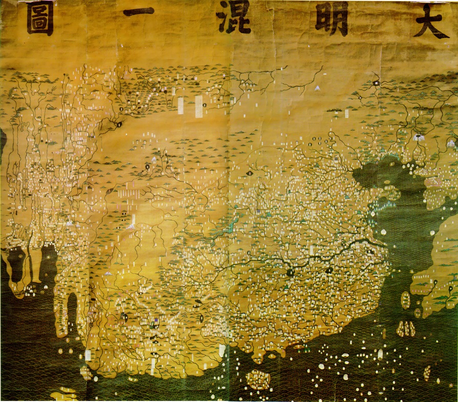 [48]
[48]
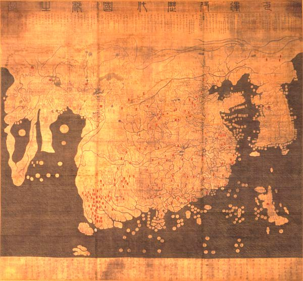 [49]
[49]
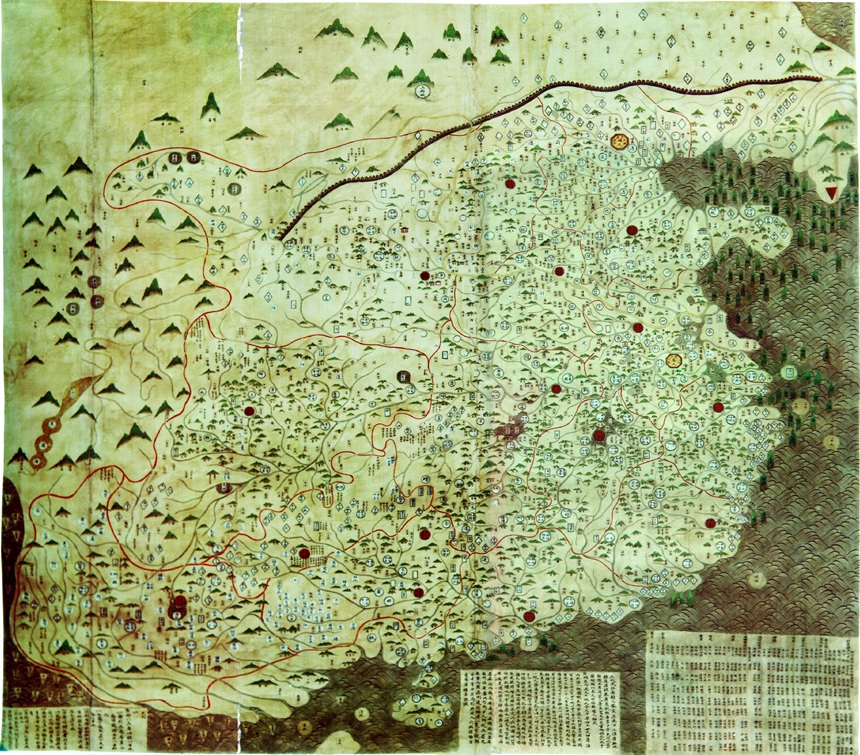 [57]
[57]
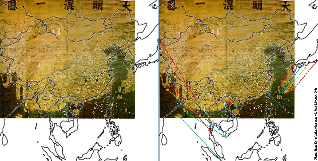 [49a]
[49a]
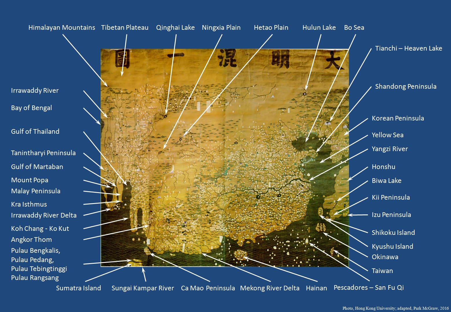 [49a1]
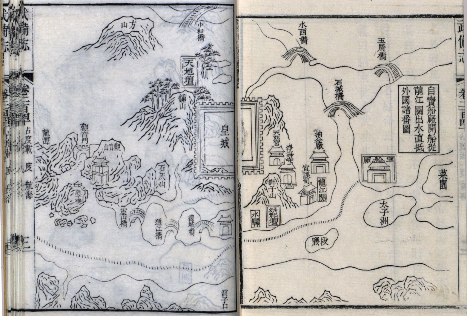 [58e]
[58e]
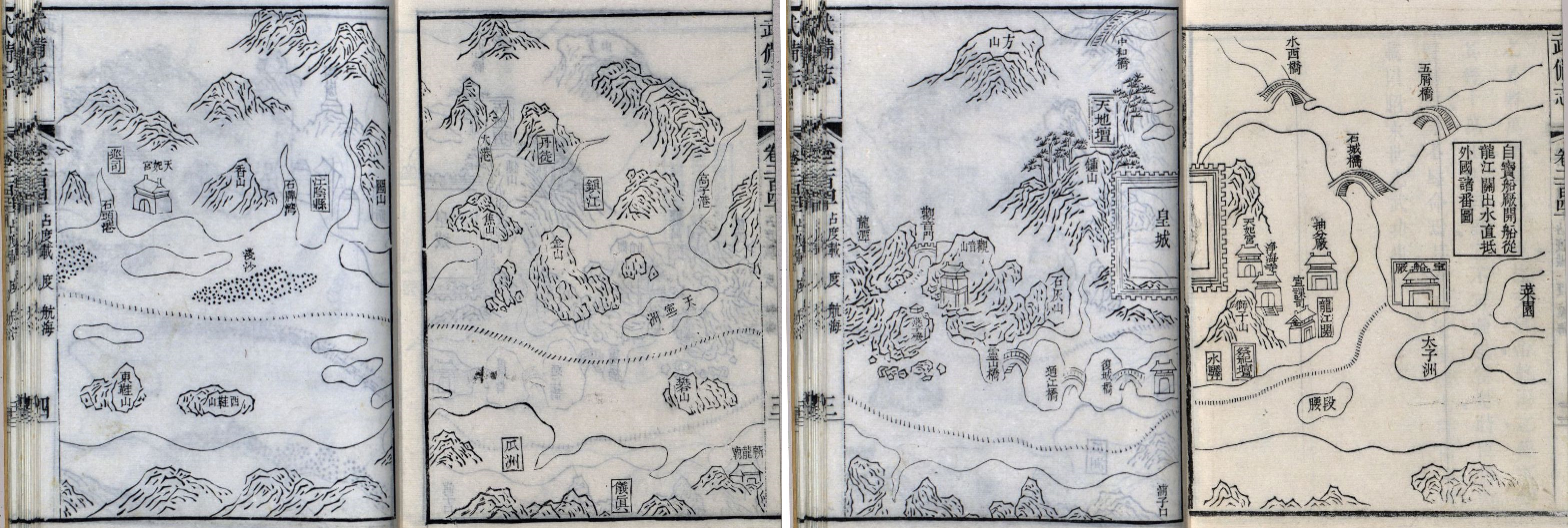 [58j], [58j1]
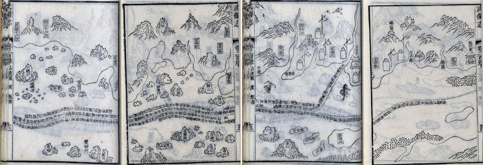 [58k], [58k1]
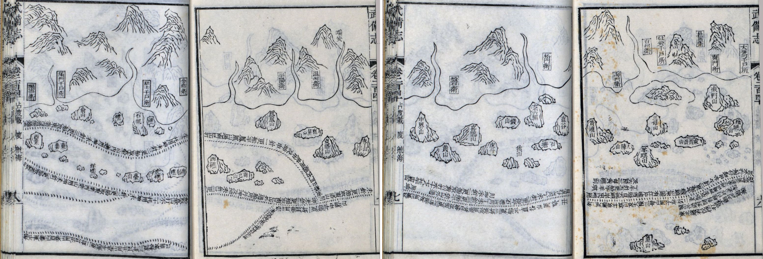 [58l], [58l1]
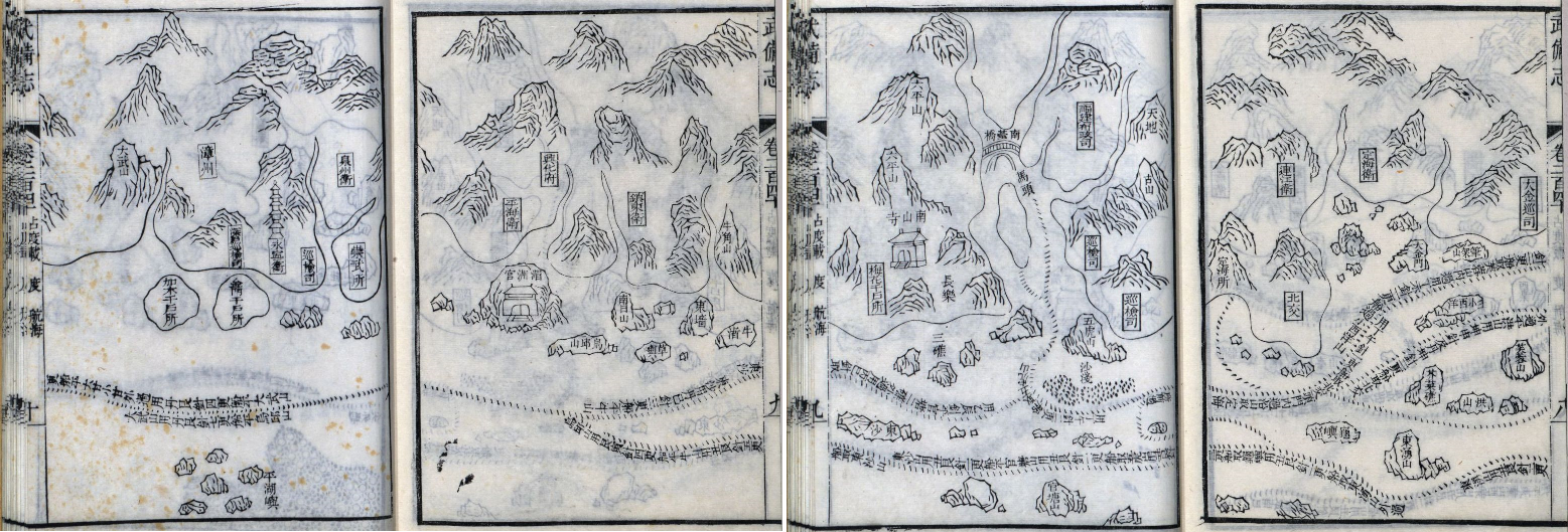 [58m], [58m1]
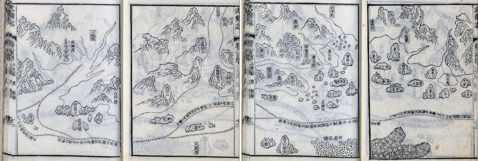 [58n], [58n1]
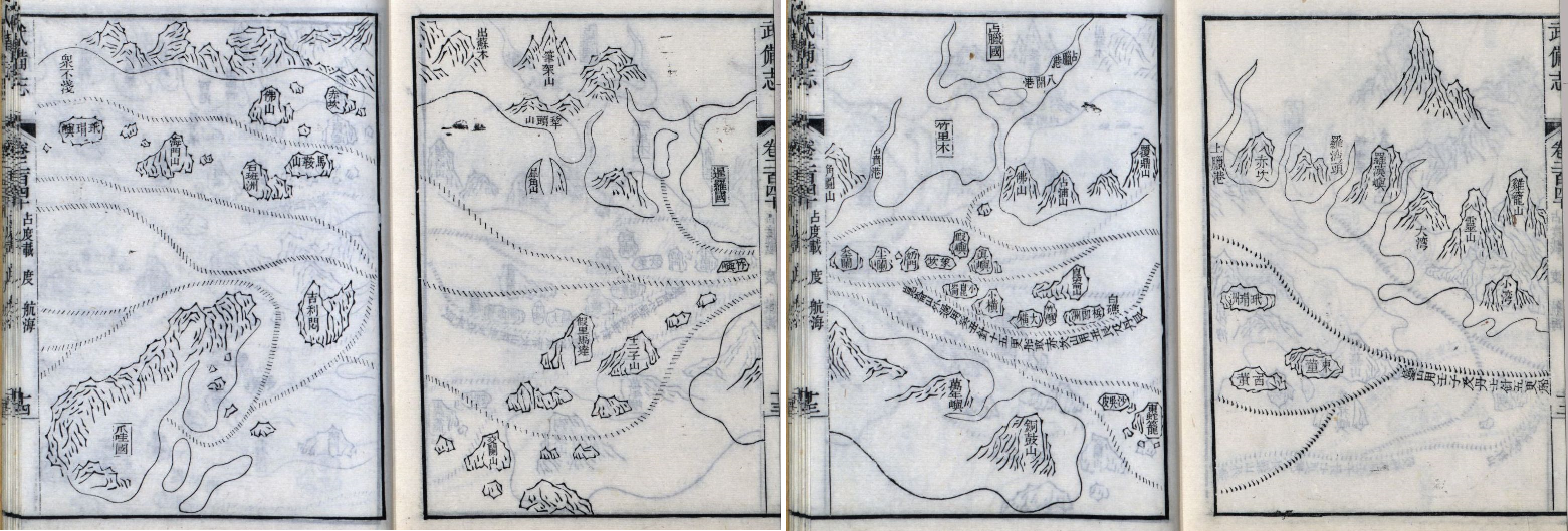 [58o], [58o1]
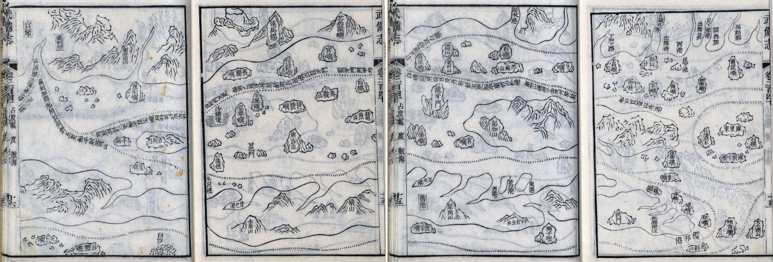 [58p], [58p1]
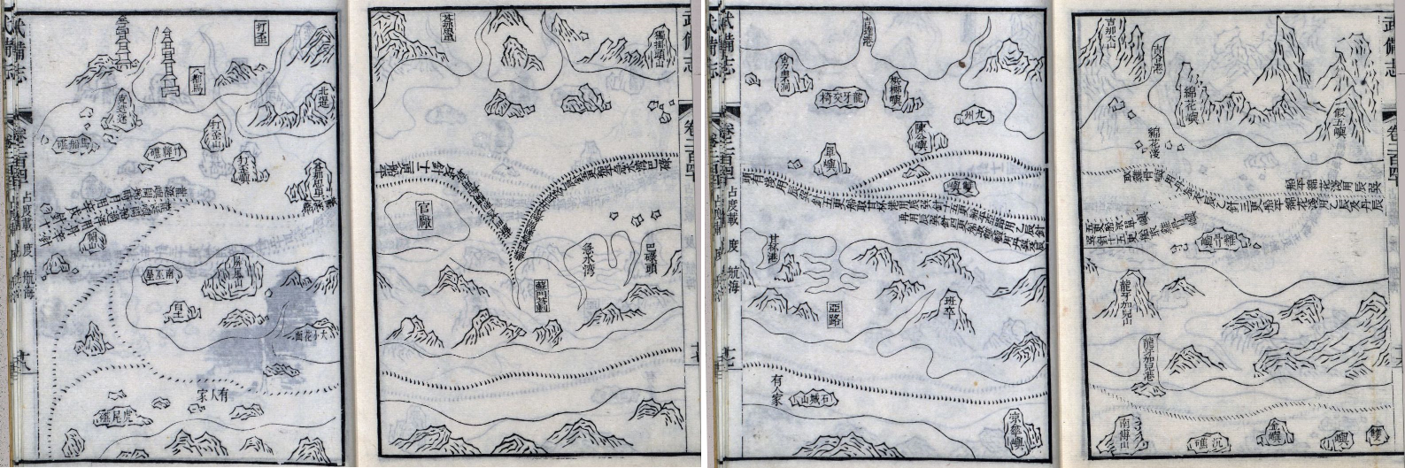 [58q], [58q1]
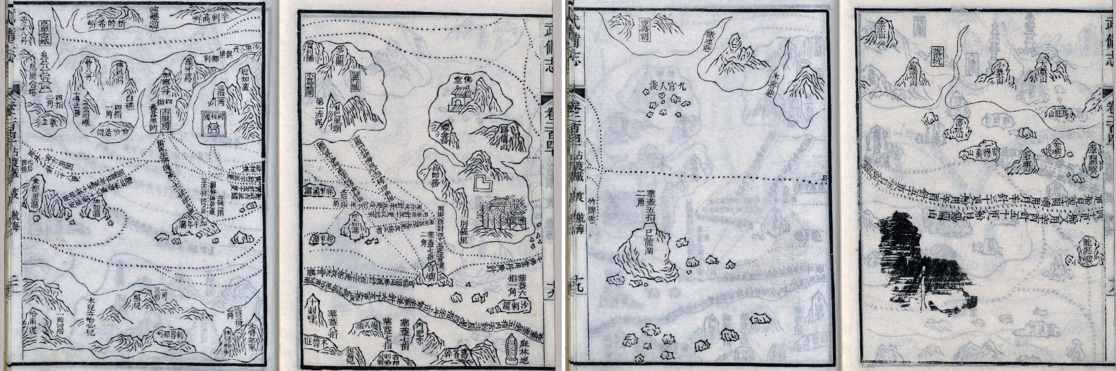 [58r], [58r1]
 [58s], [58s1]
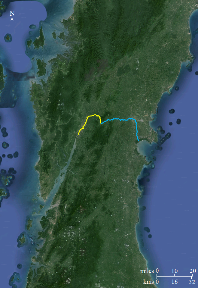 [83p3]
.png) [83p4]
[83p4]
_and_Isthmus_Thailand.jpg) [83r7]
[83r7]
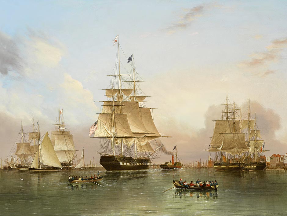 [83r14]
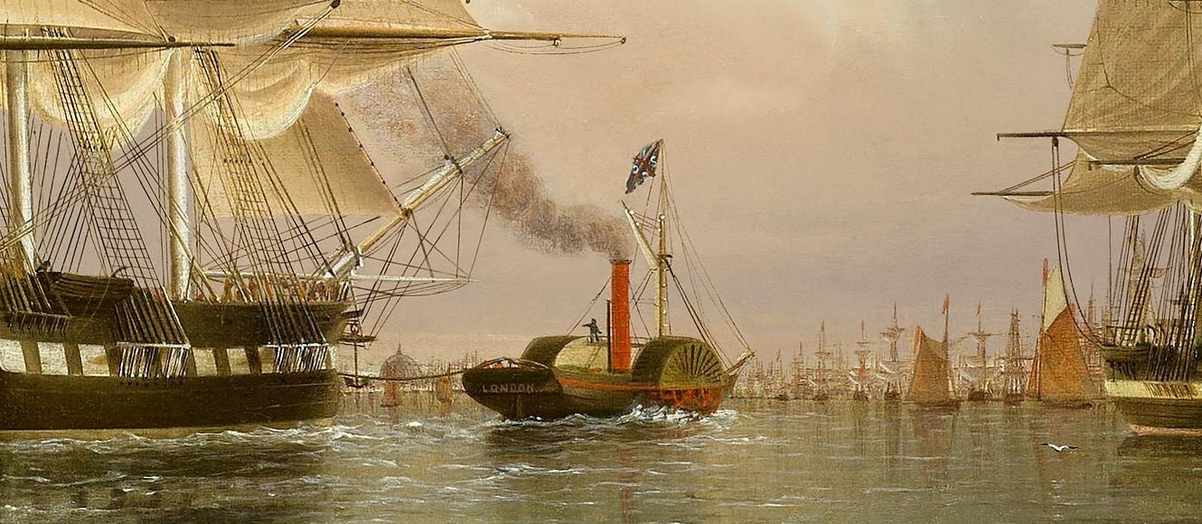 [83r15]
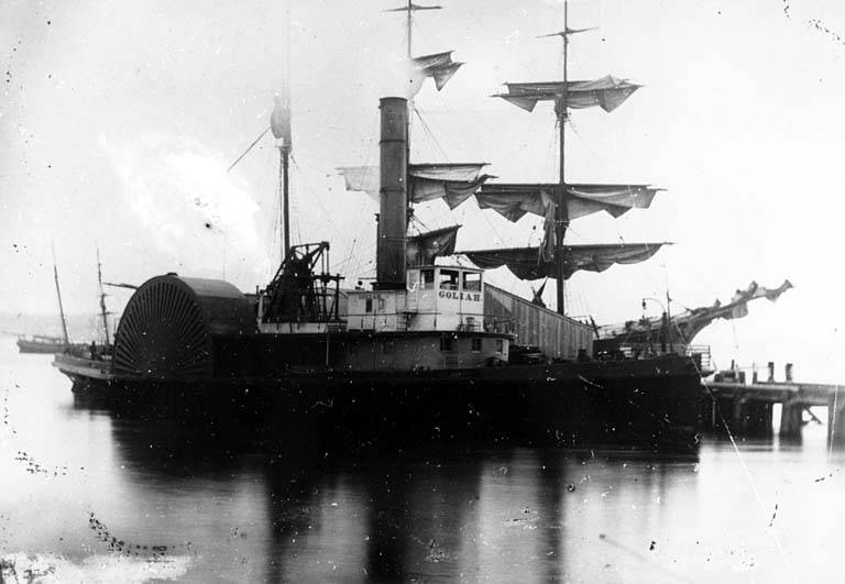 [83r19]
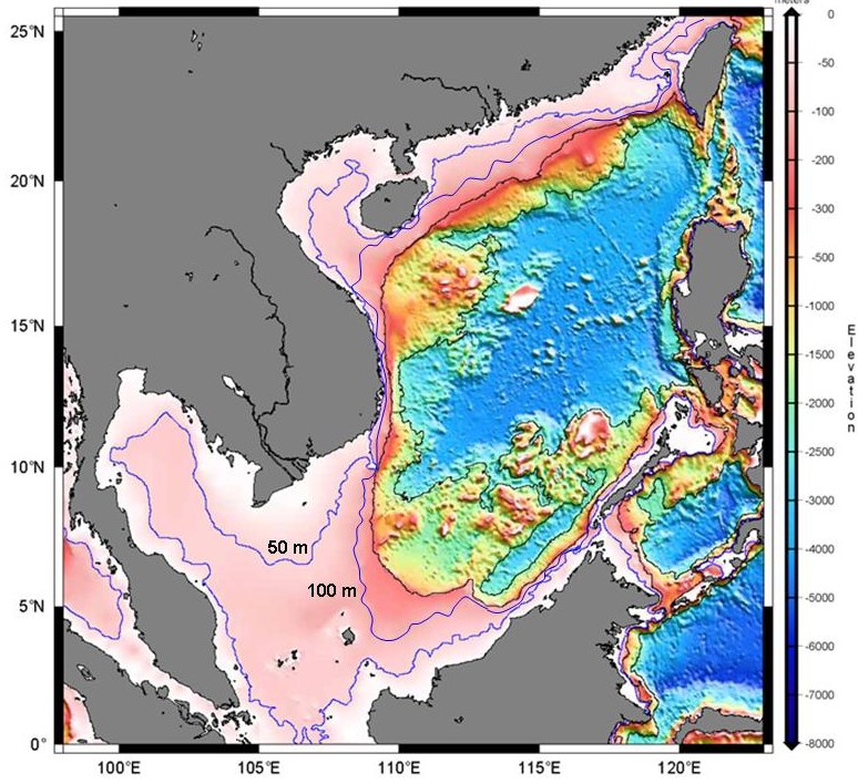 [xx]
[xx]
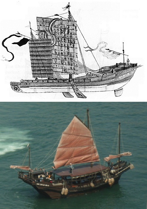 [66], [66a]
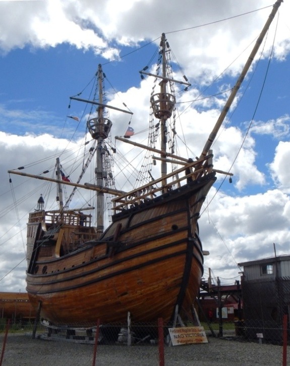 [67]
[67]
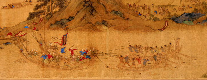 [73c]
[73c]
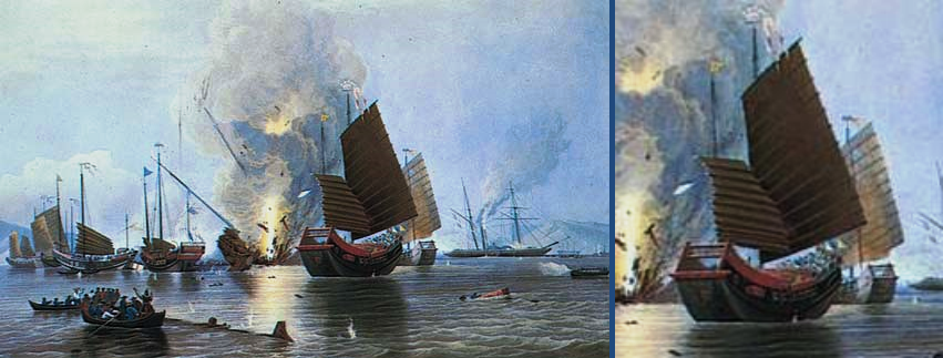 [xxx]
[xxx]
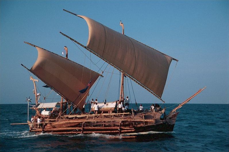 [xxx]
[xxx]
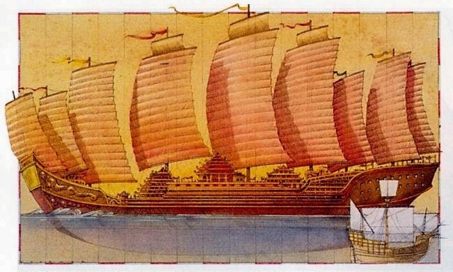 [65c]
[65c]

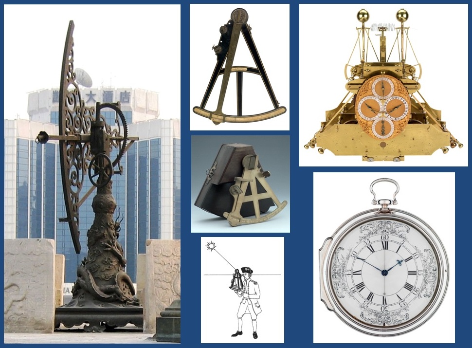
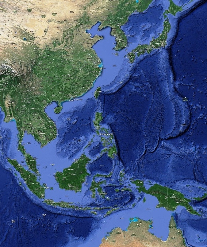 [80]
[80] 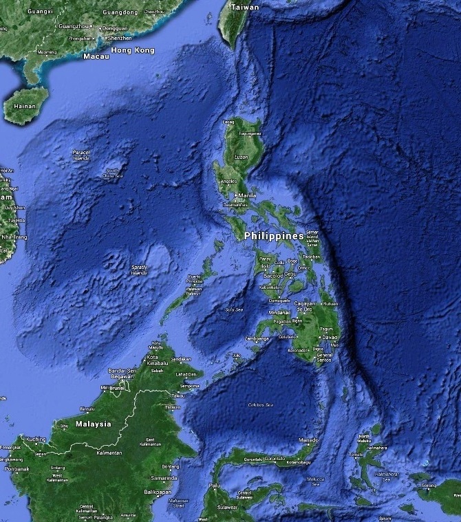 [81]
[81]
 [83d]
[83d]
 [xx]
[xx]
_Malay_Peninsula-c.png) [83j2]
[83j2]
 [83k3]
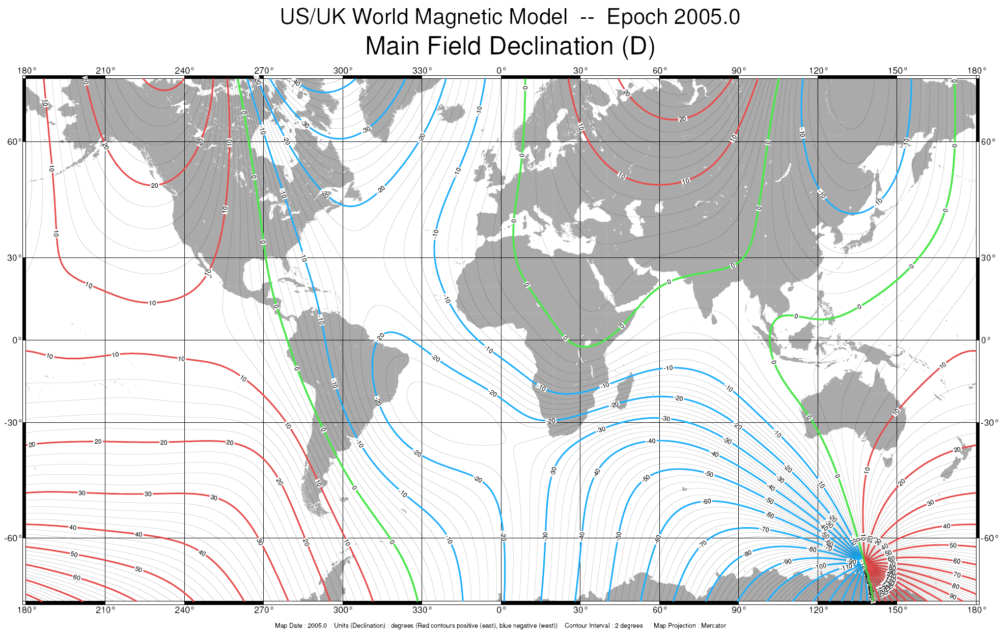 [83x1]
.jpg) [83x4]
[83x4]
.png) [83x5]
[83x5]
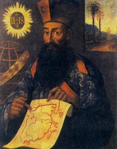 [84]
[84] 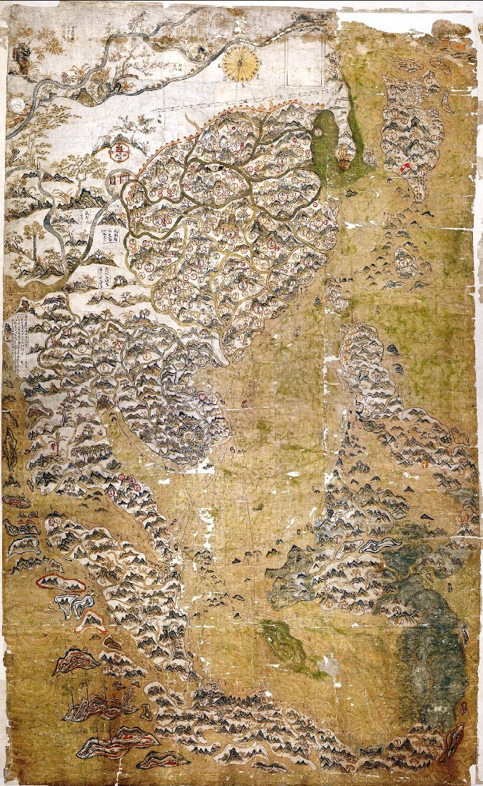 [84a]
[84a]
_De Jode's_1578_Speculum_Orbis_Terrarum.jpg) [86e1]
[86e1]
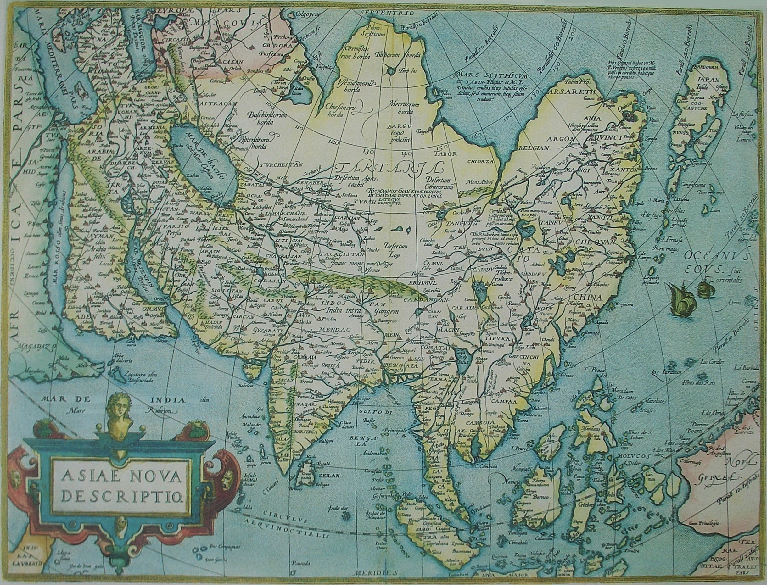 [86f]
[86f]
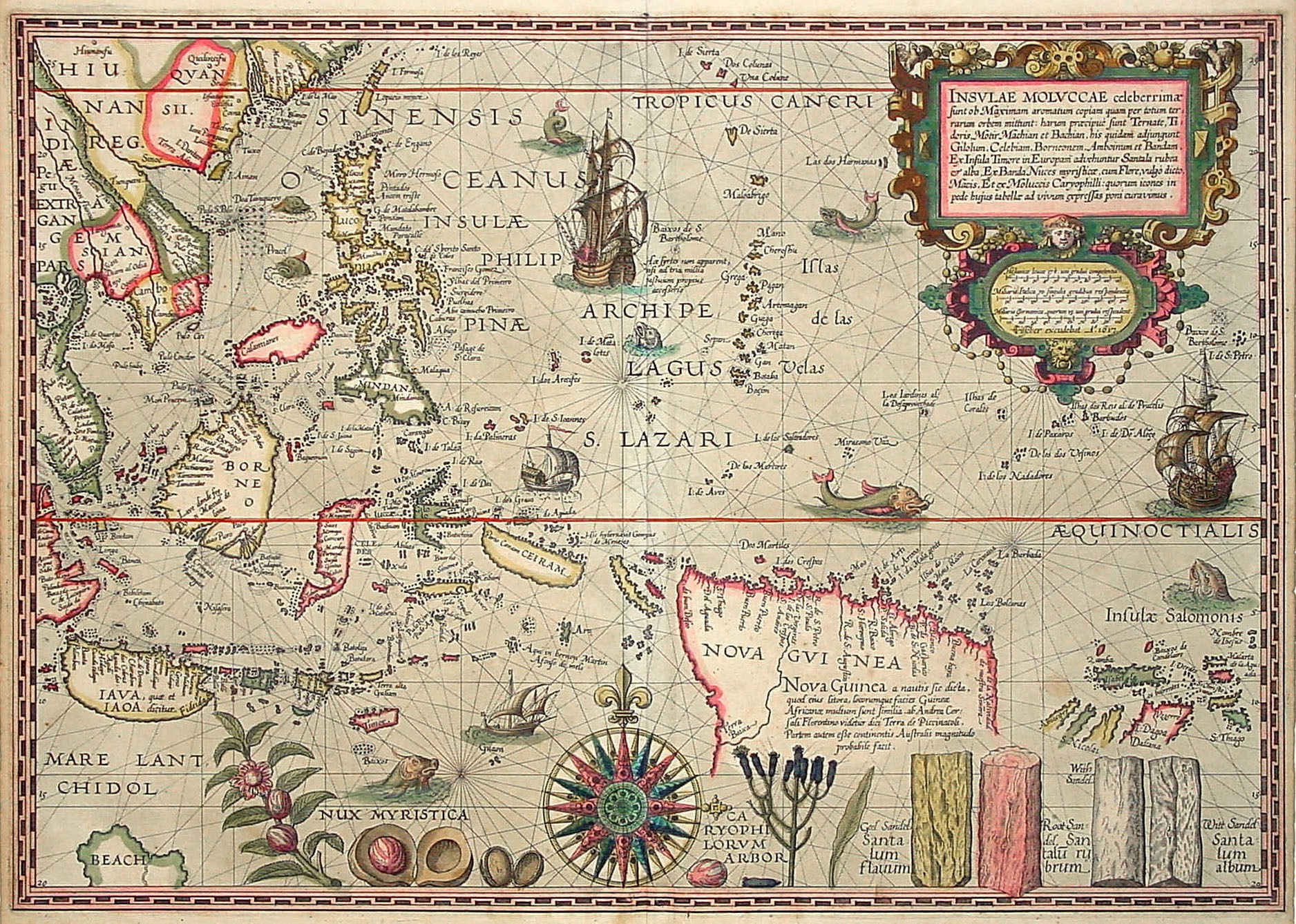 [86f3]
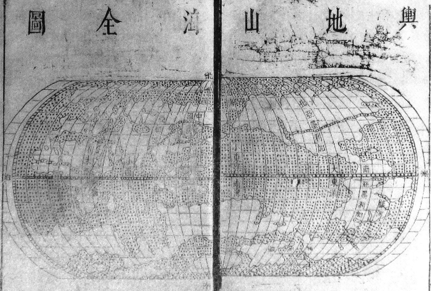 [87]
[87]
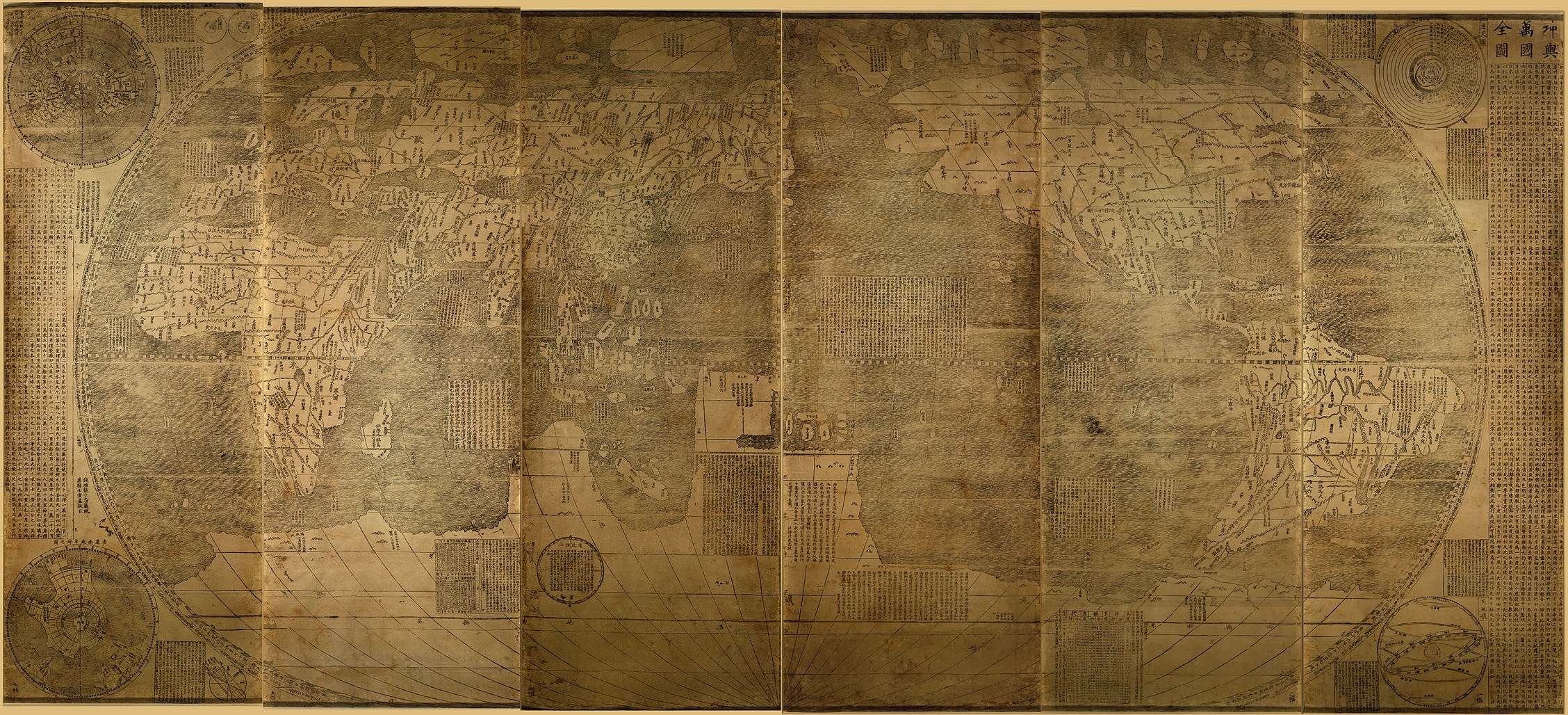 [xxx]
[xxx]
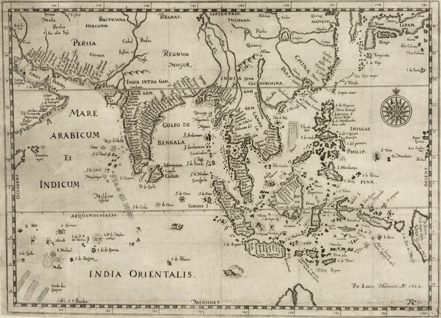 [103]
[103]
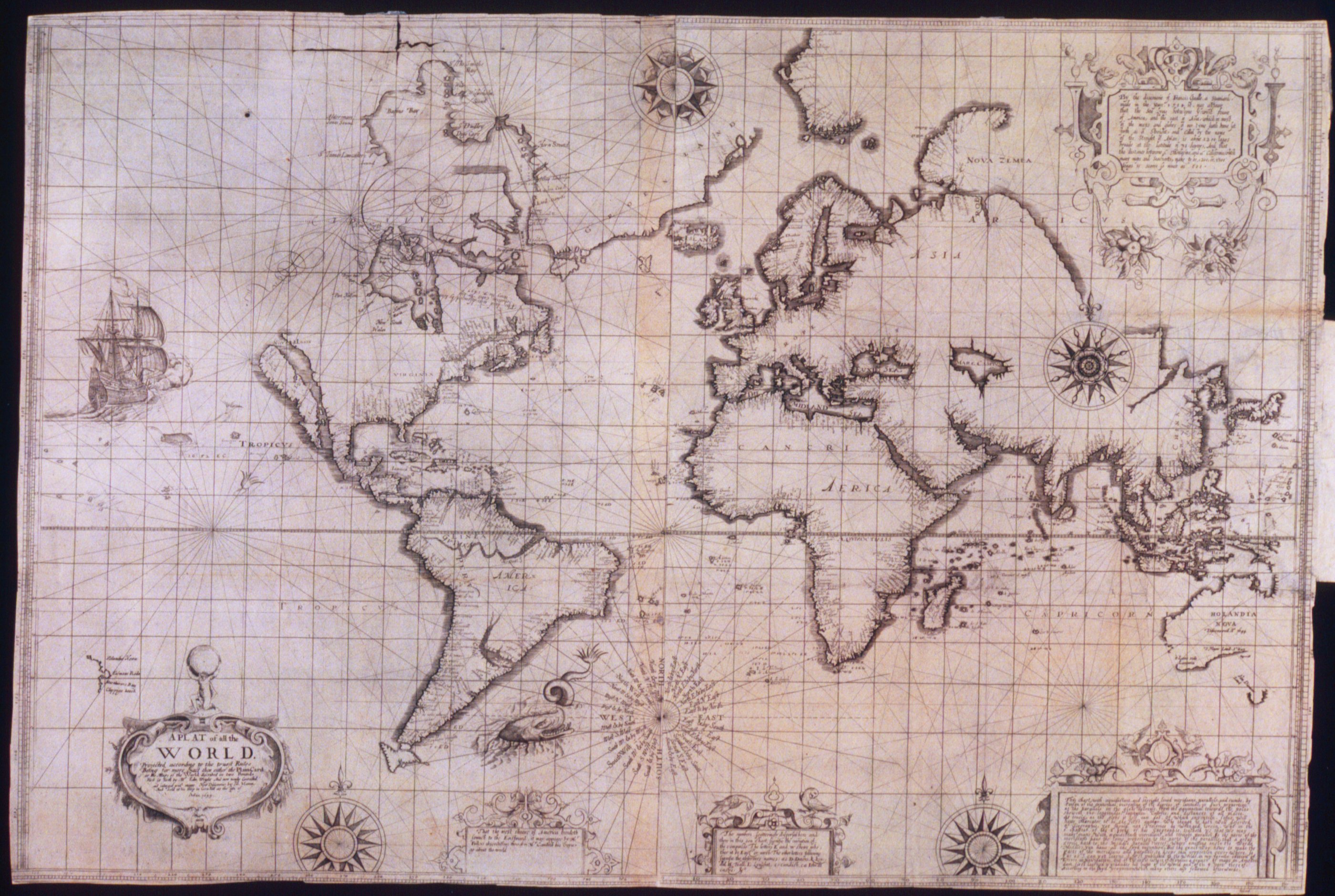 [xxx]
[xxx]
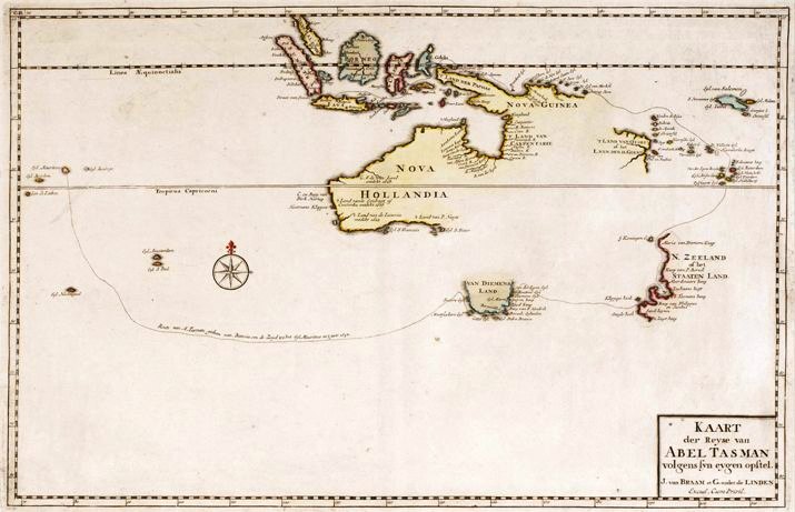 [93]
[93]
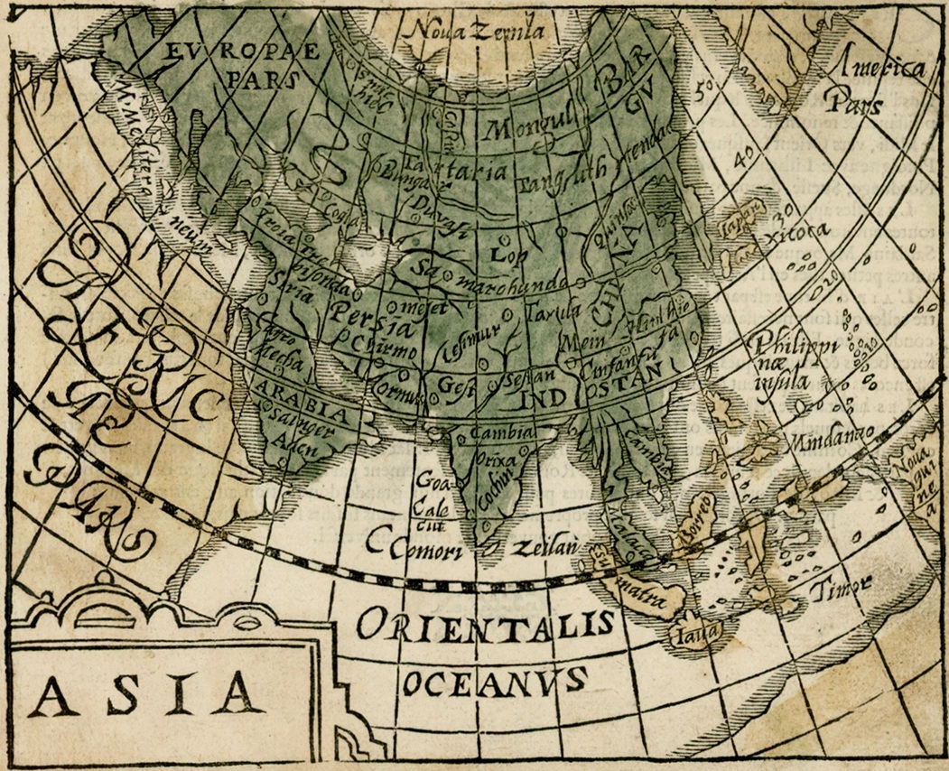 [xx]
[xx]
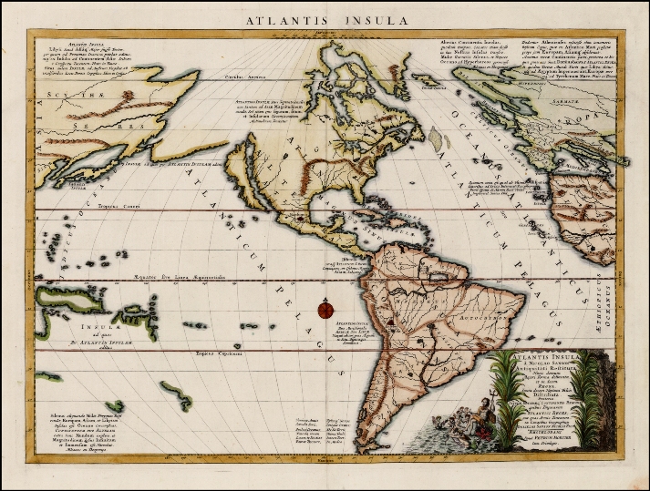 [96]
[96]
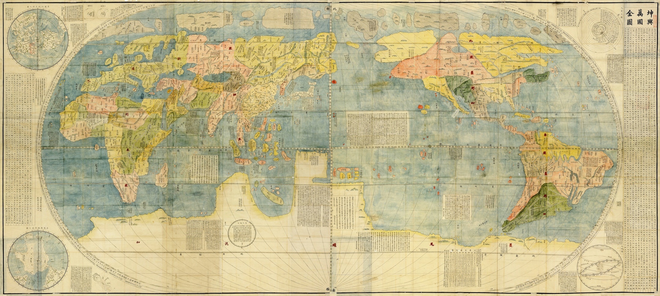 [99]
[99]
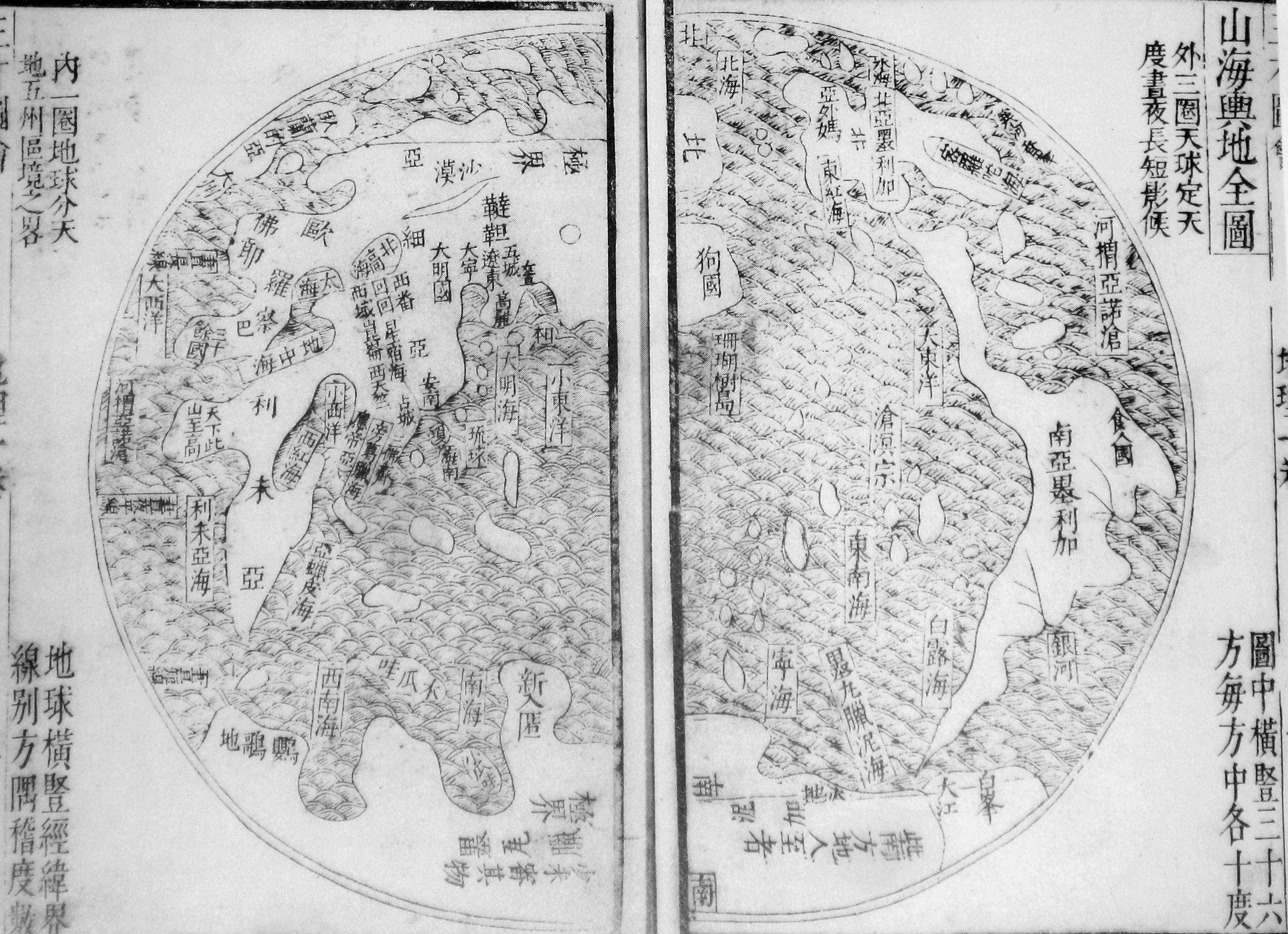 [101]
[101]
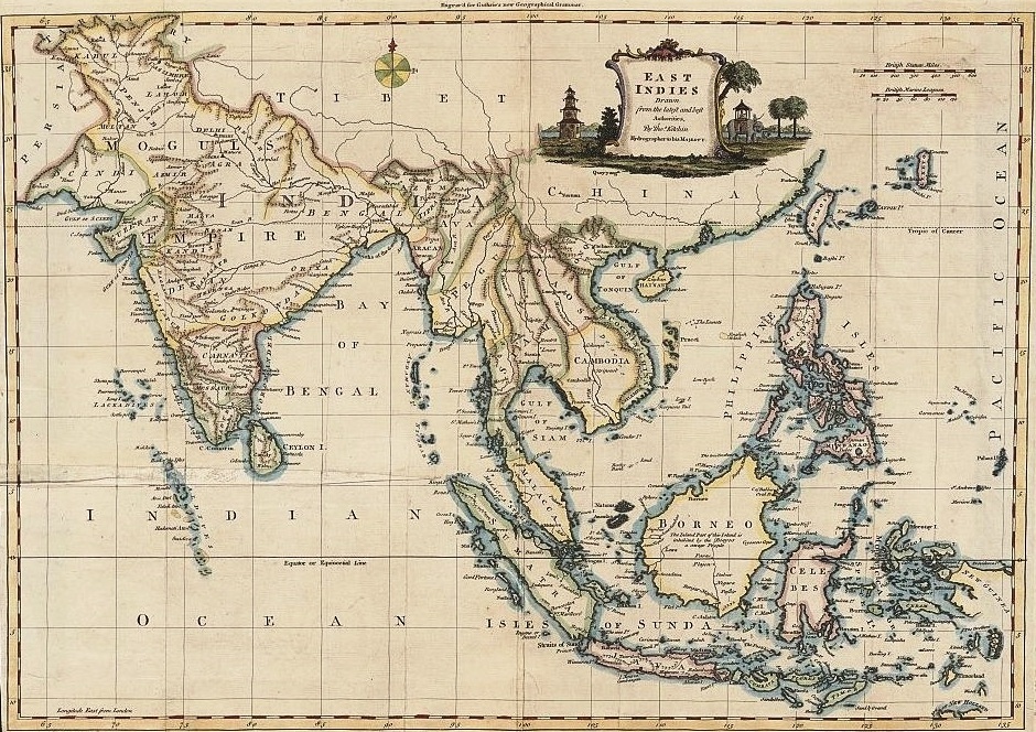 [104]
[104]
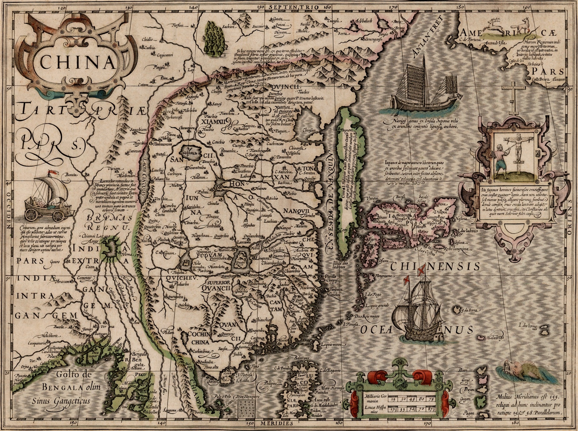 [107]
[107]
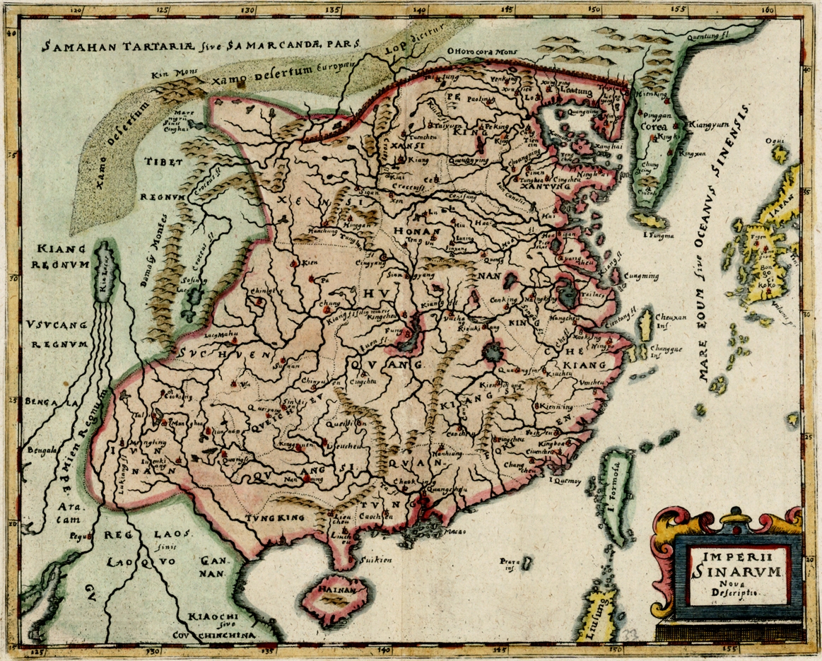 [108b]
 [xxx]
[xxx]
 [108g1]
 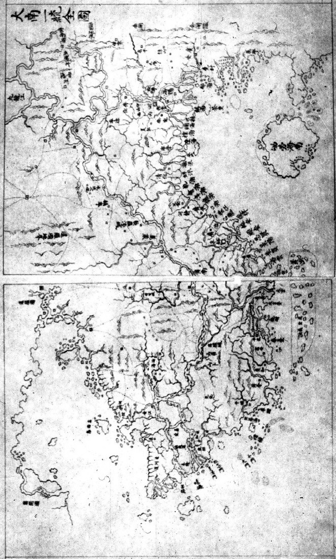 [108g2]
_1734 map_of_the_Philippines.jpg) [108g13]
[108g13]  [108g14]
 [108g15]
 [108g28]
 [108i1] [108j]
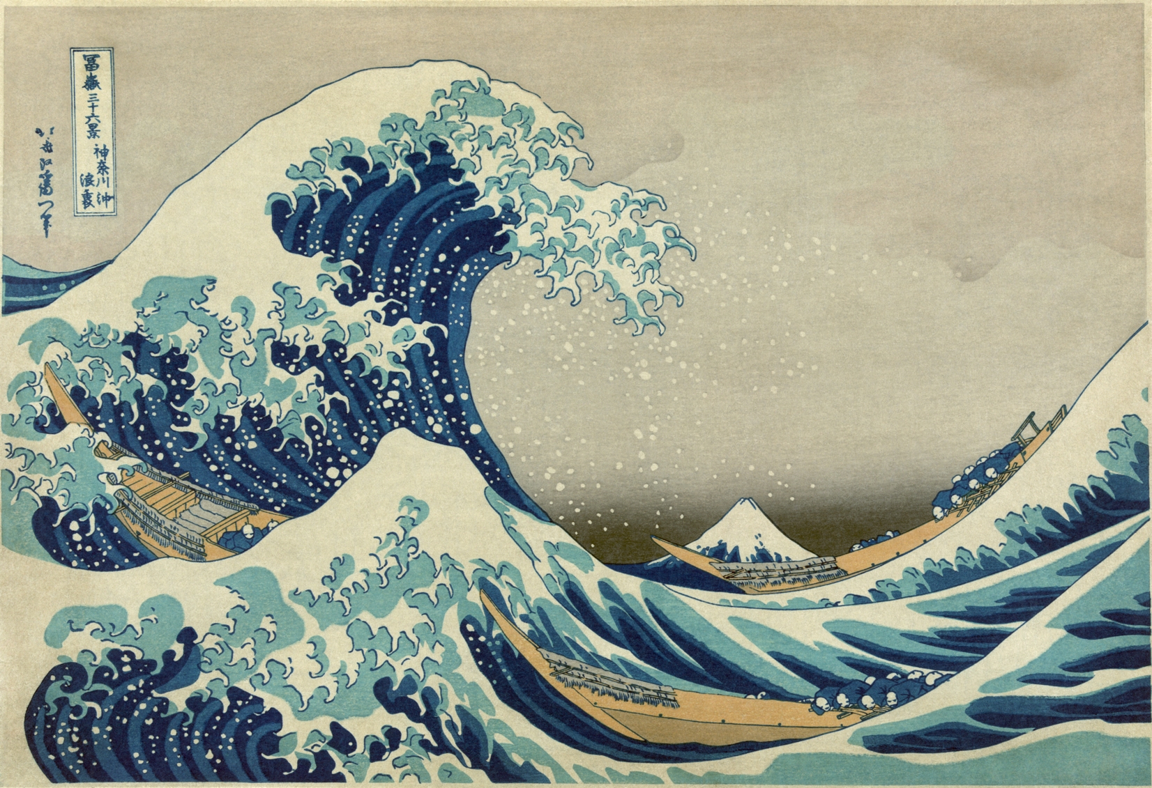 [xxx]
[xxx]
 [108m2]
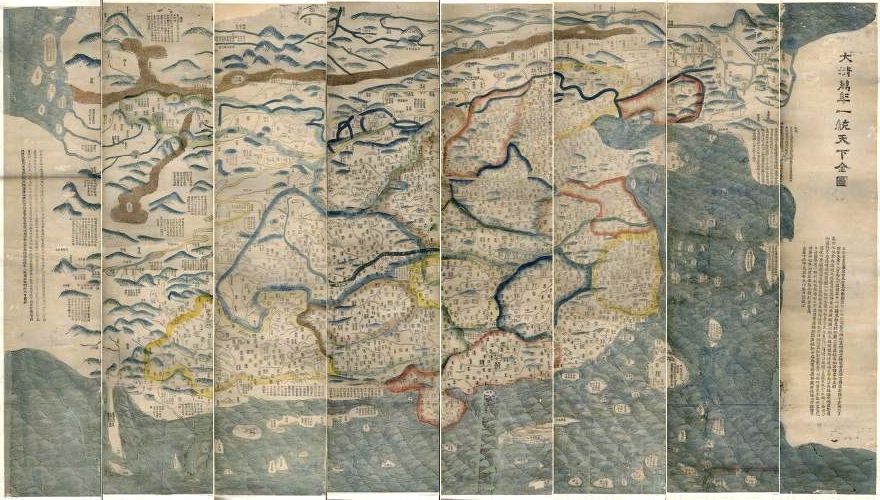 [104]
[104]
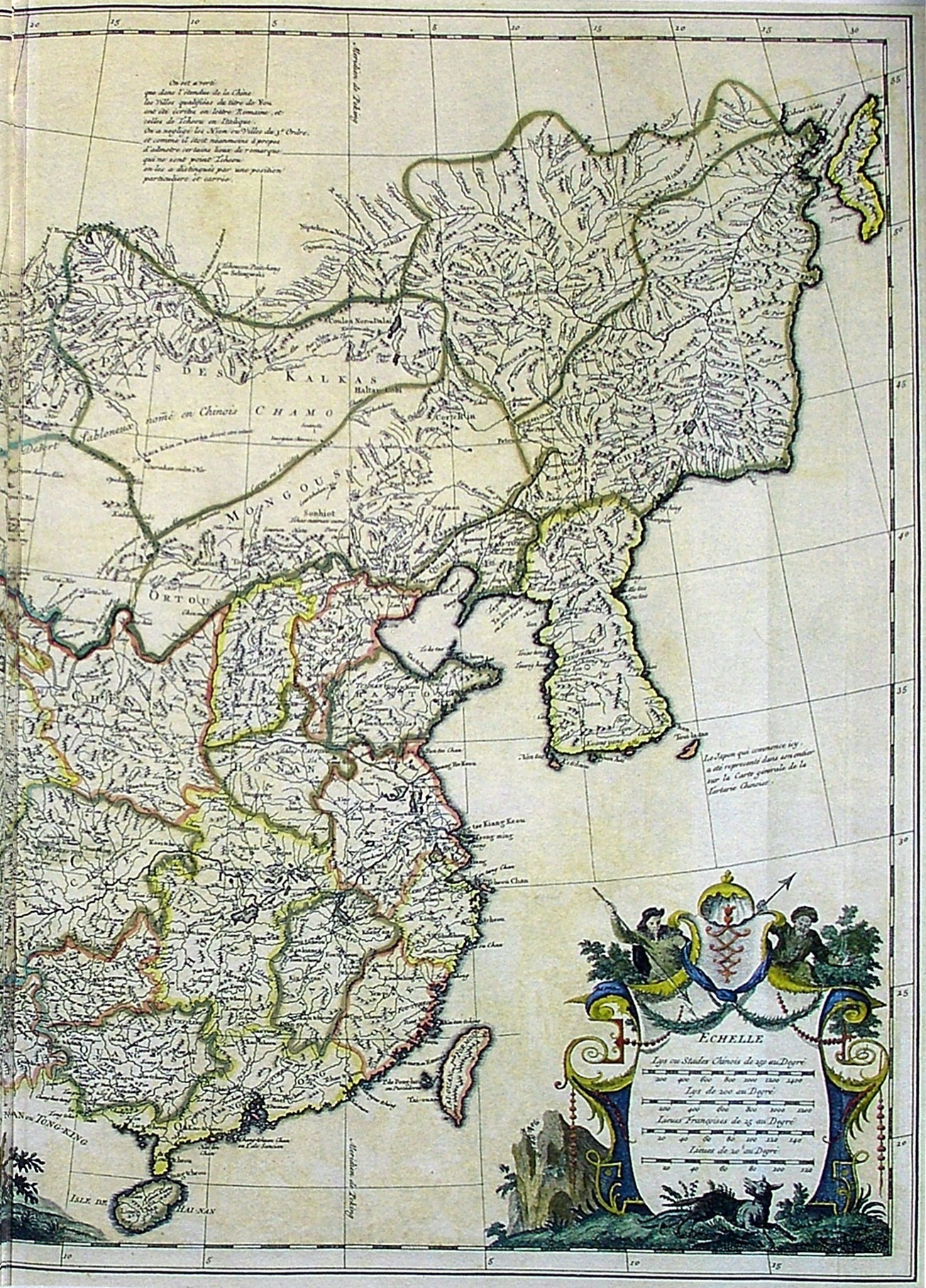 [xxx]
[xxx] 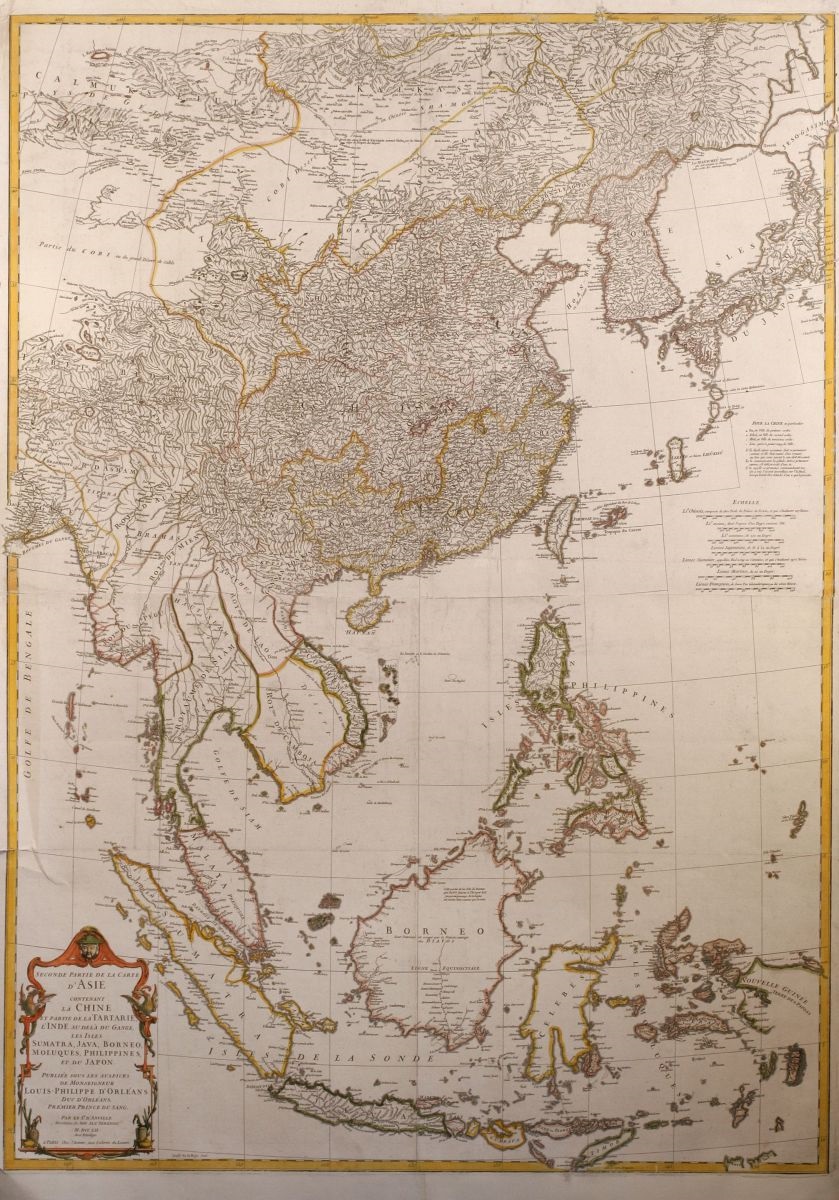 [104a]
 [xxx]
[xxx]  [104d]
 [104e]
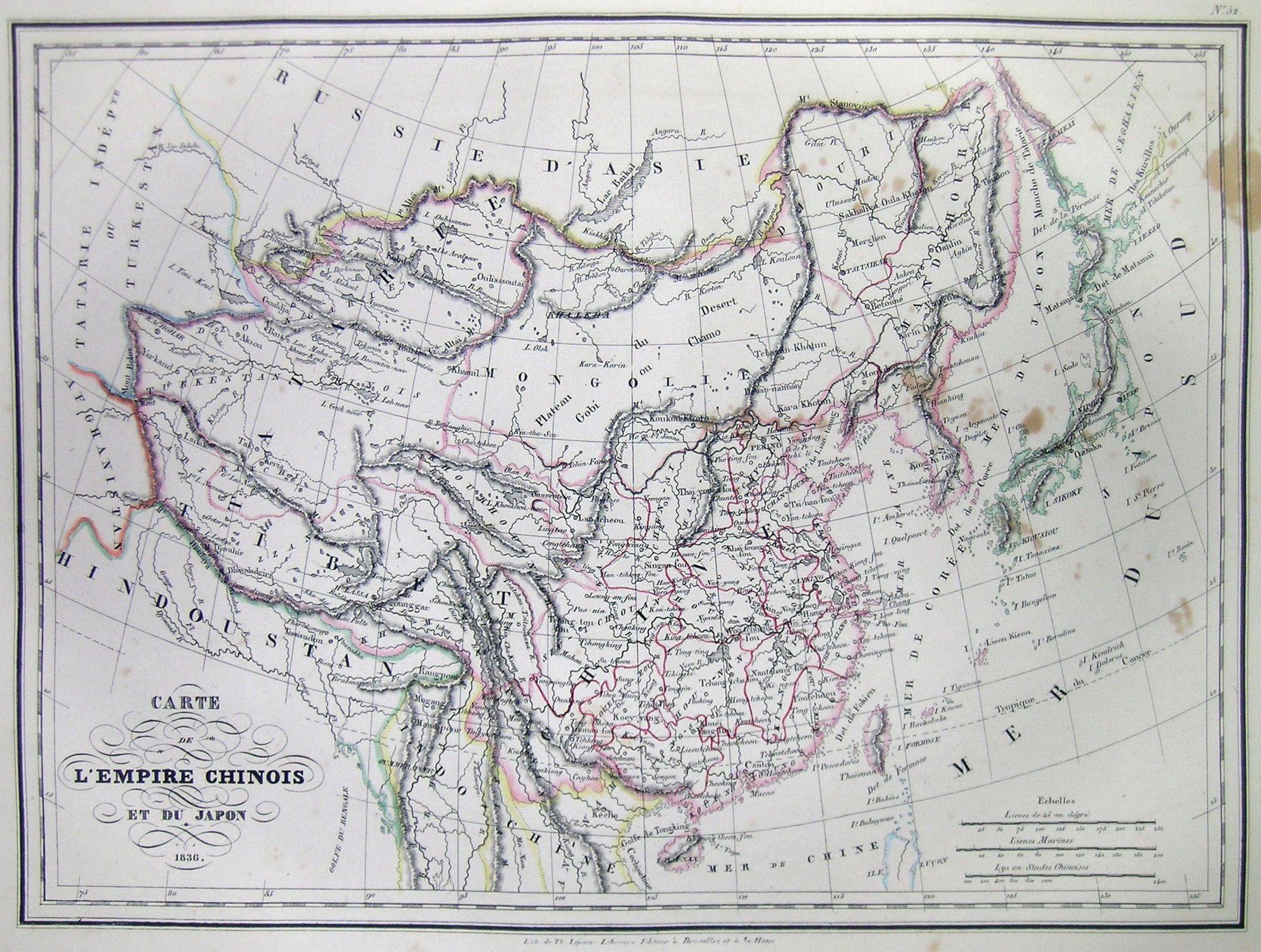 [104h]
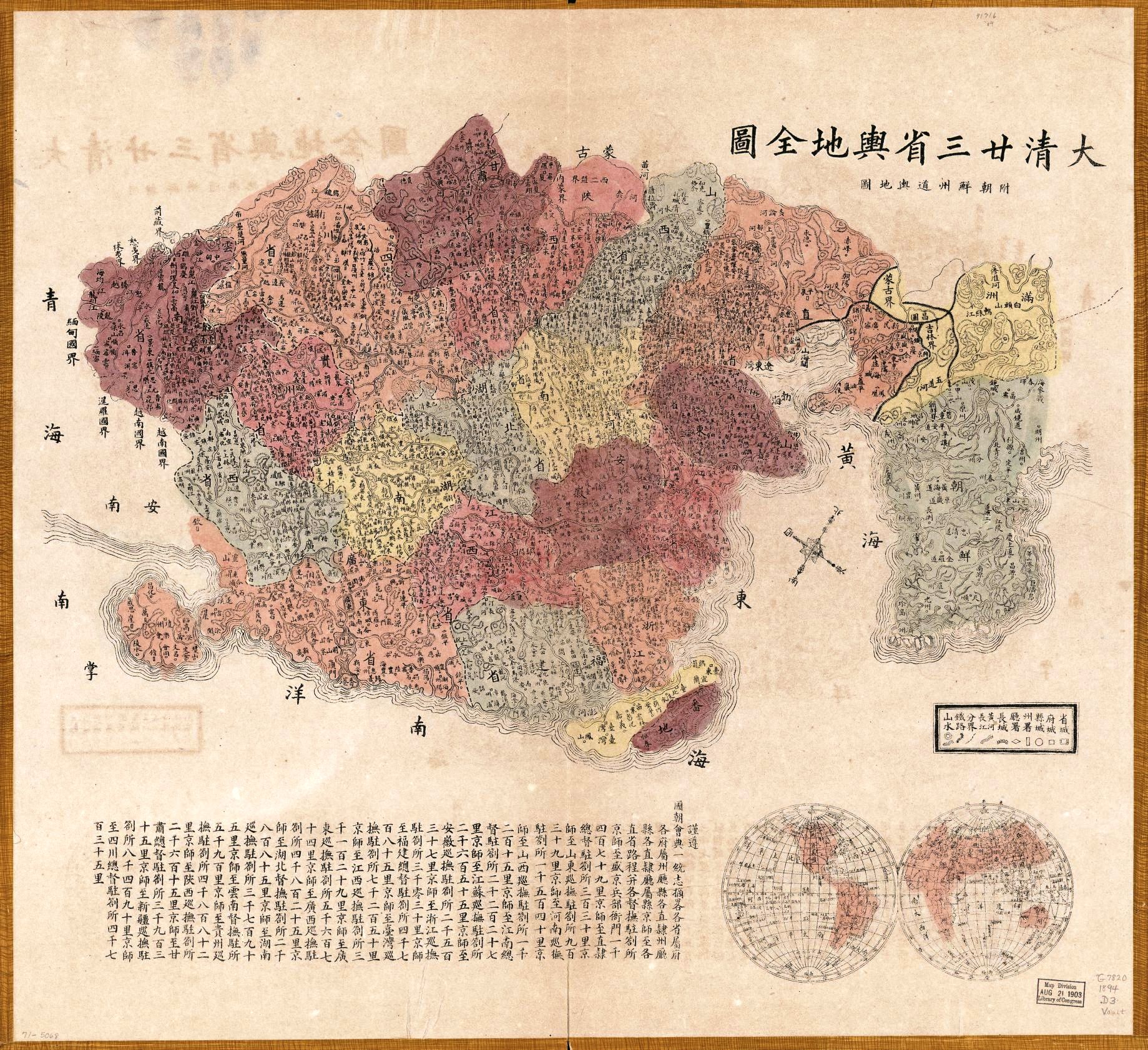 [108n]
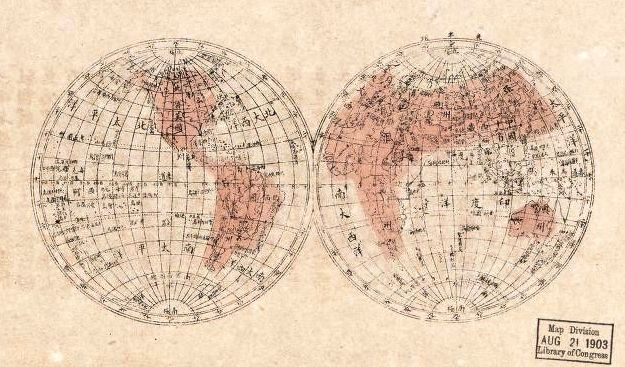 [108o]
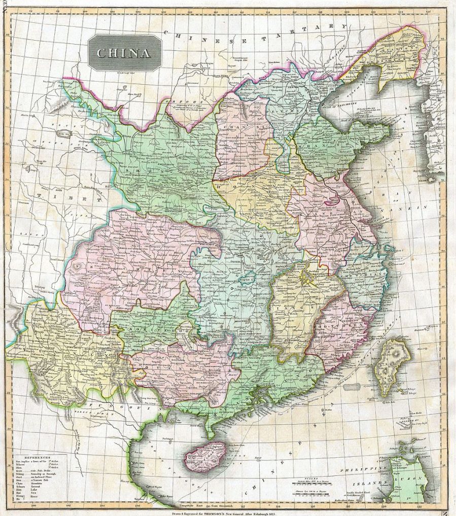 [xxx]
[xxx] 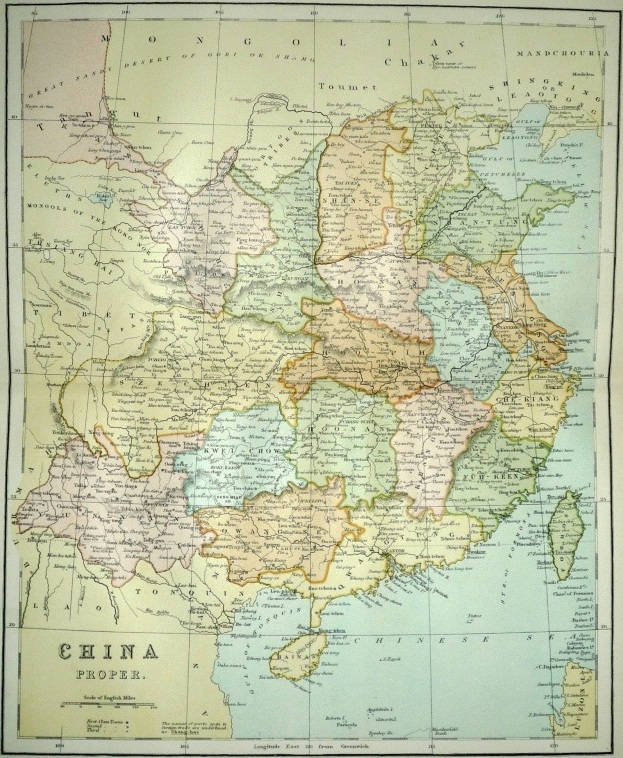 [110]
[110]
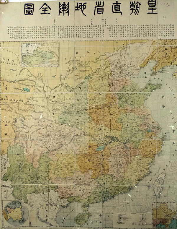 [110b]
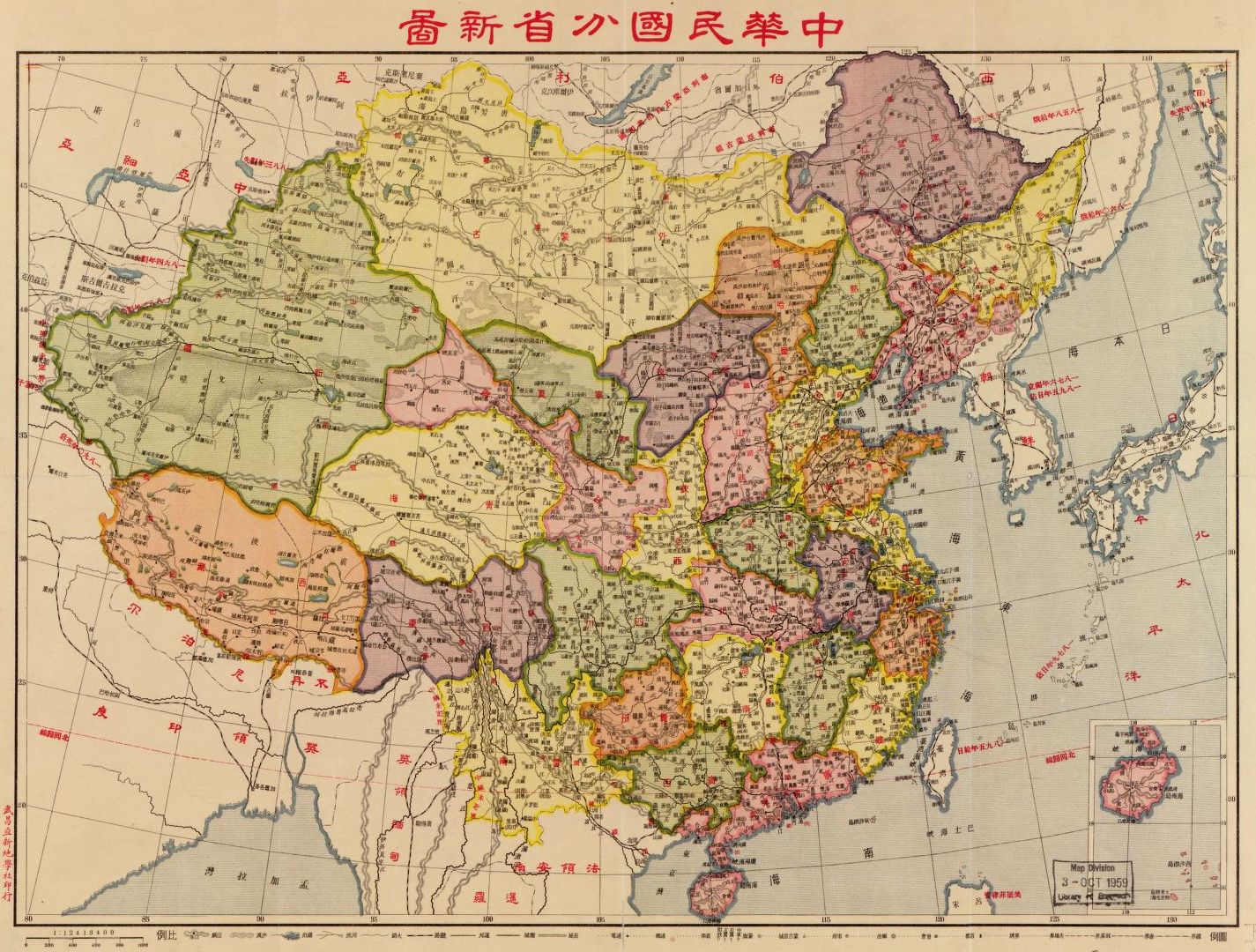 [110e]
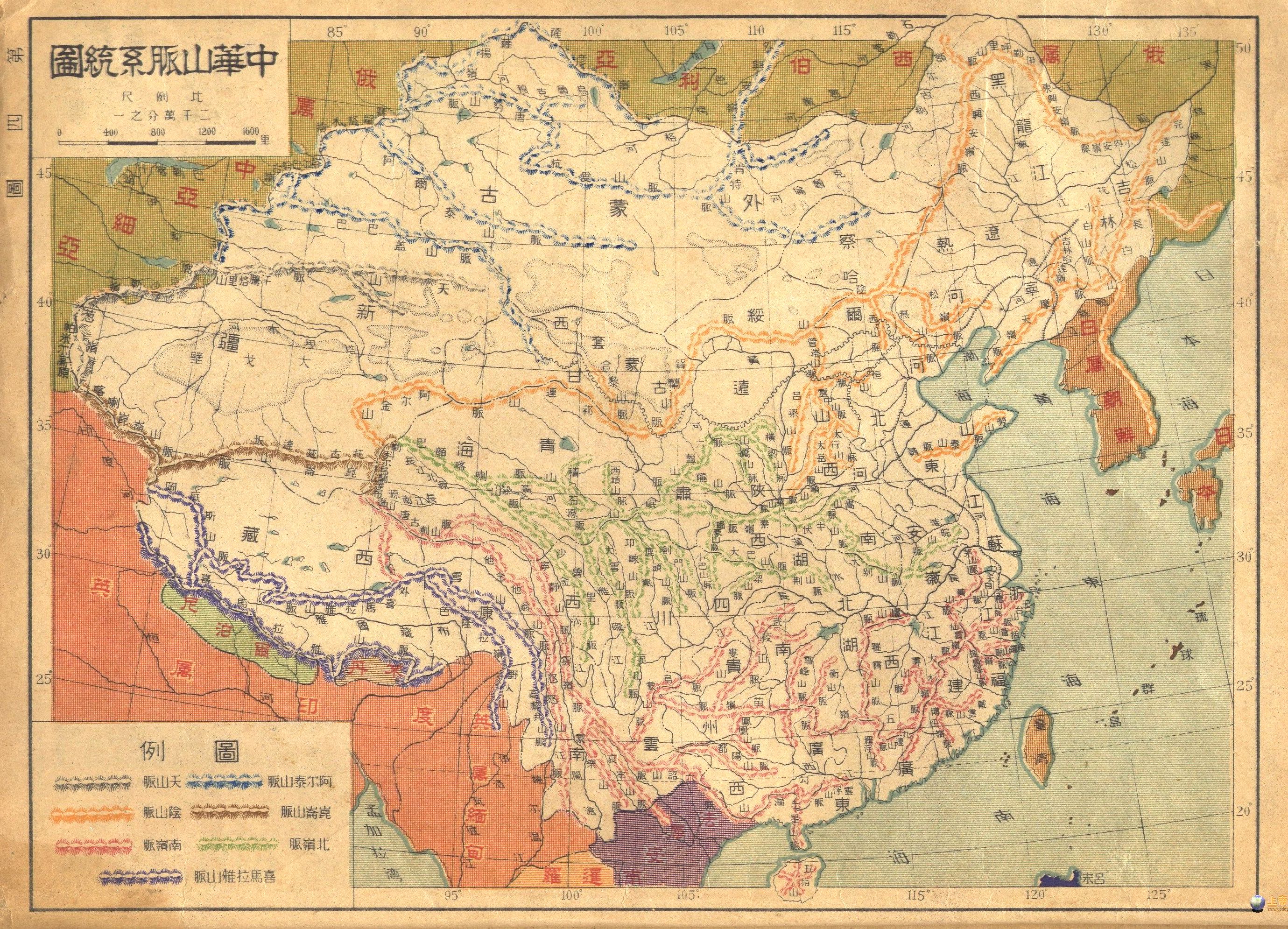 [110g]
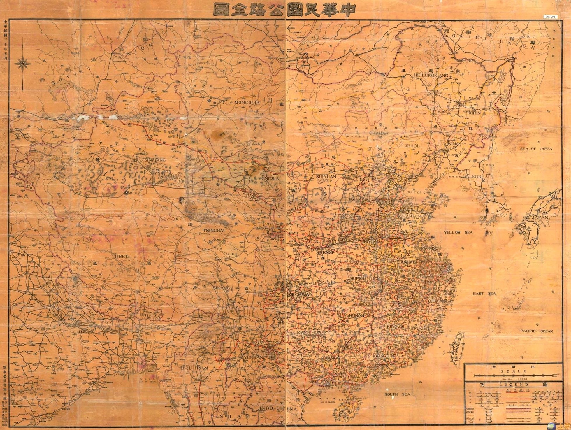 [110m]
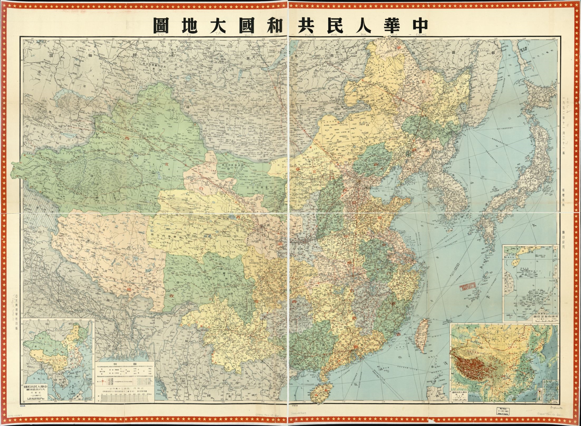 [113h3]
 [113h6]
 [xxx]
[xxx] 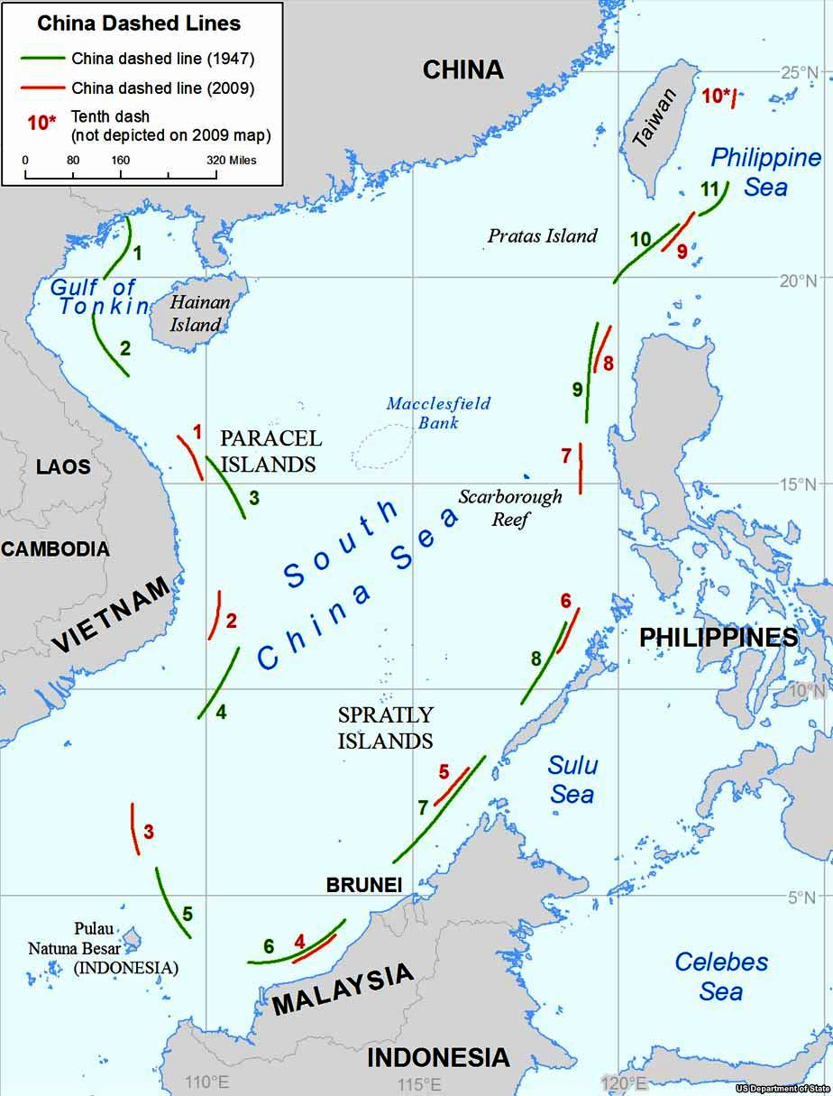 [xxx]
[xxx]
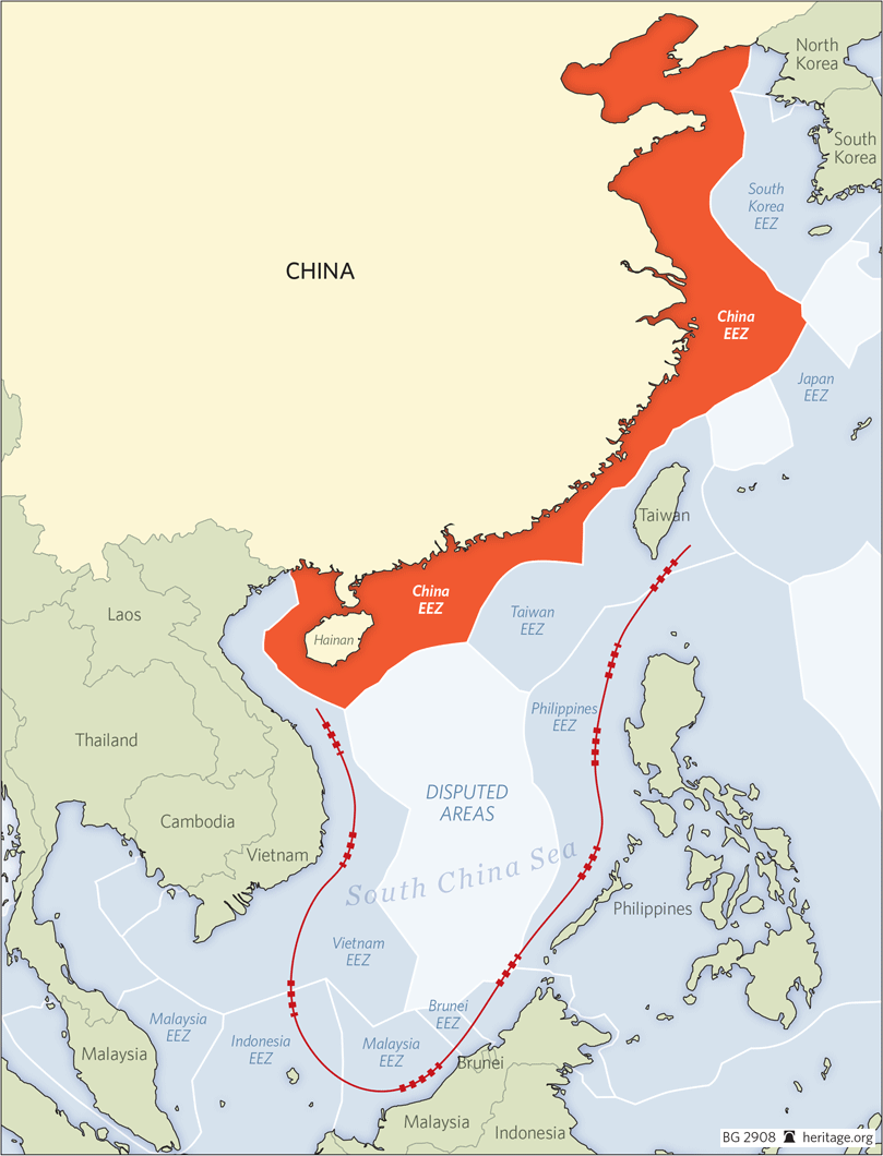 [115]
[115] 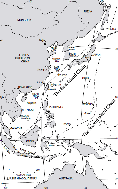 [116]
[116]
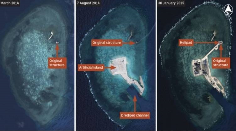 [118]
[118]
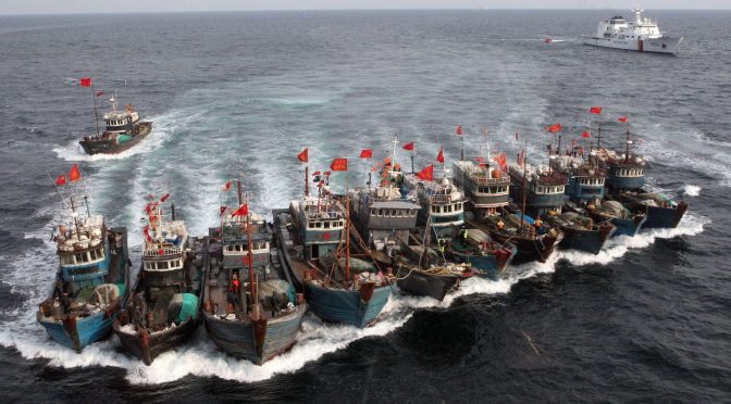 [118b]
.jpg) [128]
[128]
 [131]
[131]
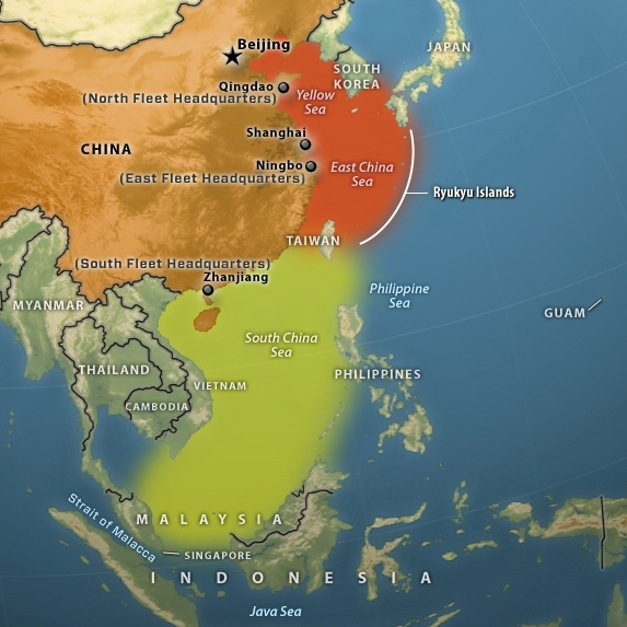
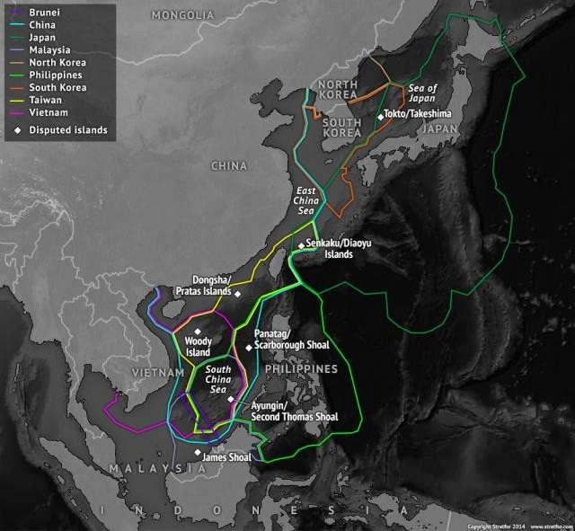
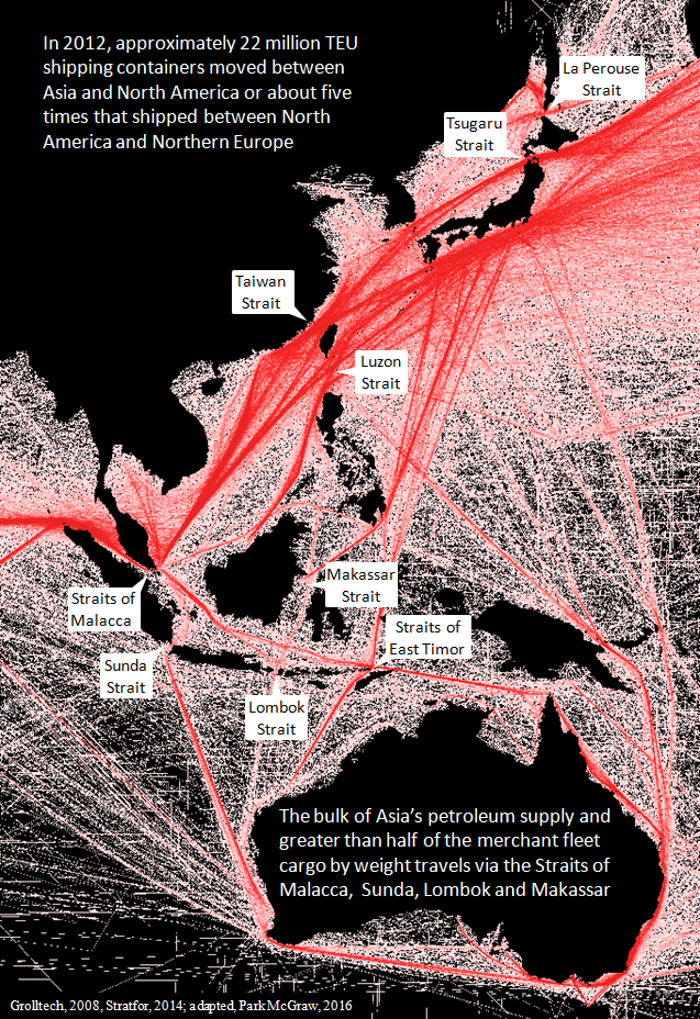
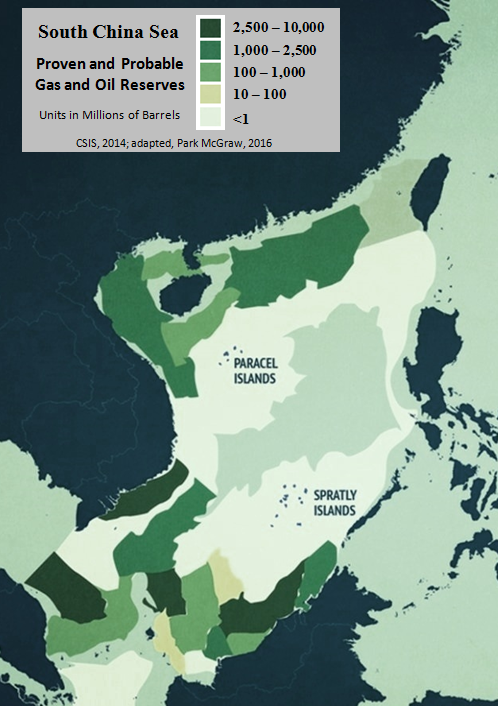
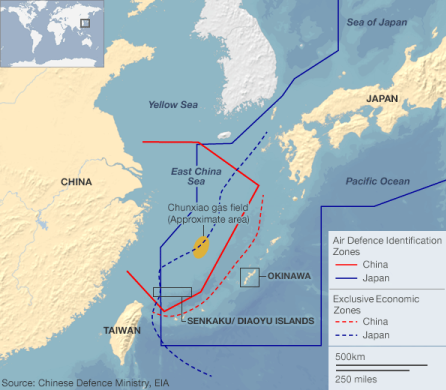
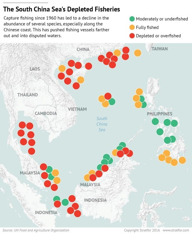
-2.jpg)
-1.jpg)
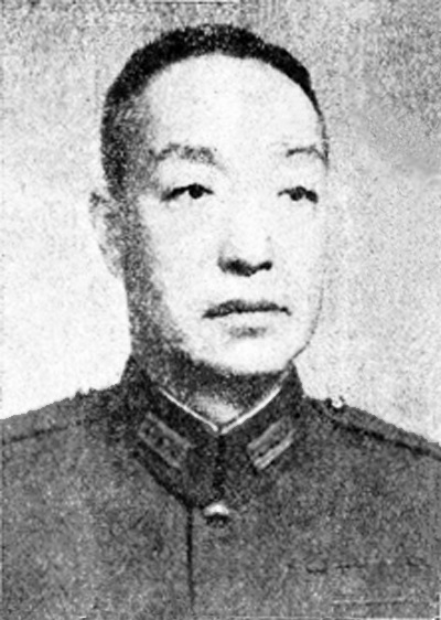
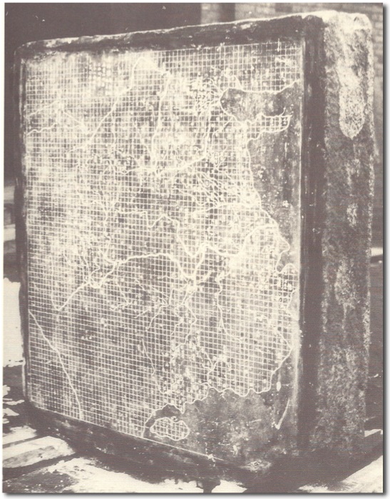
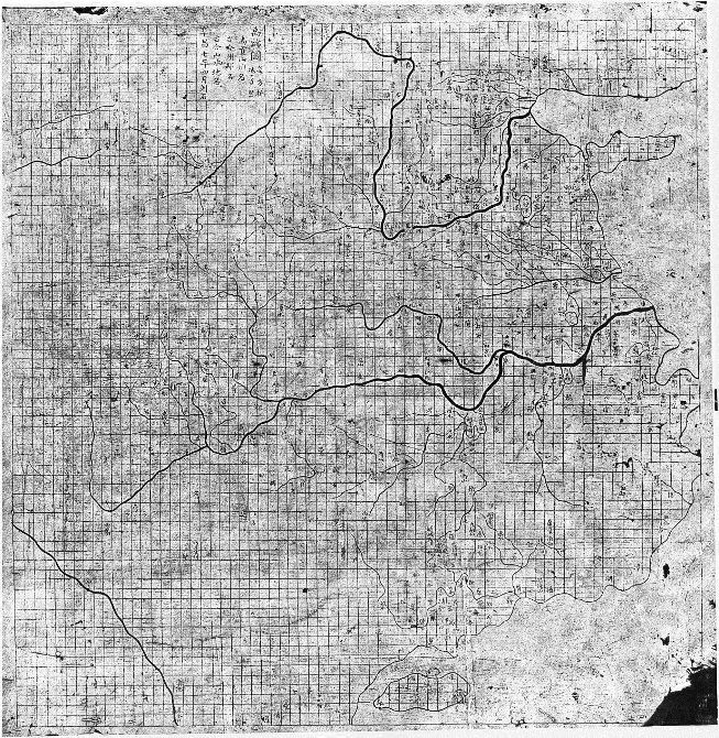
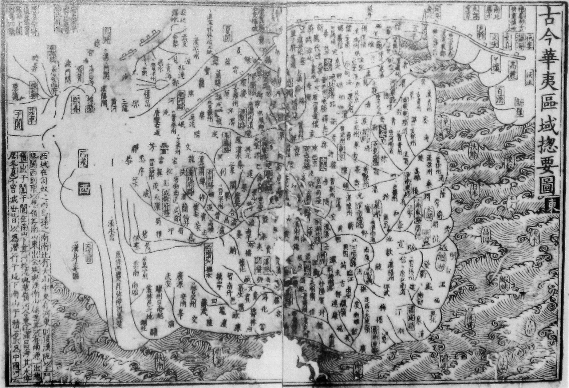
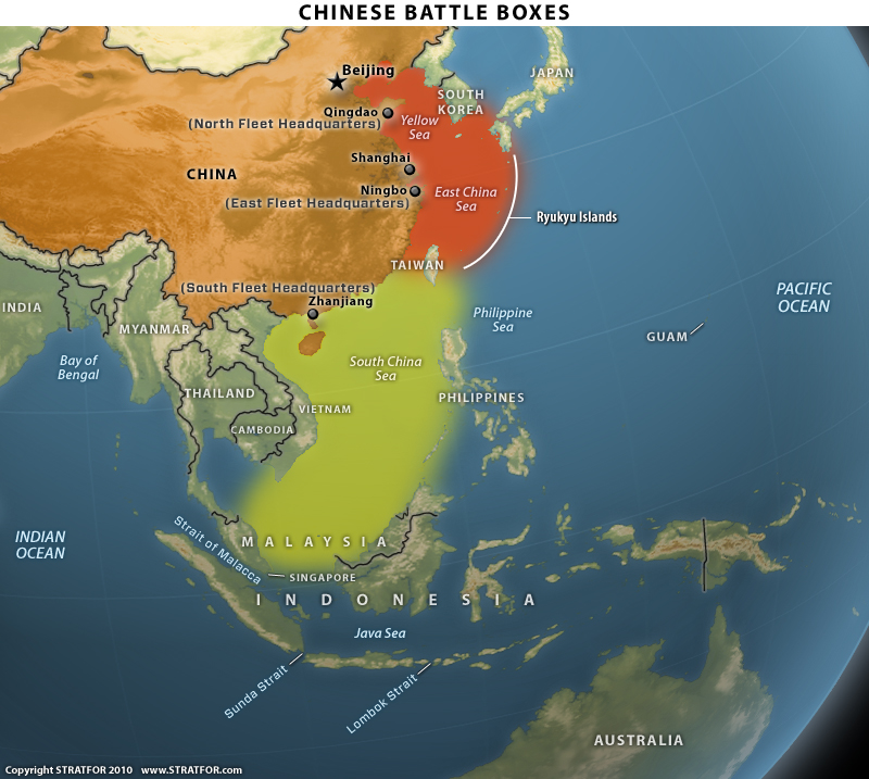